
The spread of the Arnica fire, now mapped at 9,300 acres, has slowed over the last two days. The map below which depicts heat detected by satellites, shows a major reduction in heat compared to what the fire was doing two to three days ago.

But it certainly is not out yet. The Mt. Washburn web cam occasionally is socked in by smoke as the wind sometimes blows the smoke directly at the lookout.
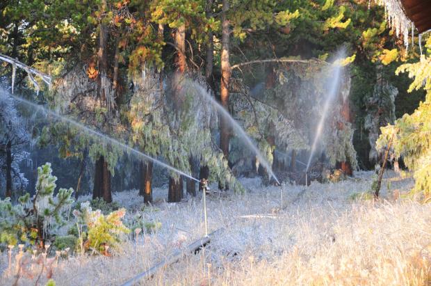
Fire personnel have been running an irrigation system to protect structures. Night time temperatures have obviously been below freezing.

The weather today could be conducive to additional fire spread, with the forecast calling for 18 mph SE winds gusting to 28, a high of about 60, and a minimum humidity of 21%.
But rain is expected to begin by 6 p.m. this evening and should change to snow by midnight. A total of about 6 inches of snow is predicted through Thursday morning, which most likely will be the fire season ending event for Yellowstone. The forecast calls for chances of more snow all the the way through Monday, October 5.
(UPDATE at 7:38 p.m., Sept. 29. The Weather Service has changed the forecast. The rain has been scrubbed, and the snow is expected to begin Tuesday night at midnight. It should continue through Wednesday night, with about 6 inches accumulating. There will be a chance of additional snow every day through at least Monday.)
The biggest problem facing firefighters now is how to avoid having to deal with frozen and broken irrigation pipes and pumps as the temperature dips into the teens Wednesday and Thursday nights. Removing a massive irrigation system in the snow is something I imagine they are not looking forward to.

HERE is a link to a more detailed version of the map above.

I will be in Yellowstone as well on the 3rd or 4th. I don’t forsee their being any major problems due to the fire. I guess we will just have to play it by ear.
I was planning a trip to Yellowstone this weekend and have been watching the fire closely. We’re going to camp, so despite cold weather, is there any reason I shouldn’t come? Are views obstructed by smoke etc? Any help from someone closer to the situation would be much appreciated.
In looking at the section of the fire near Lake it should be very close to the 1988 burn area. I was at Lake in 88 and we had a couple of very intense days chasing spot fires that kept popping up all over the place in and around the devoloped area. Once it snowed there were miles of wet, cold, stiff hoses to recover from the backcountry. We bundled it best we could and flew it out in slings. Back at the helibase the crew started a warming fire in the wet falling snow. We were a wet, cold, tired bunch. One of the mis-informed LE rangers arrived and said he was going to write one of us a ticket for a out of bounds open fire. Some one got him aside and talked some common sense into him. It would have been ugly.