(UPDATE at 9:52 a.m. PT, May 29, 2013)
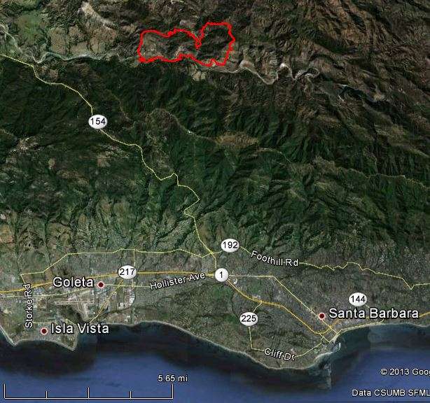
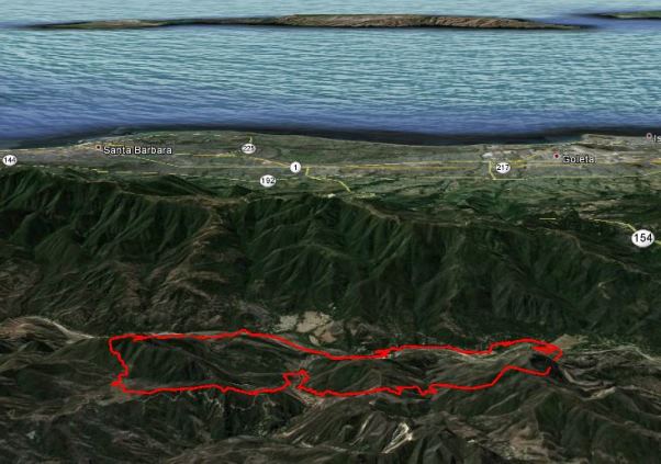
The maps below of the White Fire, 10 miles northwest of Santa Barbara, show the perimeter as of 8:50 p.m. PT on Tuesday. The incident management team has revised the size to 1,858 acres and the containment has increased to 80 percent.
****
(UPDATE at 8:22 p.m. PT, May 28, 2013)
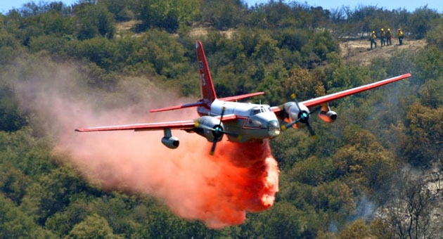
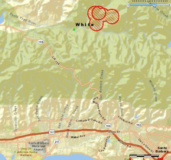
The fire has burned 2,025 acres and is threatening 50 residences, 5 commercial properties, and 50 outbuildings. One residence was damaged. The fire is 65% contained. Today there were 6 air tankers, 2 air attack aircraft, and 5 helicopters supporting firefighters on the ground.
****
(Originally published at 8:48 a.m. PT, May 28, 2013)
The White Fire burned through the compound of the Los Padres Hotshots Monday. The facility is in the Los Padres National Forest 10 miles northwest of Santa Barbara, California. According to a report by the Forest, the fire damaged one building and one privately owned vehicle and destroyed another vehicle. The fire also went through Sage Hill Campground just across the drainage from the Hotshot’s camp but the damage is unknown at this time.
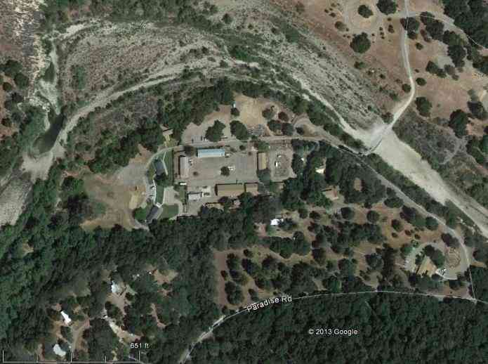
The White Fire started Monday at approximately 2:45 p.m. in the White Rock day-use area along the Santa Ynez River not far from the Hotshots’ barracks. According to Sheriff Department officials, two to three thousand people were evacuated.
KEYT reports that some campers in the area had to leave very quickly:
Sage Hill campground was engulfed in flames at one point. NewsChannel 3 reporter Victoria Sanchez described what she saw at the Fremont, Sage Hill, Red Rock and White Rock campgrounds. She said campers evacuated so fast they left cut up watermelons on the tables with all of their food sitting there as if they were just ready to sit down and eat when they escaped the fire. In one case, hotdogs were still cooking on a grill.
The Tuesday morning Situation Report lists the fire at 1,800 acres and 10 percent contained.
On Monday there were 6 air tankers, 2 air attack fixed wing, and 4 helicopters working the fire, however at approximately 5 pm, the air tankers were grounded due to strong winds. California Central Coast Incident Management Team 2 (Nunez) assumed command of the incident at 6:00 a.m. Tuesday. Today there will be 6 air tankers, 2 air attack aircraft, and 4 helicopters assisting firefighters. There are a total of 563 personnel assigned.
Monday night a moist marine layer moved into the fire area, slowing the rate of spread and raising the relative humidity to 88 percent at the Los Prietos weather station. The area is under a High Wind Warning until 3 a.m. Wednesday, but much of the fire is burning in the Santa Ynez Valley, partially sheltered from strong winds which across the ridges Tuesday should be north to northeast at 15 to 25 mph with gusts to 40 mph. In the valley they predict winds of 6 to 12 mph with gusts to 18 in the afternoon. The minimum humidity will be 28 to 35 percent, not extremely low for southern California, but the live fuel moisture is very low for this time of the year due to drought.
Here is a link to a video that was filmed at a USFS facility, probably the Hotshot/Administrative complex at Los Prietos. It shows some of the damage to a vehicle and a structure. (Thanks to Walt for providing the link in a comment.)

I was hot shot supt.before Mark Linnane. The arial photo shows my old trailer were I raised my family.I cane to the L.P. SBRD in 1969 from the Cleveland N.L.El Cariso hotshots were I was foreman.
The Santa Barbara Ranger Station is the building located in the lower right corner of the photo. The “compound” hosts not only the LP Hotshots, but the district engine as well as warehouse, wilderness, recreation and other district employees and programs.
Thanks Rosie.
Los Prietos Hotshots? Los Padres Hotshots!
You’re right; I changed it, thanks. When I was with the El Cariso HS and fought fire alongside them they were Los Prietos HS.
They started out as Los Padres HS in 1948, changed to Los Prietos HS in 1965, then back again to Los Padres HS in 1994.
Its only May! Cut the budget to Cal Fire, eliminate the DC 10 exculsive use, immediate need, (Cal Fire contract) strip the South of all air tankers for I.A. Still waiting for the Feds to come up with a tanker or two. What a mess this fire season will become through out the West. Yes Colorado your on Mother Natures hit list. It doesn’t work everytime but immediate delivery of fire retardant on a new breaking fire (within 20 minutes) will save $, lives and property.
That’s it. This shows the extent of the damage: http://ktla.com/2013/05/28/white-fire-burns-1200-acres-in-santa-barbara/#axzz2UbMqHkHU