(UPDATE at 11:30 a.m. MDT, June 20, 2013)

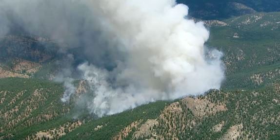
On Wednesday the Lime Gulch Fire near Foxton, Colorado grew quickly, throwing out spot fires causing firefighters to have to withdraw for their own safety. Today the size is estimated at 500 acres with no containment.
****

(The name of this fire was changed from Chair Rock to Lime Gulch.)
(UPDATE at 6:45 p.m. MDT, June 19, 2013)
A tweet from the Rocky Mountain Coordination Center:
NEW: Lime Gulch (CO-PSF) 8 miles south of Conifer, CO. (39.25 30N 105.13 48W). RMA IMT2 Team B (Dallas) has been assigned.
— Predictive Services (@RMACCNewsNotes) June 20, 2013
Dan Dallas’ IMTeam will assume command at 6 p.m. Thursday.
Radio traffic from the online scanner at about 4 p.m. said the fire is 150 acres and they will transition to a local Type 3 Incident Management Team tonight.
A military C-130 MAFFS air tanker was over the fire at 3:40 p.m. A Single Engine Air Tanker may have dropped on the fire earlier. A helicopter is also dropping water on the fire.
Jefferson County Sheriffs’ office has posted evacuation information HERE.
****
Colorado has another fire that is causing evacuations. The Lime Gulch fire is 7 miles southeast of Conifer and 13 miles southwest of Columbine in the southern part of Jefferson County.
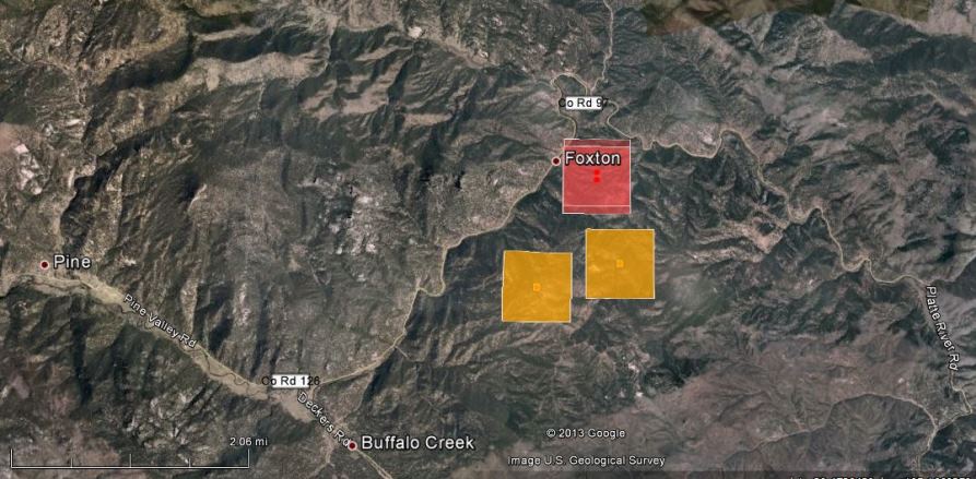
The map of the Lime Gulch fire above shows heat detected by a satellite at 1:49 p.m. MDT, June 19, 2013. The locations of the red squares can be as much as a mile in error.
Just before 2 p.m. the Sheriff ordered immediate evacuations for a 3-mile radius around the intersection of Foxton and Platte River roads. Calls went out to 401 phones in the area.
At least one helicopter is on scene dropping water, and other aircraft have been ordered.
SKY9 was streaming live video of the fire at 3:06 p.m. Wednesday, but that could end any time.


“the fire is small but the flame lengths are high” report on conditions? Why isn’t Colorado taking their fire situation seriously? Almost three hours before a SEAT and bug sprayer arrived on this fire. Two new movies in the making Red Skies of Colorado and Up in Smoke II.
I just de-mobed from the Black Forest Fire. Looks like we stand a chance of turning around and heading right back. Sure is looking like another busy summer.
And to add the the confusion, this fire should either have been continued as the Chair Rocks fire or called Lion Gulch (a feature in the middle of it) as there is no “Lime Gulch” anywhere in the region…….Oh well, not the first time a miss-named fire became too established to correct. Nearly 150 acres now and growing.
I found this also:
The Lime Gulch (previously called the Chair Rock) Fire is south of Conifer and east of Bailey.
The Jefferson County Sheriff’s Office said it issued Level 3 evacuations (meaning residents should leave now) for a 3-mile radius from the intersection of Foxton and Platte River roads. “Leave immediately,” deputies tweeted.
The best evacuation route is County Road 126 or Foxton Road, deputies said.
The subdivision of Spring Creek has also been placed on a “Be Ready” Level 1 evacuation status.
Deputies said 401 phones have been contacted in the evacuation radius with 69 contacted in the Spring Creek area.
May I ask which site you are using that integrates GOES / MODIS / etc with Google maps? We are nearby this fire and would like to get a better picture relative to our residence.
I’m no experts, but the fire is moving NE – so, N to E are the winds. But the scanner just said that buffalo creek to the s of the fire is level 3 (evac I assume). Do you have your phone registered w/ the reverse 911?
If the fire is moving NE, winds are coming from the W or SW; not from the N or E.
correct!