Red Flag Warnings and Smoke Map, August 16, 2013 - Wildfire Today
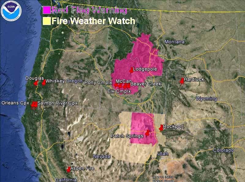
The map above shows the distribution of smoke from wildfires in the United States at 2:13 p.m. MDT, August 16, 2013. (UPDATE: Darren Clabo provided this link to a satellite animation that shows the smoke early Friday morning.) Red Flag Warnings and Fire Weather Watches for enhanced wildfire danger have been issued by the National Weather … Continue reading "Red Flag Warnings and Smoke Map, August 16, 2013"
Bill Gabbert