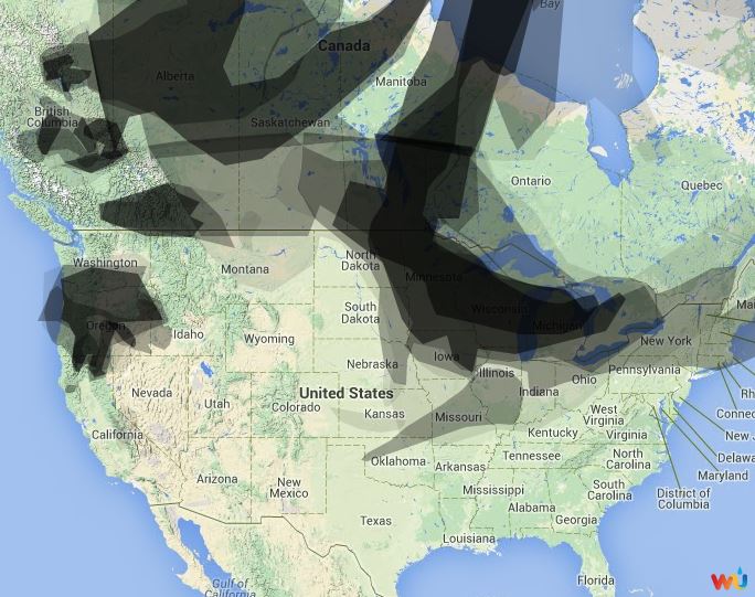
The map shows the distribution of wildfire smoke in Canada and the United States. It is similar to yesterday’s map, except the fires in the northwest U.S. are creating much more smoke, and the Canadian-created smoke is more extensive now in the Great Lakes states.
If someone wants to breathe smoke-free air, right now the best places to be are in the deep south or the southwest. However, New Mexico had a ton of lightning the last two days, so that could change if they have some dry weather.
@NWSSacramento has the answer: hi-res satellite look at numerous #NorCal fires. #cawx #cadrought #wildfire pic.twitter.com/yxuceW25qQ
@NWSSacramento has the answer: hi-res satellite look at numerous #NorCal fires. #cawx #cadrought #wildfire pic.twitter.com/yxuceW25qQ
— Austin Elliott (@TTremblingEarth) August 3, 2014
