The photo above was distributed on Twitter Friday morning July 10 by the National Weather Service out of Glasgow, Montana, along with this explanation:
A view of two circulations in the upper level flow mixing with smoke from Canadian wildfires.
The smoke is so that that it is casting a shadow on the ground. Pretty fascinating, I must say.
To get you oriented, the US/Canadian border goes across the middle of the photo, and below that are the states of Idaho, Montana and North Dakota.
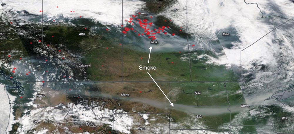
The next image is from the Aqua/MODIS satellite, taken on Thursday, July 9. I added the text and the arrows. The red dots represent the location of wildfires. Click on the photo to see a larger version.


Is the lower smoke coming from Oregon/Washington fires?
I think so Randy. Some of it may also be coming from fires north of Victoria, BC.
That is cool. My buddies in Glasgow and Malta are pretty smoked up, they actually had “hazardous” air quality for a while last week. Maybe still do. I am west of Glasgow 130 miles on Highway 2, we have been smoked up some, but not as bad.
Good find Mr. Gabbert.