Half of our Holy Grail of Firefighter Safety is for firefighters and their supervisors to know the real time location of firefighting resources working on an incident. The other half is to know the real time location of the fire. These two pieces of information would greatly enhance the situation awareness and safety of the personnel. Not knowing this information has led to dozens of firefighter fatalities.
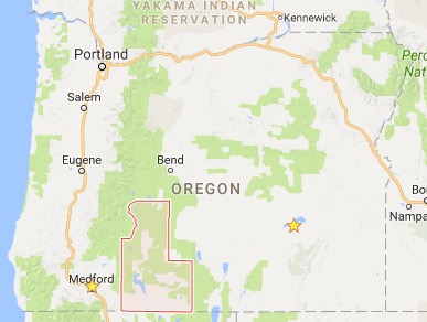
Keno, Oregon has spearheaded the development of a system that takes care of the the first half of the Holy Grail — showing the location of firefighters on a map. This is one of several systems nationwide that is being used by local organizations in the United States. Theirs goes far beyond that, however, and can display detailed information about structures.
Gene Rogers helped put the system together which has grown to include Klamath County. He sent us this description.
****
Klamath County Situation Analyst (KCSA) and Situation Analyst Field Tool (SAFT)
Decades of collaboration and experience with incident management challenges formed the premise of the goals and objectives developed by a rural fire chief, a retired federal fire manager turned consultant, and a state district forester. Brainstorming sessions often focused on a theme of what would make emergency management more efficient. The need for current information on emerging incidents that could be easily shared across the spectrum of cooperators was a goal. Their vision was to collect incident information at initial response that could be easily passed on as the incident evolved to extended response and ultimately to an IMT (Incident Management Team). Another goal was to minimize repetition, redundancy and confusion throughout any incident. Applicability to any incident; structure fire, wildland fire, rescue, flood, earthquake, weather event, was a fundamental objective. Traditional paper maps and hand written notes contain information not readily shared with incoming responders. KCSA and SAFT are applications to enhance the sharing of information and greatly increase public and responder safety. These applications offer real-time, shareable, interoperable information on a common operating platform.
Following the completion of the Keno, Oregon Community Wildfire Protection Plan (CWPP) in 2003 attention was turned to gathering structure and parcel fuels data for Wildland Urban Interface (WUI) properties. In 2006 grant funds were used to recruit and train summer interns to collect the data on 10,000 Klamath County WUI residential properties.
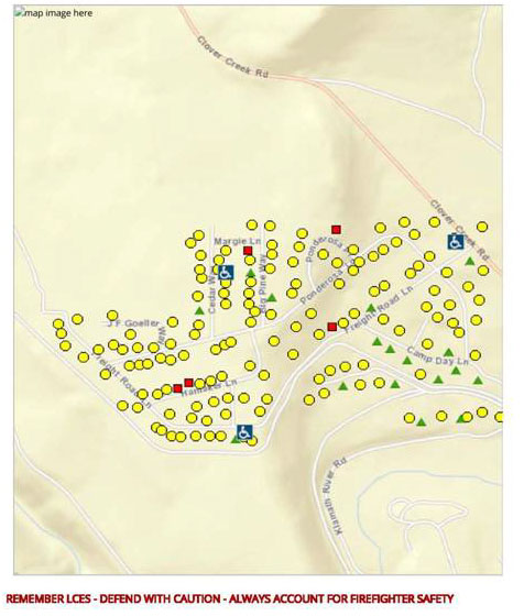
Current technology allowed for data collection on handheld data recorders, GPS units, and digital cameras. The data was assembled using commercial software from RedZone Software. Individual reports on each WUI structure and parcel included construction attributes (roof, siding, etc.), wildland fuel conditions, a photo of the structure and a composite risk score. The collected data was distributed to responding districts and agencies on compact discs and hard copy maps. The data and resultant hazard ratings were used in the 2007 Klamath County CWPP. The information was valuable but the project managers also wanted technology that allowed rapid sharing of data across the emerging technology of smart phones, tablet computers, and laptops.
 By 2013 the project steering committee had selected Intterra, a company specializing in geospatial information technologies, to integrate the Klamath County structure survey data, collection process, and other information into a modified version of their Situation Analyst named KCSA. Additional capabilities requested included Automatic Vehicle Location (AVL), real-time incident mapping on touch screen devices, structure pre-plan data collection, and a property owner feedback process. The Yarnell Hill Fire of June 2013 emphasized the need for managers to know the location of incident resources. KCSA and SAFT incorporate the capability to track resources by cell phone GPS or commercial GPS tracking devices on vehicles and personnel. The 2016 Klamath County CWPP update discusses the uses of KCSA and SAFT.
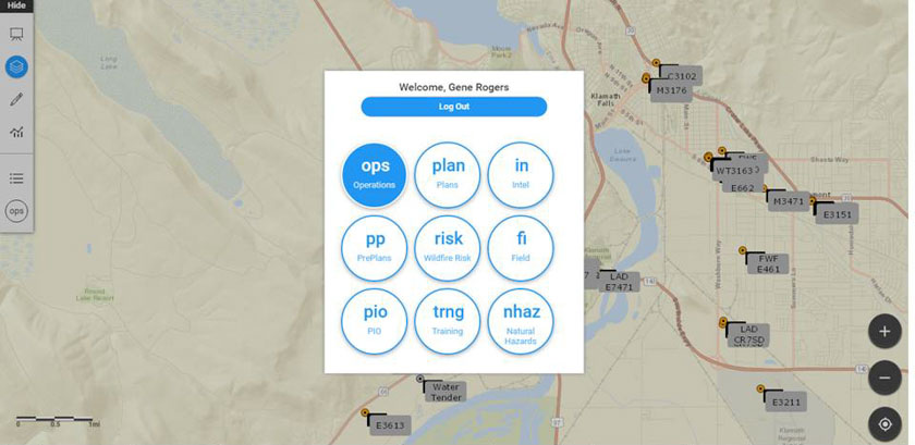
KCSA is an application for connected devices that offers the full array of system capabilities. SAFT is an application that can be downloaded to mobile devices (from the App Store or Google Play). SAFT can be used whether or not the device is connected to the internet. Mapping, collected data, and pictures can be shared to users of KCSA when the device is connected. Example: field data can be collected in terrain without connectivity, then uploaded to the KCSA system when connectivity is achieved. Use of either application requires a Login ID and Password. Permissions to various capabilities are assigned when the user profile is established. This can be done pre-incident locally or at an incident when checking in arriving resources.
Permissions to use features in the applications relate to specific users and their level of qualification on incidents. For example: a Field Observer (FOBS) cannot edit the map prepared by someone with Operations permissions (OSC1/OSC2, OPBD, DIVS). Other capabilities relate to specific tasks. The Pre Plans (PP) module allows structure fire departments to map buildings with key information critical to their fire and rescue work. The available workspaces are tailored to the needs of that functional area, e.g., Plans or Public Information Officer.
The Risk module compiles the wildfire risk survey data for structures and parcels in the surveyed data. An onsite survey for a new structure and parcel can be completed in minutes. This is particularly useful for structure protection and evacuation planning in areas where surveys have not already been completed. 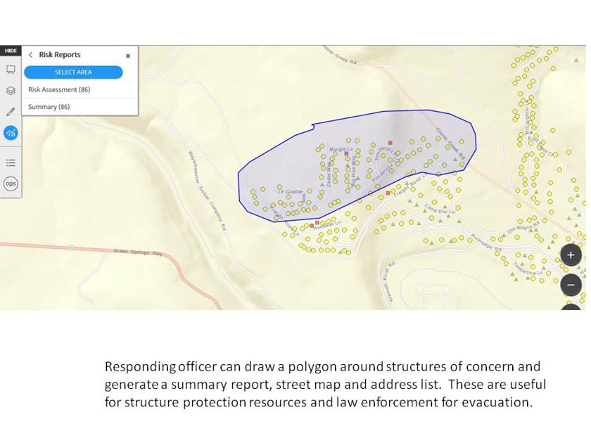
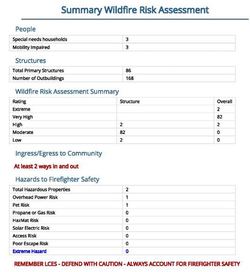
Once surveyed, the user can circle the structures of concern and produce a map and address list to pass to Law Enforcement for evacuation. This takes seconds when the structures have been previously surveyed. Home symbol and color correspond to assigned risk score and rating adjective. Homeowners can view their risk score at www.kcrsg.org.
Use of the applications is spreading in the emergency management organizations of Oregon. The Oregon State Fire Marshal (OSFM) is supporting the use of the applications by OSFM Incident Management Teams. KCSA was used on wildfires in the southeast states in 2016. Klamath County fire districts, Oregon Department of Forestry, and federal wildland fire agencies are currently using the software. Use of the applications is spreading into several other counties in Oregon. Grant monies funded the development of the applications. Future expenses will be nominal and shared proportionally by users for the cost of the hosting server. The software is free of charge.
This is a brief discussion of the development and capabilities of the KCSA and SAFT applications. Those interested in further information about Situation Analyst should contact Intterra at info@intterragroup.com. Questions about the use of KCSA and SAFT can be sent to firechief@kenofire.com.

