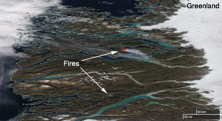
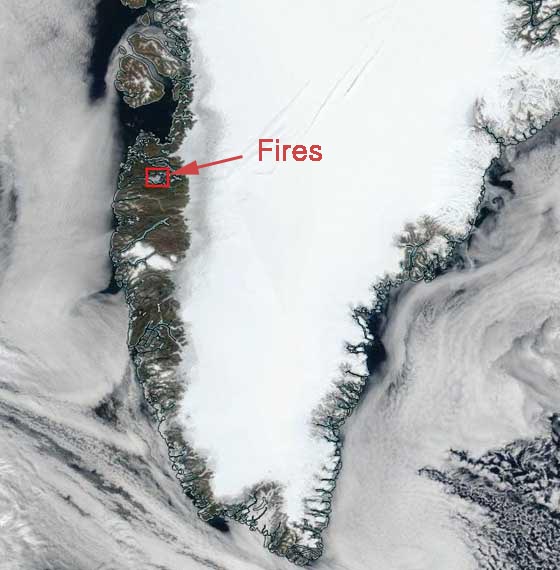
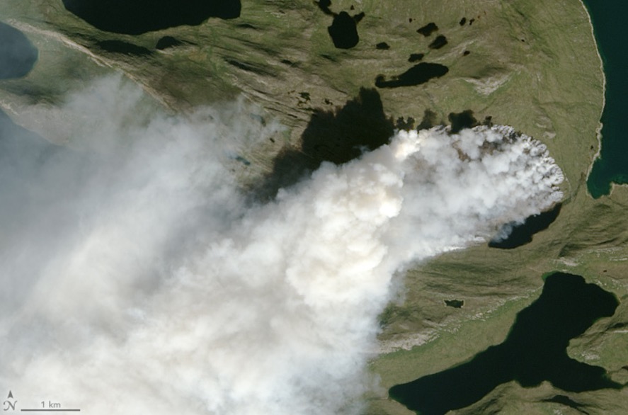
Above: Satellite photo of one of the wildfires burning in Greenland August 3, 2017. Sentinel-2A data from the European Union Earth Observation Programme.
(Originally published at 11:25 a.m. MDT August 7, 2017)
Three-quarters of Greenland is covered by the only permanent ice sheet outside Antarctica, and permafrost is found on most of the rest of the island. These are reasons why it is very unusual, and possibly unprecedented, that two wildfires are burning on the giant island.
The fires are near Sisimiut in Western Greenland north of the Arctic Circle at 66.9 and 67.8 degrees north latitude, which compares to the “Far North” area of Alaska near the Brooks Range.

According to Danish and Greenlandic news reports, they were first spotted from an airplane piloted by Per Mikkelsen who took photos of the fires. The weather forecast for the area indicates no rain in the next 10 days.
“These fires appear to be peatland fires, as there are low grass, some shrub, and lots of rocks on the western edge of the Greenland Ice Sheet”, Jessica L. McCarty, an Assistant Professor of Geography at Miami University told us Monday. She continued, “They are likely occurring in areas of degraded permafrost, which are predicted to have high thaw rates between now and 2050 with some evidence of current melt near Sisimiut. Fires in the High Northern Latitudes release significant CO2, CH4, N20, and black carbon. A fire this close to the Greenland Ice Shelf is likely to deposit additional black carbon on the ice, further speeding up the melt. More on black carbon deposition in Greenland from wildland fires can be found here.”
“The European Union Earth Observation Programme has stated that wildfires in Greenland are rare but have no data on previous wildland fire activity in this region”, Ms. McCarty said.

****
(UPDATE at 3:03 p.m. MDT August 7, 2017)
After we published this article, NASA posted the satellite photo below that was acquired August 3, 2017 by the Operational Land Imager on Landsat 8.


Hazy, smoky sky blue over the Netherlands, 20 and 21 August. Smoke from the Greenland fires?
I don’t believe so. It is likely to be smoke from fires in Canada. There was a tremendous blowup of wildfires in British Columbia about 10 days ago (12 August) and we have been watching it’s progress ever since. Some of the smoke got quite high in the atmosphere – as high as 17km. It has tracked across the high Arctic and the North Atlantic and into Europe. So I think that’s what you’re seeing.
Is there any likelihood of methane hydrates being present in the peatland, and might a warming of that area release methane which could be fueling the fire? (This, of course, in no way explains how the fire got started, but it could make its persistence and spread more plausible.)
As mentioned by Mark Ruminski, we have further satellite evidence that the likely fire start date was 31 July:
http://cimss.ssec.wisc.edu/goes/blog/archives/24645
On 31 July, a small smoke/cloud signature was seen at the fire source region on 1543 UTC and 1600 UTC MODIS true-color images (but was not evident on a slightly earlier 1513 UTC VIIRS true-color image) — and *no* such signatures were seen at that location on 30 July MODIS or VIIRS true-color images.
One of the Danish news sources note that hiking has been suspended in and near these areas for the time being. So a human source is possible. I haven’t checked the lightning data but this is a polar region, 66 degrees N!, so I wouldn’t think lightning.
Mark – thank you for checking the GOES 16 data! That makes these fires at least 10 days only. The fires are not advancing much so that also gives credence to it being peat. Historically this is an area where peat was used to make houses, too.
We first detected and included the more northern fire in our HMS fire analysis on July 31. It was detected in VIIRS imagery as a hotspot but we could also see the hotspot faintly in GOES-16. The smoke plume clearly showed up in the GOES imagery. So that pushes the start date back by at least 4 days. Wonder how these fires got started. I would have to think human caused, unless there was a very rare lightning strike.
Do they have an idea what started the fires in such remote areas? Lighting?
Lightening or small meteorite impacts. Those would be the usual suspects in an area that remote. With two burning at the same time in the same area, I’d lean toward the meteorites. The spike in the incidence of fireballs and meteorites over the past 3 or 4 years is highly unusual.
Mike Hankey, director of operations at the American Meteor Society, has this to say about meteorites starting forest fires:
“First off, meteorites don’t start forest fires,” Hankey told The Washington Post. “A meteor explodes so high up the atmosphere that it’s cold when it hits the ground.”
It would be interesting to know the cause(s) of the Greenland peat fires.