(UPDATED at 12:10 a.m. PST December 5, 2017)
****
(UPDATED at 11:31 p.m. PST December 4, 2017)
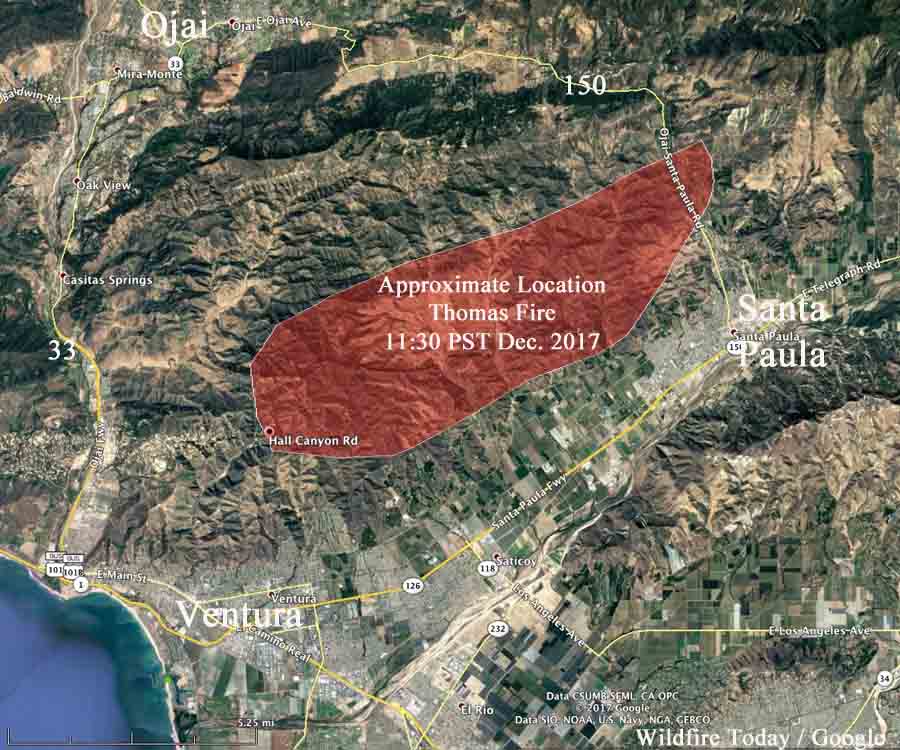
ABC7 is showing on their live video that the Thomas Fire has spread from Santa Paula, California southwest to the outskirts of Ventura. As of 10:40 p.m. PST the fire had reached Hall Canyon and Sexton Canyon Roads north of Ventura. It is moving toward Highway 33.
(For the most current information about the Thomas Fire, visit https://wildfiretoday.com/tag/thomas-fire/)
Anyone between Highways 150 and 33 or north of Foothill Road should be prepared to evacuate. Much of that area is already on fire.
#ThomasFire – mandatory evacuations ordered for East Ventura, north of foothill Road. The rapid rate of spread will push this fire into that area within a few hours. pic.twitter.com/wfYwI2S8vu
— VCFD PIO (@VCFD_PIO) December 5, 2017
The wind driven fire is launching burning embers very far ahead to the west and southwest that are starting spot fires ahead of the main fire which then grow quickly.
Our unofficial tracking shows that the fire is approximately 12 miles long. Many areas have lost electrical power, including portions of Santa Barbara.
Approximately 30 mobile homes off Wheeler Canyon Road north of Foothill Road have burned, according to ABC7.
#ThomasFire #ventura #crownplaza pic.twitter.com/zS1KJNhXm4
— Sheri Henderson (@SheriHenderson) December 5, 2017
Ventura County Fire Department estimates the Thomas Fire has burned about 10,000 acres.
****
(Originally published at 10:24 p.m. PST December 4, 2017. We will update this article as new information is available. )
A wind-driven wildfire is causing evacuations north of Santa Paula, California 8 to 10 miles northeast of Ventura. At 9:41 p.m. Monday Ventura County Fire Department officials said the fire was about 5,000 acres, and is spreading quickly. They expect it to reach the city of Ventura Monday night.
#ThomasFire updated acreage is 5000 acres. Incident commander expects this fire to impact the city of Ventura this evening. @VCFD #VCFD
— VCFD PIO (@VCFD_PIO) December 5, 2017
Multiple structures have burned, but how many is unknown.
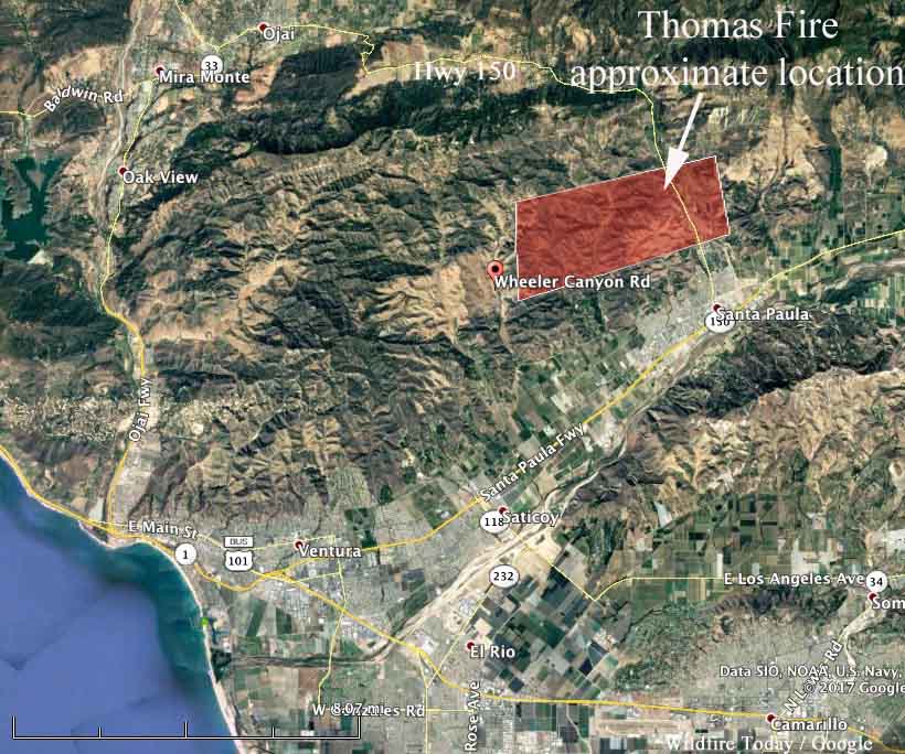
Santa Ana winds that are affecting much of the coastal and mountain areas of Southern California have pushed the fire at least five miles to the west across Highway 150 and at 9:30 p.m. PST had reached Wheeler Canyon Road where structures are reportedly burning. Portions of the fire have also reached Aliso Canyon Road.
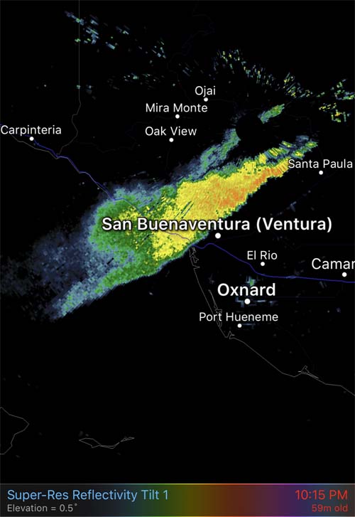
Weather stations in the Santa Paula area recorded wind gusts of 17 to 28 mph out of the east with relative humidity of 7 to 16 percent.
We put together the following map which is very unofficial, based on live video from ABC7.
The Ventura County website has details about evacuations, but occasionally the site is down, probably due to heavy web traffic.
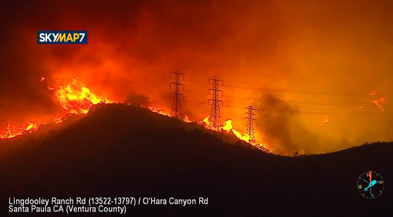
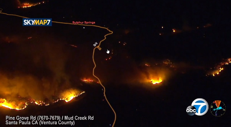
The images below are screenshots from the ABC7 live video.

You’re providing a great service. It’s hard to find these aerial photos and up-to-date info, and major news services are getting a lot of geography wrong. Thank you.
Ask the folks at KOA
How did the fire start? God bless everyone affected and all the displaced wildlife.