Oklahoma wildfires: 34 Complex slows, Rhea continues to spread

The two fires have burned more than 316,000 acres and 63 homes

Map Rhea Fire

Above: Map of the Rhea Fire, April 16, 2017. Incident Management Team.

Two wildfires that are 20 miles apart in Western Oklahoma have burned more than 316,000 acres and 63 residences.

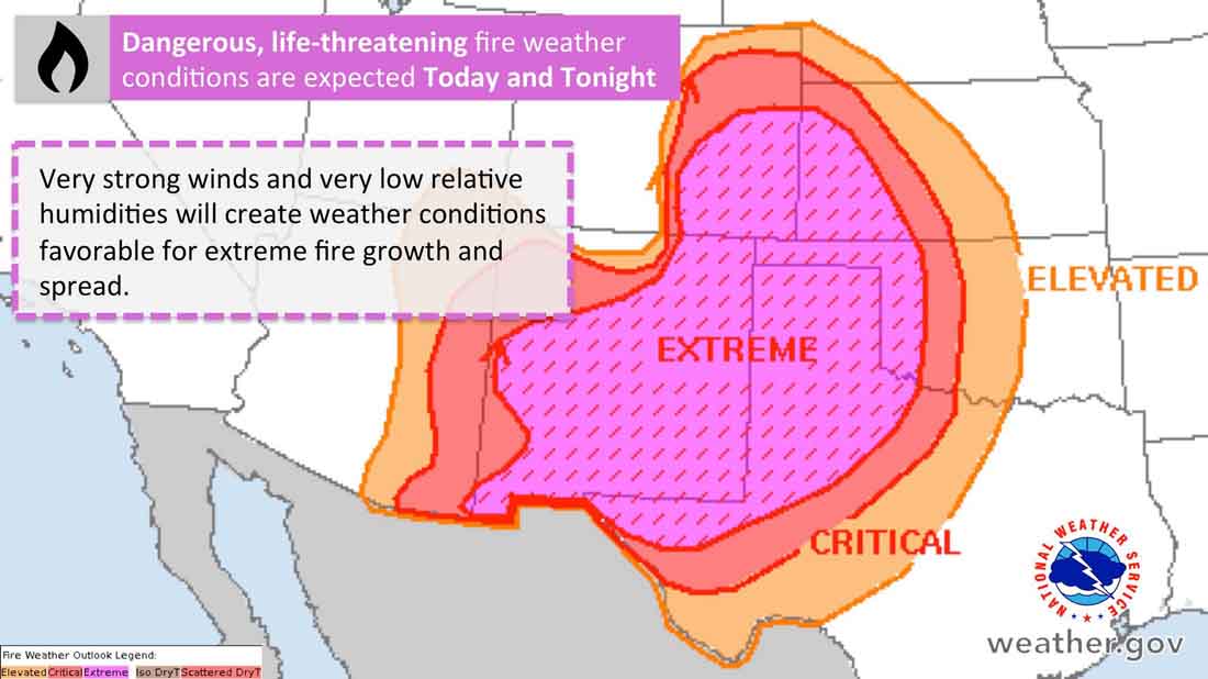
The spread of the 34 Complex of Fires north of Woodward has slowed, but the strength of the firelines could be tested Tuesday with fire weather conditions called “historic”. The forecast includes winds out of the southwest at 35 to 45 mph with gusts up to 65 along with humidities as low as 7 percent.
map rhea 34 complex wildfires
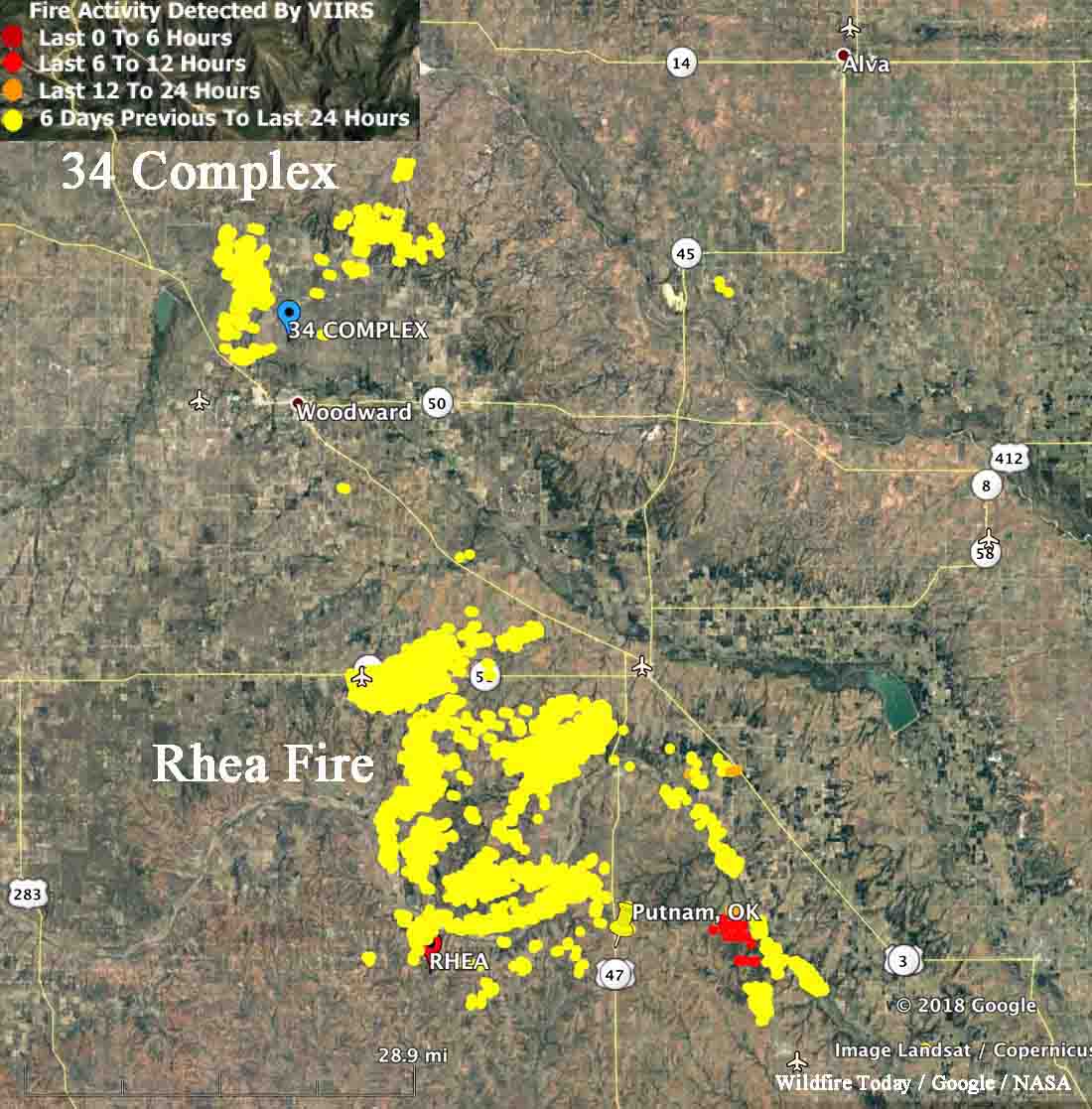
Map showing heat detected by a satellite on the 34 Complex and Rhea Fires in Western Oklahoma, current at 2:22 a.m. CDT April 17, 2018. The satellite flying over the area twice a day can’t detect heat in light vegetation that burns and then cools before the next pass.

The same conditions will affect the huge Rhea Fire 20 miles south of the 34 Complex. Some areas of the 248,589-acre fire are quiet, but it was still spreading Monday east of Putnam (shown in red on the map above). Those active areas could be challenging for firefighters with the extreme weather predicted for the area Tuesday and Tuesday night.
Fire weather april 17, 2018 dangerous wildfire
Fire weather conditions predicted for Tuesday and Tuesday night.
Rhea Fire
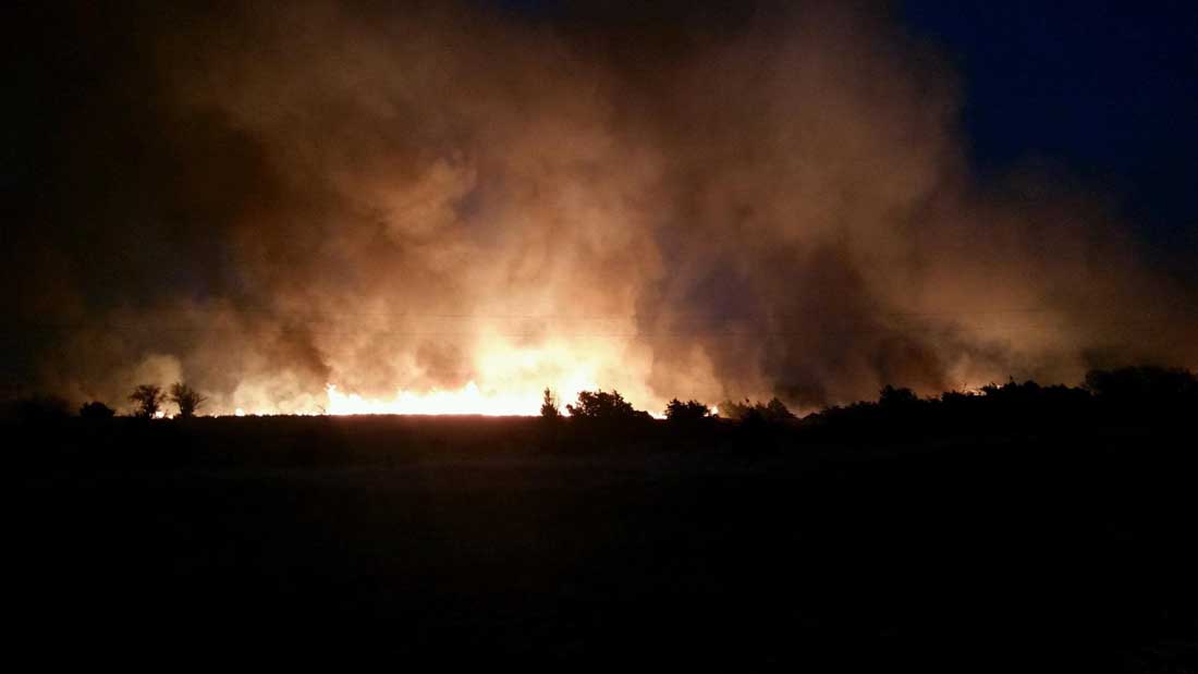
Rhea Fire, April 16, 2018. Oklahoma Forestry Services photo.

Typos, let us know HERE, and specify which article. Please read the commenting rules before you post a comment.

Author: Bill Gabbert

After working full time in wildland fire for 33 years, he continues to learn, and strives to be a Student of Fire.

One thought on “Oklahoma wildfires: 34 Complex slows, Rhea continues to spread”

  1. My family farm in in the very corner off southeast CO. I am hopoing it doesn’t get over there.

    0
    0

Comments are closed.