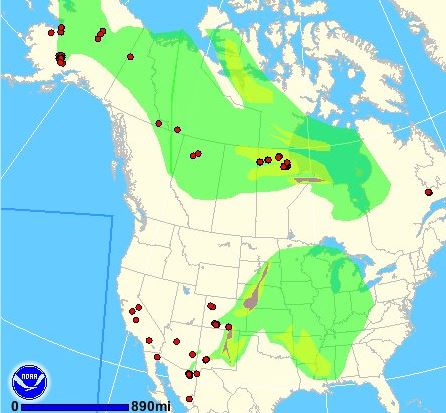
 The map shows the large wildfires in Colorado that are still active and spreading, and the acres burned for each. The Papoose and West Fork fires have now been combined into the “West Fork Complex”. We have more information about the West Fork Complex and the East Peak Fire.
Author: Bill Gabbert
Two fuels and fire behavior advisories for Colorado
The Rocky Mountain Geographic Area and the Upper Colorado River Fire Management Unit on the Colorado Western Slope issued two Fuels and Fire Behavior Advisories today. Below are the complete texts of both:
****
“Fuels and Fire Behavior Advisory
Western Slope of Colorado
06/21/2013
Subject: Western Colorado is in the third year of drought. The situation is predicted to persist or intensify through July. There is increased risk of large fire development and intense fire behavior. Dry, heavy fuels at higher elevations could pose a greater risk of active fire behavior.
Discussion: The wet spring pattern that occurred during April and May has provided a brief reprieve. Live and dead fuel moistures are quickly returning to a condition that will support large fire growth.
Forecasts do not offer the prospect of live or dead fuels conditions improving through July.
Difference from normal conditions: Fuels are described by fire managers as being deceptively green. The visual greenness being observed can lessen the sense of fire potential. Live fuels, which had shown some improvement from late spring precipitation, are drying. On the Western Slope of Colorado, 100FM fuels are setting historically low values for the date, nearing the 3rd percentile, and moving into the range associated with historic large fires. Long-term drying has made large, higher elevation fuels, available as well.
Concerns to Firefighters and the Public:
- Recent large fires on the Front Range and Western Slope have displayed intense and/or extreme fire behavior.
- Long-range spotting, fire whorls, extreme fireline intensity and high winds have been observed and will continue to be control problems on both wildland and urban interface incidents.
- Local preparedness planning and cooperation should be on-going.
- Management of suppression resources rest and recovery as activity increases.
Mitigation Measures: Strategies for dealing with each of the specific circumstances listed above include using Predictive Service¡¦s forecasts of higher potential for large fire occurrence, rapid initial attack in those high risk areas, and daily fire and fuels briefings to suppression personnel.
Continue reading “Two fuels and fire behavior advisories for Colorado”
Photos from the West Fork Fire
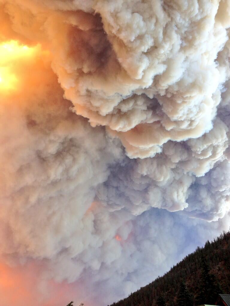
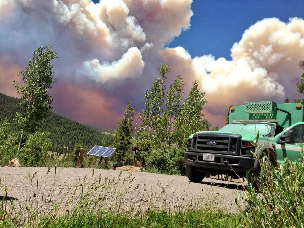
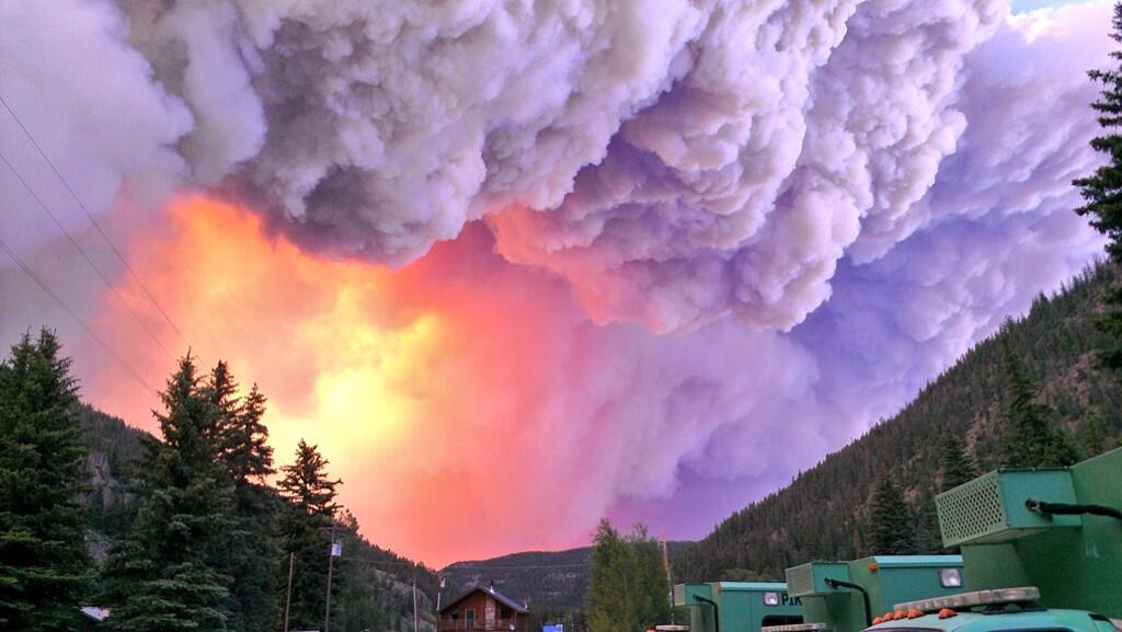
If you’re not keeping up with the status of the West Fork Fire in south-central Colorado which has forced the entire town of South Fork to evacuate, you have missed seeing these very impressive photos taken by the Colorado-based Pike Hotshots. If you’d like to comment on the photos or the fire, please do so at the main West Fork Fire article which is updated as conditions change.
Map of active fires in Colorado, June 21, 2013
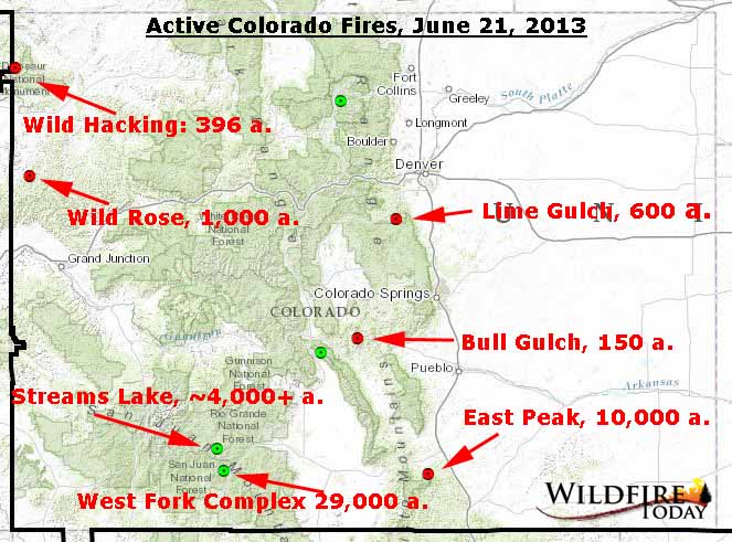
On the map above showing the active wildfires in Colorado, the green dots represent fires that are not being fully suppressed, while the red dots are fires that ARE being fully suppressed. The base map, with the dots, was provided by the Rocky Mountain Coordination Center; we added the fire names and acres.
Fires in Sumatra smoke out Singapore
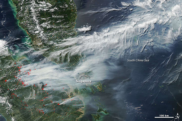
Fires in Sumatra are creating massive quantities of smoke that inundated Singapore on June 19, says NASA which released this photo taken with their Terra and Aqua satellites.
Below is the NASA description of the photo:
****
“…striking images of smoke billowing from illegal wildfires on the Indonesian island of Sumatra. The smoke blew east toward southern Malaysia and Singapore, and news media reported that thick clouds of haze had descended on Singapore, pushing pollution to record levels.
Singapore’s primary measure of pollution, the Pollutant Standards Index (PSI)—similar to the Air Quality Index (AQI) used by the U.S. Environmental Protection Agency—rose to 371 on June 20, 2013, the highest level ever recorded. The previous record occurred in 1997, when the index hit 226. Health experts consider any level above 300 to be “hazardous” to human health. Levels above 200 are considered “very unhealthy.”
Both images above were captured by the Moderate Resolution Imaging Spectroradiometer (MODIS), an instrument that observes the entire surface of Earth’s every 1 to 2 days. The top image shows smoke blowing east at 3:30 Universal Time (11:30 a.m. local time); the lower image shows the same area on the same afternoon at 6:30 UTC (2:30 p.m. local time).
Though local laws prohibit it, farmers in Sumatra often burn forests during the dry season to prepare soil for new crops. The BBC reported that Singapore’s Prime Minister Lee Hsien Loong warned that the haze could ‘easily last for several weeks and quite possibly longer until the dry season ends in Sumatra.’ “


