Followup on firefighters injured by rolling log

On August 27 we reported that several members of the Bonneville Hotshots assigned to the Trinity Ridge Fire on the Boise National Forest were injured by a large rolling log. What we didn’t know at the time was that the log was being bucked, or cut, by another firefighter.

The 72 hour report has been released on the incident. Here is the narrative section:

On August 25, 2012 a down tree rolled downhill in Division C injuring 3 firefighters on the Bonneville Hot Shot Crew. The down tree was in the process of being cut into smaller pieces by a sawyer. The tree “broke loose” prior to a final release cut by the sawyer. The piece was approximately 24 inches in diameter and 40 feet in length. It traveled approximately 40 feet downhill before impacting the firefighters.

An adjacent felling operation was in progress on the other side of the ridge. Four firefighters moved the commensurate distance away from the felling operation which placed them approximately 40 feet downslope of the bucking operation.

The 4 firefighters had their attention on the falling operation and became aware of the bucking operation only after the down tree broke loose and began rolling toward them.

One firefighter leaped over the rolling log and did not sustain any injuries. A second firefighter sprained his ankle and a third firefighter sprained his neck. The fourth firefighter suffered blunt force trauma to his chest. The firefighter with the most serious injury was transported to a local hospital for evaluation, and was released that same day and then to be demobed to his home unit.

A after action review (AAR) was conducted of the incident by the crew that same day. One lesson learned from the folks involved was that concurrent saw operations were a factor in the incident. They stressed situational awareness, “look up, down, all around” while staying in a location over time and whenever you change location. They discussed taking more time in planning and conducting operations. It should be noted that after the incident occurred the medical evacuation and emergency management was handled with maximum efficiency.

(end of 72-hour report)

We are very glad the injuries were not any more serious than they were.

The firefighter that leaped over the rolling 24-inch by 40-foot log needs to be signed up for the high jump or gymnastics in the next Olympics, or consider a career as a running back in the National Football League.

Count the spot fires

Albert Fire
Albert Fire, MDNRC photo

The photo above was taken Sunday by state employees from a Montana Department of Natural Resources and Conservation helicopter during the initial attack of the Albert fire west of Missoula on the south side of the Clark Fork River.

It is a very interesting photo, in that you can see what appear to be multiple spot fires. How many can you count?

The spread of the fire was halted at 75 acres Sunday night, but firefighters still have a lot of work to do on the fire. They credit their success to a quick and aggressive initial attack with single engine air tankers, helicopters, and ground resources who could take advantage of the aerial attack.

Here is one other photo also taken from the helicopter:

Albert Fire
Albert Fire, MDNRC photo

 
Thanks go out to Chris

Monday morning one-liners

Fire near Pompeys Pillar, MT, BAe-146
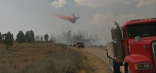
A BAe-146 air tanker drops on a fire near Pompeys Pillar, MT, Sept. 2, 2012. Photo by Lisa Openshaw, Shepherd Volunteer Fire Department

On Sunday firefighters stopped a fire after it burned 326 acres north of Pompeys Pillar in Montana (see photo above).

The National Interagency Fire Center moved the national preparedness level from four to three.

Elizabeth Reinhardt of the USFS and Dick Bahr of the NPS are quoted in an article about how larger and more frequent fires over the last several decades have limited the size of some fires, as they move into the previously burned areas.

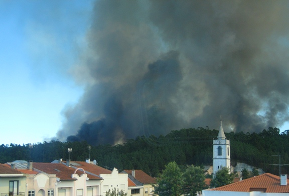
Wildfire south of Porto, Portugal, September 2, 2012

Hot, dry, and windy weather led to several large wildfires in Portugal on Sunday.


Thanks go out to Kelly

Southern California brush fire in San Gabriel Canyon

Williams Fire, Sept 2, 2012
Williams Fire, Sept 2, 2012. Photo by 10 Tanker Air Carrier

The Williams Fire started in San Gabriel Canyon north of Azusa in southern California Sunday afternoon and through the afternoon and evening grew to 3,600 acres. The origin was between Camp Williams and the shooting range along East Fork Road in San Gabriel Canyon about 3.5 miles east of Highway 39. A map showing the location of the Williams fire is below.

Map of Williams Fire Sept 2, 2012. MODIS
Map of Williams Fire. The red circles represent the location of heat detected by a satellite. Sept. 2, 2012. MODIS (click to enlarge)

San Gabriel Canyon, which will be closed on Monday, Labor Day, typically sees over 10,000 visitors on a holiday weekend.

At least 300 personnel are assigned to the fire, as well as 9 air tankers, 4 helicopters, 30 engines, 2 dozers, and 4 hand crews. It is moving north through very steep terrain toward the Sheep Mountain Wilderness area. As of 2 a.m. Monday morning the fire was listed as 5 percent contained.

All of the photos below were taken by the crew on Air Tanker 911, a DC-10 which earlier on Sunday was repositioned from Casper, Wyoming where it had been based while working the fires in Nebraska, to Sacramento. From Sacramento it was dispatched to this fire, and Sunday night was at San Bernardino. The second DC-10, T-910, was recently released from their Call When Needed contract and sent home.

Williams Fire
Williams Fire, Sept 2, 2012. Photo by 10 Tanker Air Carrier

The LA Times has a nice collection of photos of the fire.

Firefighters making progress on Wellnitz fire in SD and NE

Wellnitz Fire
Wellnitz Fire, photo by Nebraska Governor’s office

Firefighters are making progress on the Wellnitz fire that started August 29 north of Hay Springs, Nebraska and ran 28 miles north across the state line into South Dakota into the Pine Ridge Indian Reservation, stopping when it got to the community of Oglala.

The only heat detected by the MODIS satellite during its 2 p.m. pass on Sunday was near the Division A/B break at the state line (see map below), the result of a large slopover that drew “quite an air show” according to the Information Officer for the Rocky Mountain Incident Management Team A.

The fire has burned 96,000 acres, 63,000 in Nebraska and 33,000 in South Dakota. The IMTeam is calling it only 27 percent contained.

Below is a map of the fire provided by the IMTeam, prepared by Glenda Torres with data from 1200 hours on Sunday.
Continue reading “Firefighters making progress on Wellnitz fire in SD and NE”