One fatality in Colorado Springs Waldo Canyon fire

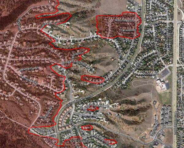
Map of Waldo Canyon fire, east side June 29, 2012(The map above is an example of how the the Waldo Canyon fire spread into the Flying W Ranch area of Colorado Springs on Tuesday, June 26. HERE is a link to a map that can zoom in to see more details. MODIS/Google)

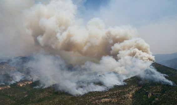
Authorities searching through the rubble of the 348 homes that burned in the Waldo Canyon fire at Colorado Springs, Colorado found the remains of one person. A second person at that home and another nine are still unaccounted for that live in the areas that burned in the fire.

Firefighters wanted to do some burning out Thursday night to remove some of the fuels adjacent to the firelines but the humidity was too high. That same humidity also prohibited any additional spread of the fire, which has burned 16,750 acres and officially is 15 percent contained at a cost to date of $5.2 million.

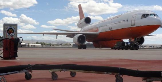
President Obama will tour the fire area on Friday to inspect the destruction. Officials said this would not interfere with fire operations and the number of closed roads will be less than you would typically encounter during a Presidential visit. He will most likely fly in to Peterson Air Force Base at Colorado Springs and we are thinking that he may have a photo op with the military MAFFS C-130 air tankers working out of the base.

If the president makes any public comments during his visit it will be interesting to see if he mentions wildland fire preparedness, such as the reductions over the last few years in funding, and the reduced number of firefighters, equipment, and air tankers.

The City of Colorado Springs announced that they will release a list of the damaged homes by mid-morning on Friday. It will be posted on the city’s web site at http://springsgov.com/

A slide show with aerial photos of the destruction in the urban area is jaw-dropping.

Contest: predict the date for entering Preparedness Level 5

It has been a while since we had a contest like the photo-caption contests we had HERE, HERE, and HERE. So we are starting a new one today, to predict the date when the National Interagency Fire Center moves into Preparedness Level 5 at the national level, not in a geographic area. Currently we are at Level 4; the national Situation Report always lists the daily Preparedness Level. Below are the descriptions of levels 4 and 5 (descriptions for all of the levels are HERE):

  • Preparedness Level 4 – Three or more Geographic Areas are experiencing incidents requiring Type 1 and 2 IMTs. Competition exists between Geographic Areas. Nationally, 60 percent of Type 1 and 2 IMTs and crews are committed.
  • Preparedness Level 5 – Geographic Areas are experiencing major incidents which have the potential to exhaust all agency fire resources. 80 percent of Type 1 and 2 IMTs and crews are committed, as well as the majority of other national resources.

If you guess the date correctly and win the tie breaker, you will become the proud owner of a 2012 Air Tanker shirt.

Air Tanker Shirt, 2012

The rules:

  • The winner will be the person who comes closest to predicting the date that we move to Preparedness Level 5 the first time in 2012. If more than one person selects that date, the winner will be the person with the closest date and who most accurately predicts the “Acres from Active Fires” on that same date as listed on the NIFC report at this site. That report is issued on week days only, so if the change to PL 5 occurs on a weekend, we will use the last report prepared before that date.
  • To enter: submit a comment below, on this article, no later than 0001 MDT the day before the national preparedness level moves to Level 5.
    • 1. Choose the date to move to PL 5
    • 2. AND the “Acres from Active Fires” as explained above.  If you don’t guess the acres, you won’t be eligible for a tie breaker, even if you correctly guess the date.
    • 3. When you type your guesses in the comment form, be sure you have a valid email address listed. That is the only way we will be able to notify the winner. As always, we will NEVER disclose anyone’s email address to anyone, unless we specifically ask you first.
  • Please ONLY leave comments on this article that are contest entries. Others will be deleted. But if you want to state your opinion or the reason for your prediction in the same comment WITH your single entry, that’s fine.
  • Only one entry is allowed per person. If anyone submits more than one, all entries from that person will be disqualified. We will be checking IP addresses to detect multiple submissions.
  • By entering, you agree that if you win, you will send us for publication on Wildfire Today a photo of you wearing the shirt at your place of work, along the lines of what was done after another Wildfire Today contest.
  • The real name and place of work of the winner will be announced here on Wildfire Today.
  • People are not eligible to enter if they sometimes have inside information about changes to Preparedness Levels, or if they work at a national government office in D.C.,  NIFC, or a Geographic Area Coordination Center.
  • No more than two shirts will be awarded. Most likely, there will be only one.
  • We reserve the right to change these rules at any time.

Thanks go out to Dick

Our disappearing forests and the fires of 1748

Whitewater-Baldy June 2, 2012 Photo by Kari Greer-USFS
Whitewater-Baldy fire, June 2, 2012. Photo by Kari Greer/USFS

In the southwest United States 1748 was a very active year for wildland fires. According to Craig Allen, a research ecologist with the United States Geological Survey in Los Alamos, New Mexico, “Every mountain range we studied in the region was burning that year”. But in spite of there being no debate or controversy about “let burn”, suppress every fire by 10 a.m., budget cuts, or air tankers, the forests survived. Not only did they survive, they thrived.

There are two reasons why the fires of 1748 had a different effect than the fires of the last 15 years.

One is tree density. In 1748 there were about 80 trees per acre. Frequent low-intensity fires maintained this stocking level, reducing regeneration, ladder fuels, and dead wood on the forest floor. Fires spread slowly and for the most part stayed on the ground without turning into crown fires. Today’s forests have about 1,000 trees per acre and sanitizing fires are no longer a part of the equation, making it much more likely that a ground fire will leap into the canopy and become a tree-killing conflagration.

The second reason is climate change. Higher temperatures along with more frequent droughts have caused heat stress on forests making them less resistant to attacks by fire and insects.

Dr. Allen’s research indicates that these conditions have brought us to a situation with increased tree mortality and forests that are less likely to regenerate. In some areas trees are being replaced by shrub lands.

The New York Times interviewed Dr. Allen. Here is an excerpt from their article:

But beginning in 1900, when railroads enabled the spread of livestock, cattle devoured the grassy surface fuels and the fire cycle stopped. A decade later, a national policy of forest fire suppression formalized this new normal. Over the next century, forest density went from 80 trees pr acre to more than 1,000.

Then in 1996, the climate emerged from a wet cycle into a dry one — part of a natural cycle for this region. Winters became drier. And “we immediately began seeing major fires,” Dr. Allen said.

With so many trees crammed into the forest, fires climbed straight to the canopy instead of remaining on the ground.

“These forests did not evolve with this type of fire,” said Dr. Allen. “Fire was a big deal in New Mexico, but it was a different kind of fire.” The result, he said, is that the species that now live there — ponderosa pines, piñon, juniper — cannot regenerate, and new species are moving in to take their place.

“Ecosystems are already resetting themselves in ways big and small,” Dr. Allen said. The challenge for managing these ecosystems, he said, is to try to help them adapt.

Seeking to preserve existing systems is futile, he said.

California: dozer rolls over in Mendocino County

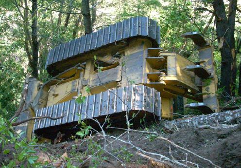
Dozer rolloverThe California Department of Forestry and Fire Protection has released a preliminary accident report, a “Green Sheet”, for an accident on the Pond fire in the northern part of the state, June 14, 2012 in Mendocino County. The dozer was privately owned and there were no injuries to the operator.

Here is an excerpt from the report:

===============================================================

SEQUENCE OF EVENTS

The fire occurred in an area of steep slopes, heavy fuels in a Wildland Urban Interface/Intermix setting. The fire was spotting in areas due to winds, steep slopes and receptive fuel beds.

As the dozer operator took action along the road, he observed the fire had extended below the road at a bend. The operator attempted to flank the fire and tie a dozer line in between the two road segments. The operator stated the visibility was very poor due to heavy smoke lying down in the area. The operator stated as he began to climb uphill to tie the line in, the slopes became very steep. Due to the steepness of the slope, the operator made three unsuccessful attempts to connect the line to the upper portion of the road.

On his third attempt to connect the line, the operator encountered a log in his path. As the operator attempted to move the log, his dozer slid perpendicular to the slope, reducing the dozer maneuverability. The operator then stated he attempted to make his way off the slope. As he moved down the slope, he encountered a soft spot of soil which caused him to slide a short distance downhill (approximately 10 feet). The operator stated the slide caused his downhill tracks to settle on a loose root wad mass. The operator said as he began to move the dozer the root wad mass acted like a fulcrum and flipped the dozer onto its side/top. The operator said he shut the dozer off and waited to ensure the dozer was done moving. Once he was confident it wasn’t moving any further, he released his seat belt and exited the dozer without any further incident.

INJURIES/DAMAGES

The equipment operator self extricated himself from the dozer and did not complain of any injuries.

The dozer has a bent grab handle on the right side of the cab. No other cosmetic damage was noted. The extent of the mechanical damage has yet to be determined.

Colorado: Flagstaff and Waldo Canyon fires force evacuations

UPDATED at 8:52, a.m. MT, June 27, 2012:

Due to a large number of people seeking information about the Waldo Fire in Colorado Springs, our site hosting provider is having some issues. We have posted updated maps and more information about the fire at our sister site, Examiner.com.

=============================================================

Waldo Canyon fire near Colorado Springs

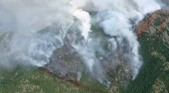
The Waldo Canyon fire has burned over 6,000 acres northwest of Colorado Springs since Saturday, but it found new life on Tuesday and exhibited extreme fire behavior as a record high temperature of 101 and strong winds pushed it into a populated area, burning an undetermined number of homes while forcing 32,000 people from their homes.

Around 7 p.m. the southbound lanes of Interstate 25 were closed at Interquest Parkway. The northbound lanes remained open at that time. All lanes were later opened.

An evacuation order was issued after 9 p.m. by the City of Colorado Springs for areas that are north of Garden of the Gods Rd. between I-25 to the east all the way to the western City limits and north to the Air Force Academy. The evacuated areas in the Air Force Academy include Academy Dr. to the USAFA’s southern and western boundaries.

The Academy’s glider port is being used as a helibase for the helicopters dropping water on the fire.Their Class of 2016, consisting of 1,045 freshmen cadets, are scheduled to arrive Thursday.

A Type 1 Incident Management Team, Great Basin Team 2, Incident Commander Rich Harvey, assumed command Monday morning, June 25.

Information about evacuations can be found at InciWeb. Public Information Center Phones: 719-520-7058, 720-402-7935, 720-202-4510, 720-237-9947, 720-237-3417

The City of Colorado Springs also has some fire information, including a map of areas that are under evacuation orders.

Flagstaff fire near Boulder

Flagstaff fire, June 26, 2012
Flagstaff fire, June 26, 2012 (KWGN)

The Flagstaff fire started mid-afternoon on Tuesday about three miles southwest of Boulder, Colorado and by 4:45 p.m. had spread so rapidly that a Type 1 Incident Management Team from California staged in the Denver area, Rocky Opliger Incident Commander, was dispatched to manage the fire. First called the Bison fire, it became the Flagstaff fire, named after a nearby road.

The first evacuations were ordered before 3:28 p.m. and the size at that time was estimated at 200 to 300 acres.

Below is information as of 9:00 p.m. from the City of Boulder Office of Emergency Management:

  • Only 26 homes have been evacuated. Those were near Bison Drive and Kossler Lake.
  • A total of 2,416 reverse notifications have been sent to people in and around the affected area [to remain on standby in case of a change in fire direction and behavior overnight]
  • Three helicopters and two tanker planes were working the fire until sunset.
  • About 100 firefighters are on the ground doing structure protection through the night.
  • The fire is burning in upper Skunk Canyon. just west of the NIST/NOAA campus, and expected to produce smoke in Boulder through the night.
  • A Federal Type 1 team is expected to take over management of the fire on Wednesday.
  • All Pets Animal Hospital, 5290 Manhattan Circle, 303-499-5335, is open 24 hours and is accepting small animals. In the case of an evacuation, small animals can be dropped off at All Pets if their owners are unable to take them with them in the case of an evacuation.
  • No structures are threatened at this time.
  • There are no reported injuries and there is zero percent containment of the approximately 300 acre fire.