(UPDATE at 7:35 p.m. PDT, July 30, 2013)
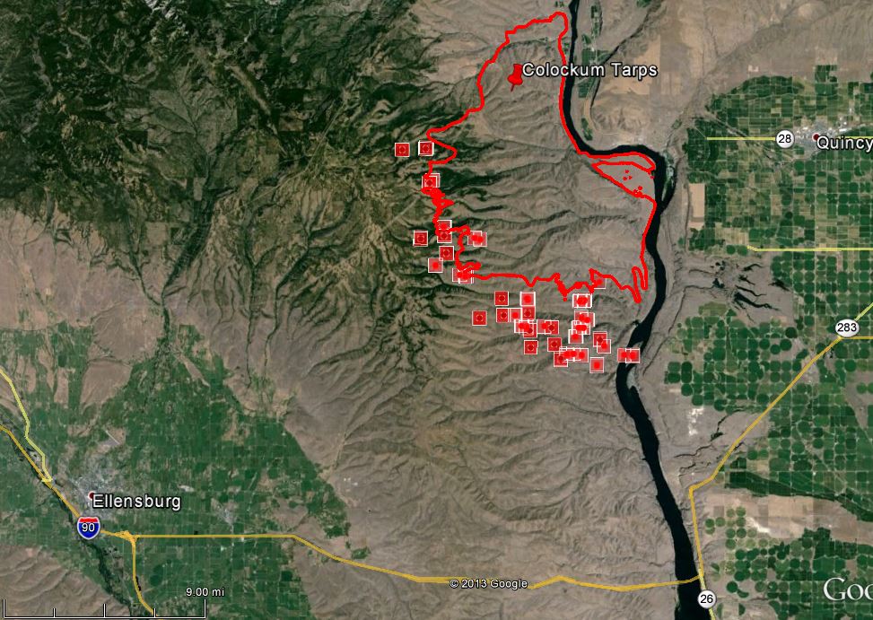
The Colockum Tarps Fire continued to spread to the south Tuesday, and according to the incident management team has now burned 59,316 acres.
In the map of the fire below, the red squares represent heat detected by a satellite during the day on Tuesday. The red line was the perimeter at 1 a.m. Tuesday. Despite the appearance of some of the red squares, the fire has not crossed the Columbia River.

About three miles southwest of the fire is a new wind farm with hundreds of wind generators. It is under a “level 2” evacuation notice, which is the next level before Get Out NOW. The fire is moving in that direction but the vegetation in the area is fairly light and firefighters are hopeful that the facilities will not be too difficult to protect. They had structure protection personnel checking it out Tuesday evening. (I wonder how retardant would affect the wind generators?)
Hotshot crews were transported by boats on the Columbia River to their assignments on the south side of the fire Tuesday.
Single engine air tankers are working the fire along with helicopters and one of the DC-10s, which is reloading at Moses Lake.
****
(UPDATE at 7:40 a.m. PDT, July 30, 2013)
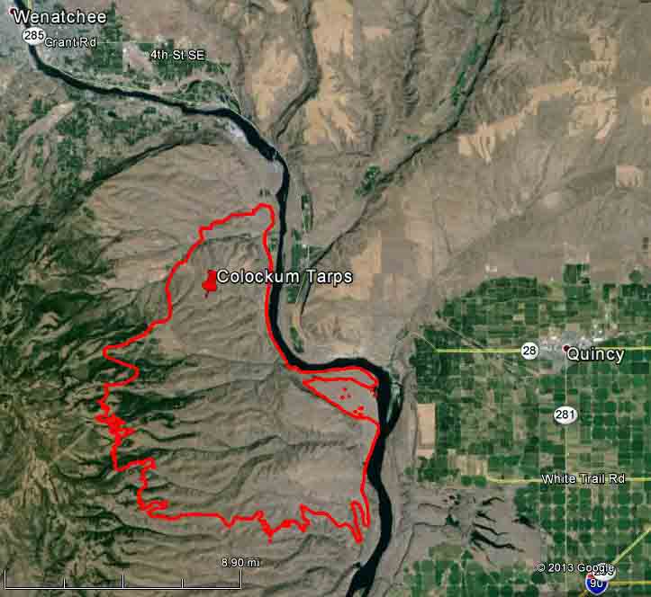
We have a more accurate map of the Colockum Tarps Fire, which, according to our sources, has burned approximately 46,000 acres, or 72 square miles. The fire is still active and continues to spread on the west and south sides. Information about evacuations can be found on InciWeb.

Carl Buick explained to us, with a visual aid, how the Colockum Tarps Fire got its name. It started near Colockum Creek and the next drainage over is Tarpiscan creek. The initial attack operations were first set up at the road junction seen below.

