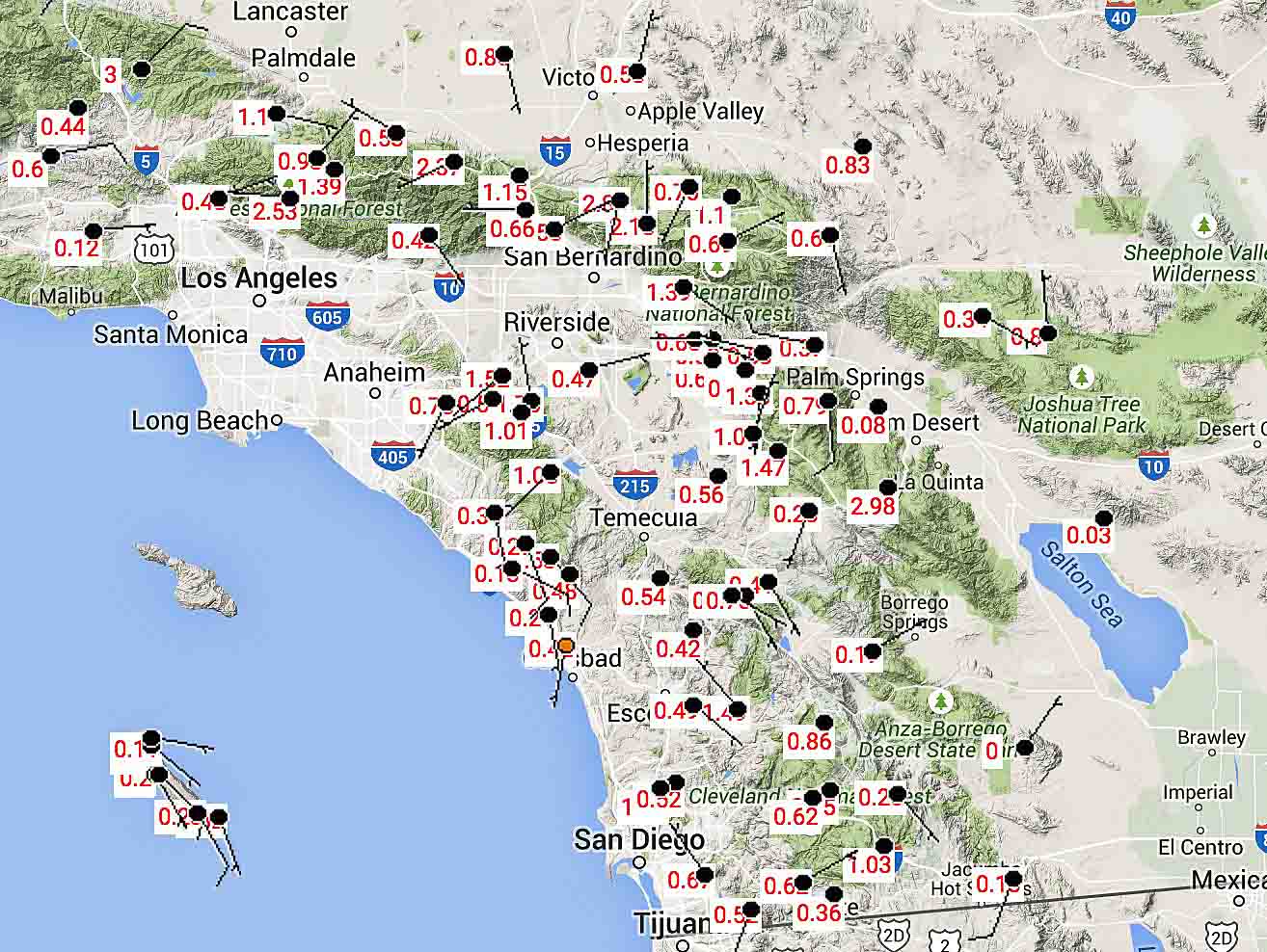
The remnants of Hurricane Dolores passed over southern California Sunday setting precipitation records across the area, putting a sudden pause on the wildfire season. All-time rainfall records were set in Los Angeles, San Diego and more than a dozen other cities.
A bridge on Interstate 10 between Palm Springs and the Arizona border washed out and nearby highways that could have served as detours were closed.

Here are some of the highest precipitation amounts at weather stations in and near National Forests for the 24-hour period that ended at 8 a.m. PT, July 20, 2015:
- Warm Springs near Castaic, 3.0″
- Pinyon, San Jacinto Mountains, 2.9″
- Cameron, east of San Diego, 1.03″
- Rock Camp, near Lake Arrowhead, 2.8″
- Mormon Rock, near the recent North Fire, 1.15″
Below is an excerpt from an article at The Weather Channel:
…San Diego broke its all-time July rainfall record Saturday when 1.03 inches fell. That broke not only the July single-day record of 0.83 inches set July 25, 1902, but also the record for an entire July’s rainfall, which was 0.92 inches July 1-31, 1902.
It’s also more rain than San Diego saw in all of January this year; on average, January is the second-wettest month and July the second-driest, with January averaging 66 times more rainfall than July. The only other time July has out-dampened January in San Diego was 1976, when July had 0.02 inch to January’s trace.
San Diego added to its total Sunday with another 0.66 inch of rain as of 11 p.m. The month-to-date total of 1.70 inches, which fell in less than 36 hours, is more rainfall than San Diego had seen in the previous 101 Julys combined; a total of 1.68 inches fell during July from 1914 through 2014 in San Diego.
Los Angeles has also broken its July rainfall records. Downtown Los Angeles picked up 0.36 inch Saturday, which broke the July full-month record of 0.24 inch from July 1-31, 1886. Los Angeles International Airport saw 0.32 inch of rain, tying the record for all of July set in 1992.

These droughts are dangerous in more than one way.