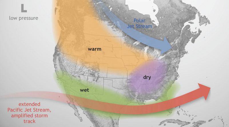
From NOAA:
El Niño conditions have continued this summer and forecasts indicate that this El Niño will strengthen, with an 84% chance of it peaking as a strong event in late fall or early winter. In terms of how long the event may last, the Climate Prediction Center (CPC) says there is a 95% chance that these conditions will last through the winter, gradually weakening through spring 2016. Research has shown that strong El Niños are often followed by La Niñas, so conditions should continue to be monitored closely, especially if the El Niño weakens next spring, as predicted.
El Niño in Winter
An El Niño develops when sea surface temperatures are warmer than average in the equatorial Pacific for an extended period of time. This is important to North America because El Niño has an impact on our weather patterns, most predominantly in the winter.
Although each El Niño is different, there are some general patterns that are predictable. For instance, the polar jet stream is typically farther north than usual, while the Pacific jet stream remains across the southern United States (see figure above).
This pattern brings above-normal temperatures to much of the Midwest region, particularly across the northern states. This does not mean that cold weather will not happen this winter but typical extreme cold weather may be milder and less frequent. In addition, this pattern may bring drier conditions to eastern portions of the Midwest.
