(UPDATED at 12:22 PST January 9, 2018)
The Southern California storm so far:
– At least 5 people dead
– Numerous unconfirmed missing-person reports
– 101 Freeway shut down for 30+ miles
– Evacuations ordered in areas of Santa Barbara, Ventura, L.A. countieshttps://t.co/ghIWwcJSqQ pic.twitter.com/FtUxihiwy7— Los Angeles Times (@latimes) January 9, 2018
****
(UPDATED at 1:24 p.m. PST January 8, 2018)
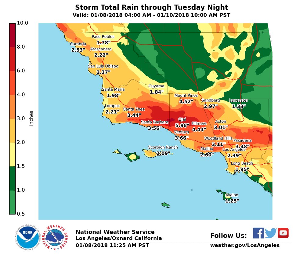
Some of the same residents who were forced to evacuate during this year’s wildfires in Southern California are being ordered to evacuate again as a very dangerous storm bears down on the area. Weather forecasters predict the Coast and valleys can expect 2 to 4″ with foothills and mountains seeing 4-7″ (locally up to 9″). Ojai, which is surrounded by the footprint of the Thomas Fire, is expected to receive 5.98″.
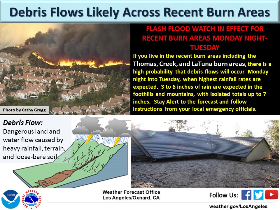
The fear is that flash floods, mudslides, and debris flows could be life threatening.
Santa Barbara County Emergency Management issued evacuation notices for areas below the Thomas, Whittier, Sherpa and Rey Fire burn areas beginning at 12 p.m. Monday, January 8. Residents can visit www.countyofsb.org and refer to the interactive map to determine if their property is affected by the notices, or call 211 or 800-400-1572 for more information.

The very powerful storm moving into the area is resulting in not only predictions for heavy precipitation, but also strong winds. Various types of weather related warnings have been posted by the National Weather Service for the following counties: Ventura, Orange, San Luis Obispo, Santa Barbara, San Diego, Los Angeles, San Bernardino, Riverside, Monterey, and Kern. The Monday night forecast for Santa Barbara calls for 25 mph winds gusting to 38 mph out of the southwest and southeast.
Updated maps showing expected rain and snow totals from upcoming storm. Over an inch of rain expected over most valley locations, 2 to 5 inches of rain over the foothills and up to 3 feet of snow over the Sierra Nevada. #CAWX #CAstorm pic.twitter.com/vVmBBg93Vr
— NWS Hanford (@NWSHanford) January 7, 2018


Would these mudslides have occurred if prescribed fires were being conducted regularly? It seems to me that prescribed fire and thinning are like getting a vaccination. If management is done then the grasses and other species that fill the forest floor hold back soil and spread out the flow of water. After time gullies that were concentrating flow can actually fill in with soil and the danger from flash flooding is reduced. The catastrophic fires and mudslides may have been the result of the new owners of the land not managing it in the way it had been maintained by Native Americans. Similar to not getting a vaccination, you might be fine for a long time until catastrophe strikes.
My condolences to the victims of these tragedies. I mention this with the hope that these types of events might be prevented in the future.
When, if ever, will County Commissioners and Planners look beyond the Tax Revenues to accept and mitigate the dangers of building homes in fire-prone areas that are classic examples of the fire & flood & mud flow cycle?
God, these poor people just cannot seem to get a break! It makes me feel guilty for griping about the cold & snow here in Montana!