Tinder Fire forces evacuations, burns structures in central Arizona

3D Map of the Tinder Fire

Above: 3D map of the Tinder Fire showing the perimeter at 1 a.m. MST April 30, 2018. Looking South. Perimeter by USFS.

(Originally published at 10:29 a.m. MDT April 30, 2018)

Structures have burned and evacuations are taking place at the Tinder Fire in Arizona. A mapping flight at 1 a.m. MT on Monday showed that it had burned 8,623 acres east of Highway 87 between Payson and Winslow, Arizona.

(To see all articles on Wildfire Today about the Tinder Fire, click here.)

Firefighters were actively engaged in structural protection Sunday night. The Incident Management Team (IMT) led by Bea Day reports that structures have burned but no details are available. The fire remains active in the communities affected by the fire and the priority is providing for emergency responder and public safety. Coconino County will be assessing damages and providing updates as they are able.
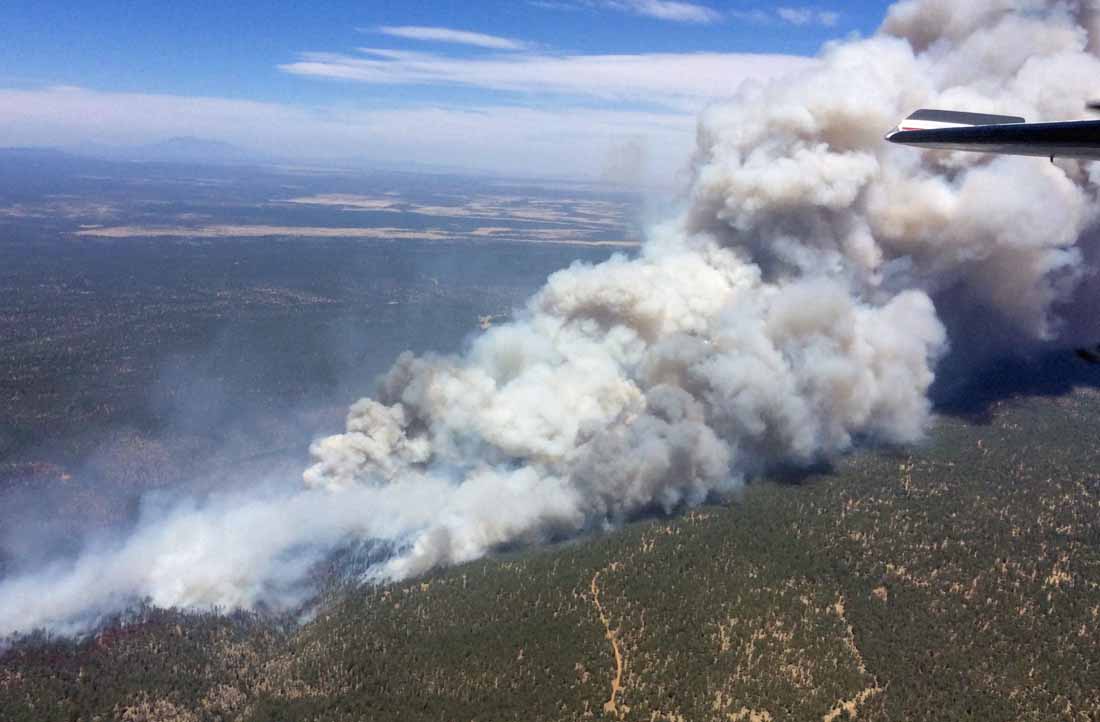
Tinder Fire
Tinder Fire, April 29, 2018. InciWeb photo, uncredited and undated.

The fire started April 27 during Red Flag Warning conditions. A map released Sunday morning showed that it had burned about 500 acres. A strong southwest wind pushed it to the northeast away from its origin near Highway 95 east of Blue Ridge Reservoir. A new map from 1 a.m. Monday  showed that it spread near a community on the east side of Highway 87/282.
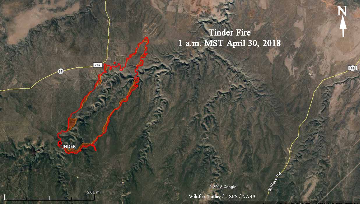
Map of the Tinder Fire
Map of the Tinder Fire showing the perimeter at 1 a.m. MST April 30, 2018. Perimeter by USFS.

The resources assigned to the fire include 13 crews, 5 helicopters, 23 engines, 3 dozers, 2 water tenders, and overhead, for a total of 510 personnel.

On Monday the fire is just outside a Red Flag Warning area, but strong southwest winds will continue to be a challenge for firefighters through Tuesday.  The IMT reports that there is a potential for very active to extreme fire behavior with rapid rates of spread and moderate to long range spotting. The weather forecast indicates that the fire will continue to move to the northeast.

The Coconino County Sheriff’s Office has ordered evacuations for communities affected by the fire that are north, east, and west of Hwy 87. Visit https://www.facebook.com/CoconinoCounty for details. Blue Ridge area residents can call the County’s Call Center, 928-679-8393, with questions about evacuations and structures.
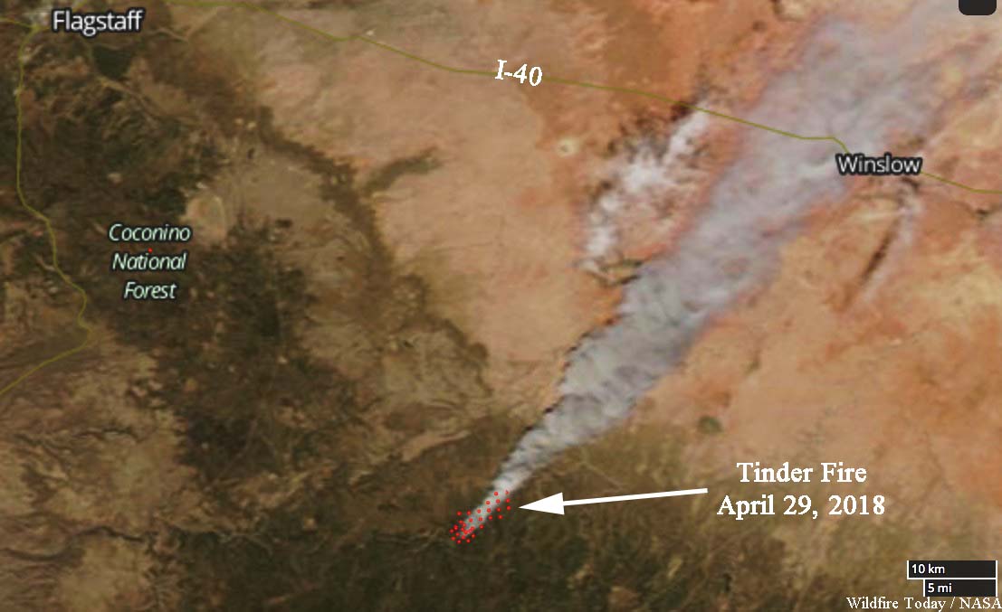
Satellite photo Tinder Fire
Satellite photo of the Tinder Fire, April 29, 2018. NASA.
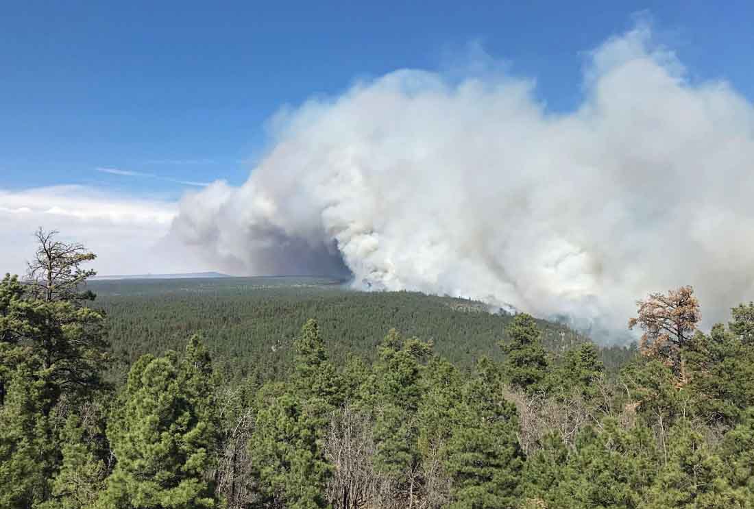
Tinder Fire
Tinder Fire, April 29, 2018. InciWeb photo, uncredited and undated.

Below is video of the fire recorded over the fire Monday morning.

Red Flag Warnings in 11 states, April 30, 2018

wildfires red flag warning weather

The National Weather Service has issued Red Flag Warnings or Fire Weather Watches for areas in Arizona, New Mexico, Kansas, Colorado, Nebraska, Oklahoma, Texas, Illinois, Virginia, Maryland, and Delaware.

The Red Flag Warning map was current at 8:50 a.m. MDT on Monday. Red Flag Warnings can change throughout the day as the National Weather Service offices around the country update and revise their forecasts.

OK Bar Fire grows by almost 8,000 acres

Map of OK Bar Fire

Above: Map of OK Bar Fire. The red line was the perimeter at 2229 MDT April 28, 2018. The yellow line was the perimeter about 20 hours before.

The OK Bar Fire in Southern New Mexico consumed another 7,817 acres Saturday to bring the total up to 37,067. Most of the growth was on the south side where it is now 8 miles north of the international border.

The area is under a Red Flag Warning that expires Monday night. Forecasters expect 25 to 35 mph southwest winds with gusts to 45 mph or higher and relative humidities reaching into the single digits. Strong southwest winds will continue through mid week.

The OK Bar Fire is not being fully suppressed and information about the incident is not easy to find. It is still not listed at InciWeb or on the official fire information site for New Mexico. Even though it has been growing by thousands of acres each day since it started April 22 the national situation report keeps saying, “Last narrative report unless significant activity occurs.”

Red Flag Warnings in 10 states, April 29,2018

wildfires weather red flag warnings

The National Weather Service has issued Red Flag Warnings or Fire Weather Watches for areas in Arizona, New Mexico, Kansas, Colorado, Nebraska, Wyoming, Minnesota, Iowa, Texas, and Wisconsin. Utah again miraculously avoids extreme fire weather.

The Red Flag Warning map was current at 11 a.m. MDT on Sunday. Red Flag Warnings can change throughout the day as the National Weather Service offices around the country update and revise their forecasts.

Medical student shares what she learned as a Hotshot

sawtooth hotshots

Above: The Sawtooth Hotshots as seen in the video below.

CC Ma, a medical student applying for residency, credits her unique experience as a crew member of the Sawtooth National Forest Hotshots for teaching her toughness and resiliency. The relationships she established with crew members gave her the needed attitude to thrive and succeed when things don’t go as planned.

Under the radar fire has burned 29,000 acres

3D map OK Bar Fire

Above: 3D map of the OK Bar Fire looking north, showing the perimeter at 3:06 a.m. MDT April 28, 2018.

A wildfire that is not getting much attention has burned over 29,000 acres in Southern New Mexico. The OK Bar Fire has a Type 4 Incident Commander assigned, the second lowest level for an IC, and 32 other personnel. It is in the southern panhandle of the state 21 miles south of Animas and has grown to within 9 miles of the Mexican border.

The fire is being managed by New Mexico State Forestry using a less than full suppression strategy. Fires not being suppressed do not receive the same exposure from the public agencies as conventional blazes, and this one may get even less in the next few days. After it grew by almost 5,000 acres on Friday, the national Situation Report for Saturday described the fire like this:

Extreme fire behavior. Last narrative report unless significant activity occurs.

Saturday morning the interagency fire information site for New Mexico did not include any information about the fire. It is not listed on InciWeb.

Following the expansion on the south end Friday, the situation is not likely to improve much in the near future. The area is under a Red Flag Warning Saturday. On Sunday and Monday the wind speed will increase each day, gusting out of the southwest above 30 mph.

The OK Bar Fire started April 22 and is burning on the Diamond A and Gray Ranches. It is expected to continue to move south over the Center Creek Mountains and east towards the Cowboy Rim/ Timber Lake Mountains.

Red Flag Warnings, April 28, 2018

wildfire weather red flag warning

The National Weather Service has issued Red Flag Warnings or Fire Weather Watches for areas in New Mexico, Arizona, Colorado, Montana, and North Dakota. The Watch locations in Arizona, New Mexico, and Colorado are for enhanced wildfire danger on Sunday.

The Red Flag Warning map was current at 7:30 a.m. MDT on Saturday. Red Flag Warnings can change throughout the day as the National Weather Service offices around the country update and revise their forecasts.

Smoke produced by large wildfires can be equal to a volcano

Satellite photo fires British Columbia

Above: Satellite photo taken August 2, 2017 showing smoke from some of the wildfires in British Columbia. The red dots represent heat detected by a sensor on the satellite.

It is not easy to measure and quantify the composition of the smoke and the amount of particulate matter that a huge wildfire produces when intense, large-scale burning forms towering pyrocumulus clouds that climb tens of thousands of feet into the sky. This launches the byproducts of combustion into the  stratosphere — the second layer of Earth’s atmosphere, above the troposphere. Once introduced at that level they have been tracked while circling the planet multiple times.

Below is an excerpt from an article by Megan Gannon at Live Science, which points out similarities between large wildfire events and volcanos.

For comparison, the explosive 2008 eruption of Mount Kasatochi, an island volcano in Alaska, sent about 0.7 to 0.9 teragrams (nearly 1 million tons) of aerosols — tiny, suspended particles — into the stratosphere, Peterson said. For months afterward, people around the Northern Hemisphere documented unusually colored sunsets, thanks to the sulfate aerosols and ash the volcano injected into the atmosphere.

Peterson’s team estimated that the British Columbia pyroCb event sent about 0.1 to 0.3 teragrams (about 200,000 tons) of aerosols into the stratosphere — which is comparable to the amount seen with a moderate volcanic event, and more than the total stratospheric impact of the entire 2013 fire season in North America, he said.

It’s well known that catastrophic volcanoes can influence the global climate. The huge 1991 eruption of Mount Pinatubo in the Philippines, one of the largest in living memory, lowered temperatures around the world by an average of 0.9 degrees Fahrenheit (0.5 degrees Celsius).

As an example of the wildfire activity in British Columbia last year, here is an excerpt from an article posted August 9 at Wildfire Today:

The wildfire situation in British Columbia has not gotten any better in the last several days. Currently there are 128 active wildfires in the province, with four of them being larger than 50,000 hectares (123,000 acres). The largest, the Hanceville Riske Creek Fire, is getting closer to half a million acres each day.

Since April 1, approximately 591,280 hectares (1,461,082 acres) have burned in 900 fires in BC.

  • Hanceville Riske Creek, 172,000 hectares (425,000 acres) approximately 60 km southwest of Williams Lake.
  • Elephant Hill, 117,000 hectares (289,000 acres), near Ashcroft.
  • Tautri Lake, 76,000 hectares (188,000 acres), 80 km northwest of Williams Lake.
  • Baezaeko River-Quesnel West, 53,000 hectares (131,000 acres).

More than 400 additional firefighters from Australia, New Zealand, Mexico and the US are expected to arrive in BC this week. Other firefighters from Australia have been in the province for a couple of weeks. More than 100 firefighters arrived from Mexico since Saturday of last week…