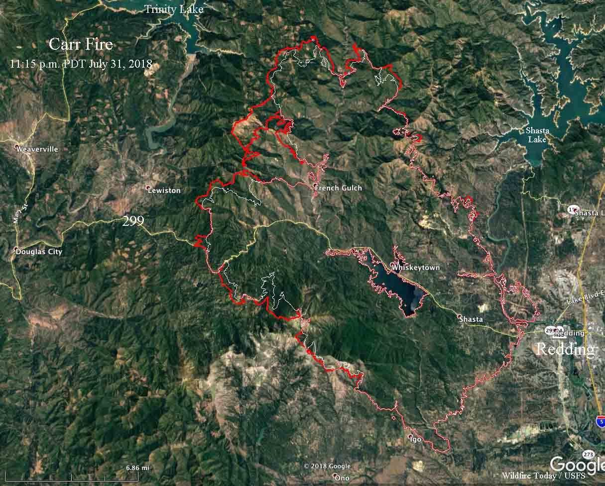
(UPDATED AT 8:54 a.m. PDT August 1, 2018)
Tuesday the Carr Fire, west of Redding, California, was active on the southwest, west, and north sides, to bring the total blackened acres up to 121,000, according to a mapping flight Tuesday night.
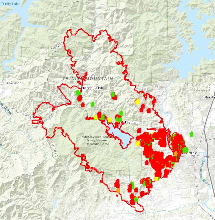
CAL FIRE has updated the number of structures impacted by the fire. Destroyed were 1,018 residences, 12 commercial structures, and 435 outbuildings. Buildings damaged included 181 residences, 6 commercial structures and 61 outbuildings.

To see all of the articles on Wildfire Today about the Carr Fire, including the most recent, click here.
(Originally published at noon PDT July 31, 2018)
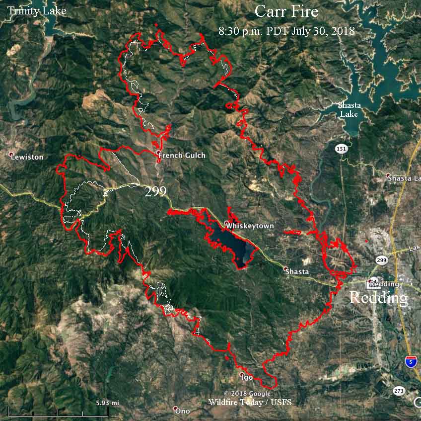
Firefighters have made a great deal of progress on the Carr Fire, resulting in no appreciable growth during the last two days within seven miles of the west edge of Redding.
On Sunday and Monday the west side of the fire saw significant expansion from the area west of Shasta Bally Road going clockwise around the west and north sides to a point 4 miles west of Shasta Lake. The fire is 3 miles east of Trinity Lake and 4 miles east of Lewiston. At a Tuesday morning briefing officials said there is “a direct threat to Lewiston”. CAL FIRE is calling it 110,154 acres.

According to the latest information, the number of structures destroyed includes 884 residences, 4 commercial structures, and 348 outbuildings. At least 2,546 remain threatened.

The Sheriff’s office confirmed that another fatality has been found on the Carr Fire, bringing the total up to six. The latest was a 60-year old man who recently had heart surgery. Other deaths include two firefighters, and a great grandmother and two grandchildren she was caring for. Another seven people have been reported missing.
Many areas have been repopulated, but others are still under evacuation orders.
Helicopters and air tankers have been prevented at times from dropping water and retardant on the fire by an inversion that traps smoke, at times decreasing the visibility to a point where it is unsafe for the aircraft to fly as required, low and slow over complex terrain.
Resources assigned to the fire include 334 fire engines, 59 hand crews, 17 helicopters, 68 dozers, and 65 water tenders, for a total of 3,607 personnel.

Bill, your group is doing a wonderful job showing where the fire is and giving us info about what the Unified Command has planned.
We evacuated Thursday, and got back in yesterday.
Thursday evening was the most colossol plume fire I’ve seen . Reminds me of the last push of the Yellowstone fire in 1988, when it blew down to Old Faithful. That fuel was a little different—70 foot lodgepole growing 3 -4 feet apart.
Hi John, and thanks. Glad you’re home. No damage, I assume.