(UPDATED at 11:51 a.m. MDT September 16, 2018)
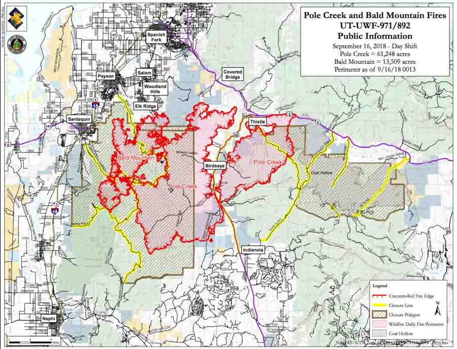
The Incident Management Team reports that as of 12:16 a.m. Sunday the Pole Creek Fire had burned 61,248 acres and the Bald Mountain Fire, 13,509 acres.
(Originally published at 9:12 a.m. MDT September 15, 2018)

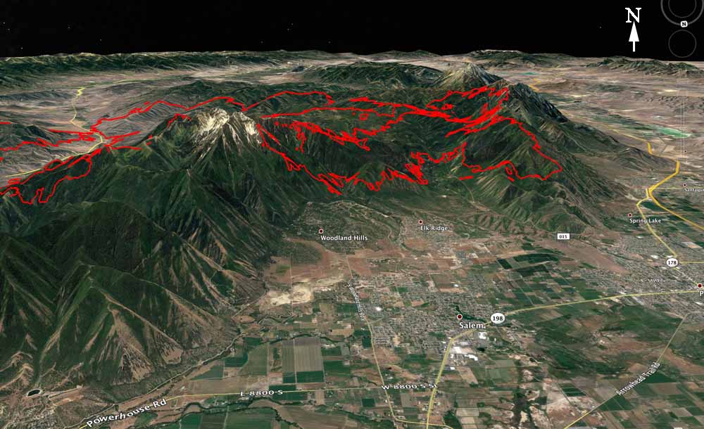
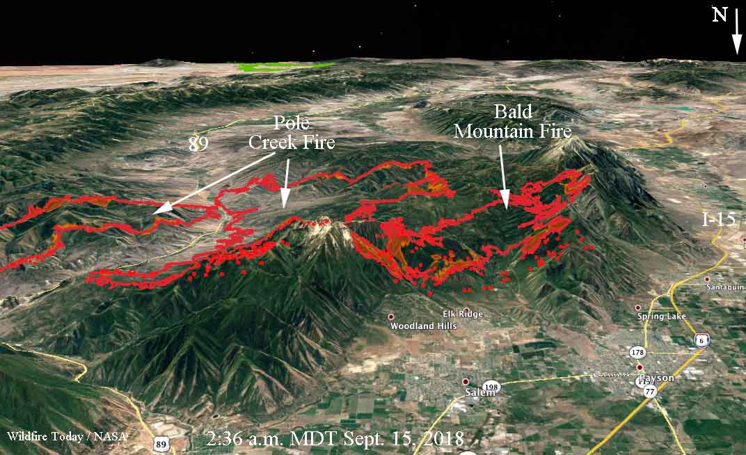
Fifteen miles south of Provo, Utah the Bald Mountain and Pole Creek fires had come within half a mile of merging when the fires were mapped at 2:36 a.m. Saturday. That city is not threatened but residents of Elk Ridge and Woodland Hills who have not evacuated yet are looking at flames on the steep slopes uncomfortably close to their homes.
The fires were started by lightning on the Unita National Forest — Pole Creek on September 6 and Bald Mountain on August 24. Initially Forest Service personnel allowed them to burn with the intention of suppressing only the portions that may threaten property, private land, important natural resources, or lives. They wanted to herd them around, while re-introducing a natural process, fire, into the environment.
To see all articles on Wildfire Today about the Pole Creek and Bald Mountain Fires, including the most current, click HERE.
Now they have both spread outside the land managed by the Forest Service and are burning private private property. No structures have been reported burned, but the estimated costs of suppressing the fires to date is almost $2 million. That number will keep rising as more firefighting resources flood in to augment the 433 personnel already on scene.
The reported sizes of the fires have been rather confusing at times, but according to a mapping flight at 10:45 Friday night the Pole Creek Fire was 48,497 acres and the Bald Mountain Fire had burned 11,090, for a combined total of 59,587 acres. A satellite overflight at 2:36 a.m. Saturday showed additional growth on the west and north sides that occurred in the four hours between the flights.
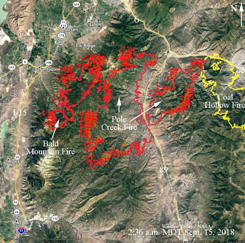
With a Red Flag Warning in effect through Sunday, rapid fire growth to the north and east is expected to continue, with strong winds, and on Saturday, single-digit relative humidity.

Joseph Smith would be proud.
I’ve been out of the game for too long to have any understanding of the way the decision-making process works anymore. That said, what I have recently witnessed here in Montana, causes me some concern as to “who,” is on “what” page of the program. We recently had several un-controlled wildland fires in the Northwest part of the state, when the Forest service began prescribed fires on the Lolo NF. Regardless of the outcome, it has left many folks shaking their collective heads.
Like I said, my 34 years are history that no longer applies, but I’m of the belief that if the outfit hopes to win the support of the taxpayers, it would be wise to do some informational outreach in a far more effective manner than what I’ve seen to date. In the meantime, I’m not looking for a job after discovering that retirement is the best job a person could hope to land.jw
The Lieutenant Governor diverted state assets yesterday morning so he and Mitt Romney could have a nice photo op on the easter, closed, side of the fire. What particular assets were diverted, how the airspace ownership was altered, and who authorized the trip are still in question. What’s not in question is that it affected the information flow for the eastern flank of the fire significantly. Ridiculous that an elected state official used an active disaster to give a candidate a nice campaign stop.
All of Woodland Hills and Elk Ridge have evacuated as of Thursday night.