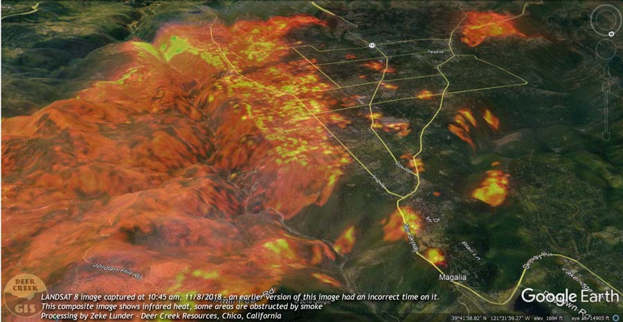
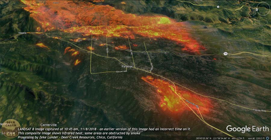
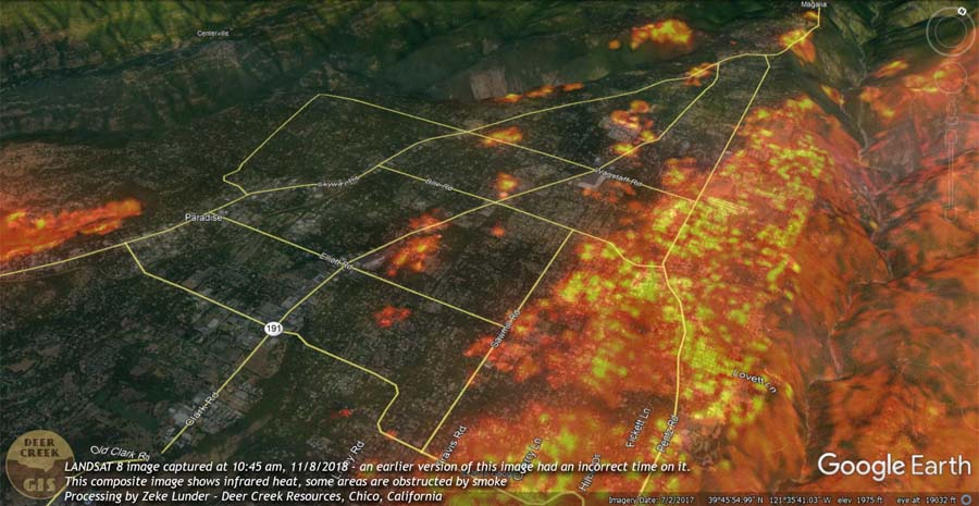
Deer Creek Resources of Chico, California has produced five images that show the Camp Fire about four and a half hours after it started near Pulga, California on November 8, 2018. Zeke Lunder used data from LANDSAT 8 with the infrared heat layer to map the location of the fire at 10:45 p.m. PST. By that time it was burning thousands of homes in Paradise.
(The images below show the corrected time stamp of 10:45 a.m. on November 8, 2018.)
To help get oriented take note of the north indicator that is at the top-right on four of the four photos. Presumably north is at the top in the other photo (above).
To see all articles on Wildfire Today about the Camp Fire, including the most recent, click HERE.
Smoke obscures some areas, as Mr. Lunder wrote, but it appears that significant spotting was occurring. During that seven-hour period the wind was out of the northeast at 8 to 15 mph gusting at 21 to 35 mph. At noon the relative humidity was 13 percent. A few hours before the fire started the wind was from the northeast at 32 gusting up to 52.
Here is more information about the fuels that the fire was burning through in the first few hours.
The was a lot of timberland logged after 2008 fires in Concow Basin the initial path of the fire, and most of Paradise had major pondo pine component.
— Deer Creek Resources (@DeerCreekGIS) November 15, 2018
CAL FIRE has not released the cause of the fire but Pacific Gas & Electric disclosed to the Public Utilities Commission that one of their high voltage power lines had a disruption in service on Pulga Road near the Camp Fire at 6:15 a.m. the day it started, November 8. The burn pattern along with the wind direction would lead one to believe that it is likely that the point of origin of the fire was in the general vicinity of Pulga Road and the small community of Pulga, but this is not confirmed. The fire was reported at 6:29 a.m.


I mistakenly labeled these images as being from 1:10pm. They were actually taken at 10:45 local time.