(Originally published at 3:07 p.m. PST November 18, 2018)
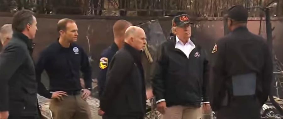
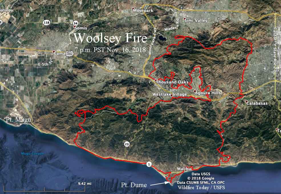
After President Trump visited the site of the Camp Fire at Paradise, California Saturday, he flew on Air Force One from Beale Air Force Base 360 miles south to NAS Point Mugu about 8 miles west of the western edge of the Woolsey Fire. From there a motorcade took the entourage to where the blaze stopped at the Pacific ocean on November 9 as it was being driven by strong Santa Ana winds out of the northeast. At Malibu the President toured the sites of burned houses on Point Dume with Governor Jerry Brown and Governor-elect Gavin Newsom.

Firefighting resources are beginning to be released from the Woolsey Fire, and Sunday is the last day that the helibase will be in operation.
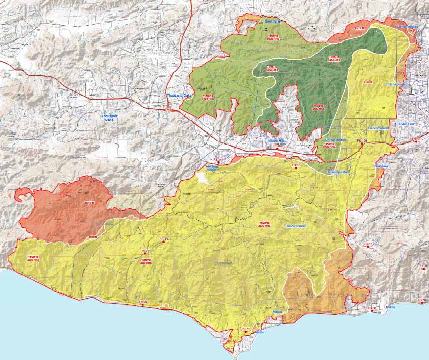
CAL FIRE says the fire has burned 96,949 acres and 1,130 structures, with no breakdown of residences vs. outbuildings. The number of civilian fatalities has remained at three for several days.
Officials have lifted evacuation orders for all locations in Ventura County, but remain in effect for some areas in Los Angeles County. Here is a link to official current information about evacuations.
Rain is in the forecast for the fire area on Wednesday with the potential for about 0.7″ in the Thousand Oaks area. There is a 20 percent chance of debris flows below the burn areas, with a possible effect on properties and roadways.
Now that the fire activity has decreased scientists are moving in to begin an assessment of the changes. For example, they have already determined according to the LA Times, that “of 13 mountain lions with radio collars they had been tracking before the Woolsey fire broke out, scientists confirmed that 12 were alive and moving outside of the burned areas.”

Most of the land within the Santa Monica Mountains National Recreation Area burned, destroying at least 616 structures including the Paramount Ranch where many western-themed shows were filmed. The National Park Service hopes to rebuild the western town within two years with the help of a fundraising campaign in Hollywood.

This fire reminded me of several I survived in Malibu around 1990 , one in particular, that took out Deer Creek Canyon, at whose edge I lived, Dick Clark scooted fast out of his compound the next day as the fire started to creep up at the edges it had not taken out during the previous night’s Santana, 70 mph, an electric fire from a light pole, started at about midnight. i had fought fires in Alaska …. and was amazed to see it leap frog with the wind. embers setting the dry tinder aflame.
We’ll see how many rakes for fire suppression are budgeted for fiscal year 2019.