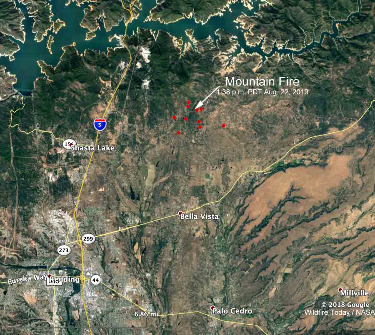
The Mountain Fire is causing evacuations in Northern California, northeast of Redding. The fire is 4 miles east of the community of Shasta Lake and is north of Highway 299. At 1:38 p.m. PDT most of the fire was between Bear Mountain Road and Dry Creek Road, an area with many structures.
It was reported at noon on Thursday and by 2:40 p.m. had burned approximately 600 acres. Later in the afternoon Air Attack estimated the size at 820 acres.
Pacific Gas and Electric shut off the power to about 1,200 customers.
By 5:50 p.m. PDT the radio traffic on the incident had slowed considerably, which often indicates the spread of the fire has slowed as well. It was first burning in timber and other heavy fuels but some portions moved into lighter vegetation that provided less resistance to control, and where aircraft could be more effective.
The Shasta County Sheriff’s Office has a lengthy list of areas under evacuation orders. The evacuation center is at Crosspointe Community Church, 2960 Hartnell Road, Redding CA. According to the Sheriff’s Office, 1,110 structures are threatened and 3,885 residents have been evacuated.
New start E of Shasta Lake. Great webcam view on it pic.twitter.com/N3COoYcIT0
— Bruno Rodriguez (@brunorodriguezq) August 22, 2019

Thanks for the post, Bill