UPDATED at 4:26 p.m. PDT August 1, 2020
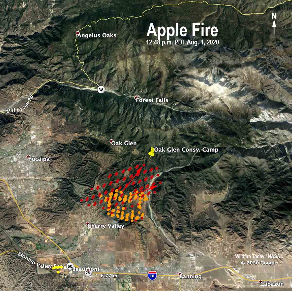
The map below shows heat detected on the Apple Fire by a satellite at 12:48 p.m. PDT August 1. On Saturday the fire has been moving to the north and east and by 3:30 p.m. had spread past the Oak Glen Conservation Camp.
(To see all articles on Wildfire Today about the Apple Fire, including the most recent, click here.)
UPDATED at 3:31 p.m. PDT August 1, 2020
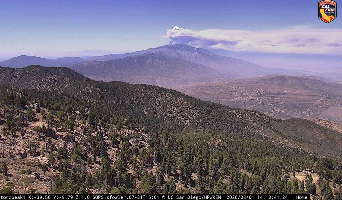
The Apple fire has been very active in the early afternoon Saturday, spreading up the slope at least two miles over the last 12 hours, surrounding CAL FIRE’s Oak Glen Conservation Camp #35. The 40 acre site built in 1949 for housing and training up to seven inmate fire crews is the largest state facility of its kind.
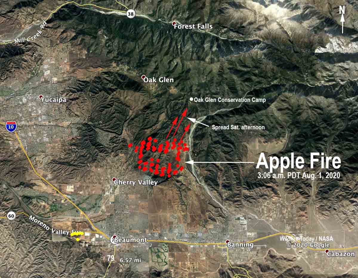
CAL FIRE/Riverside County reported at 3 p.m. Saturday the Apple Fire has burned 4,125 acres.
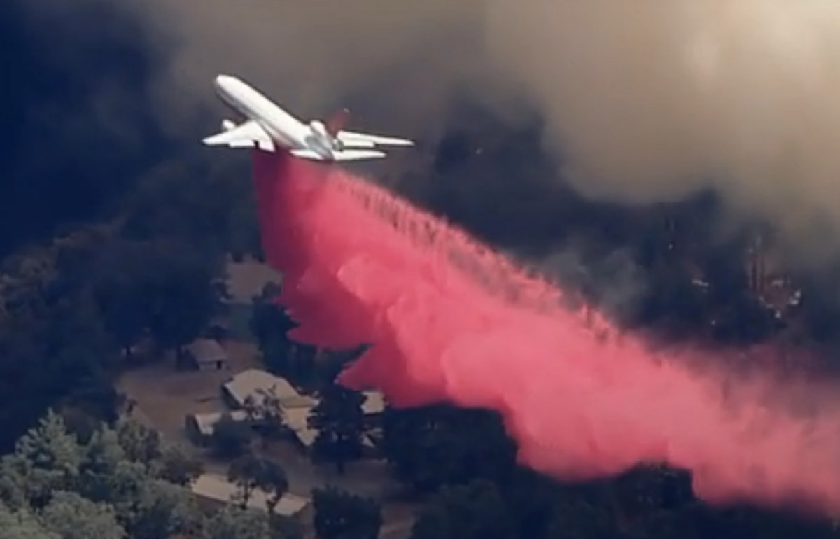
Firefighters have ordered additional large and very large air tankers including two DC-10s and the 747. Additional strike teams of engines, dozers, and crews have also been requested.
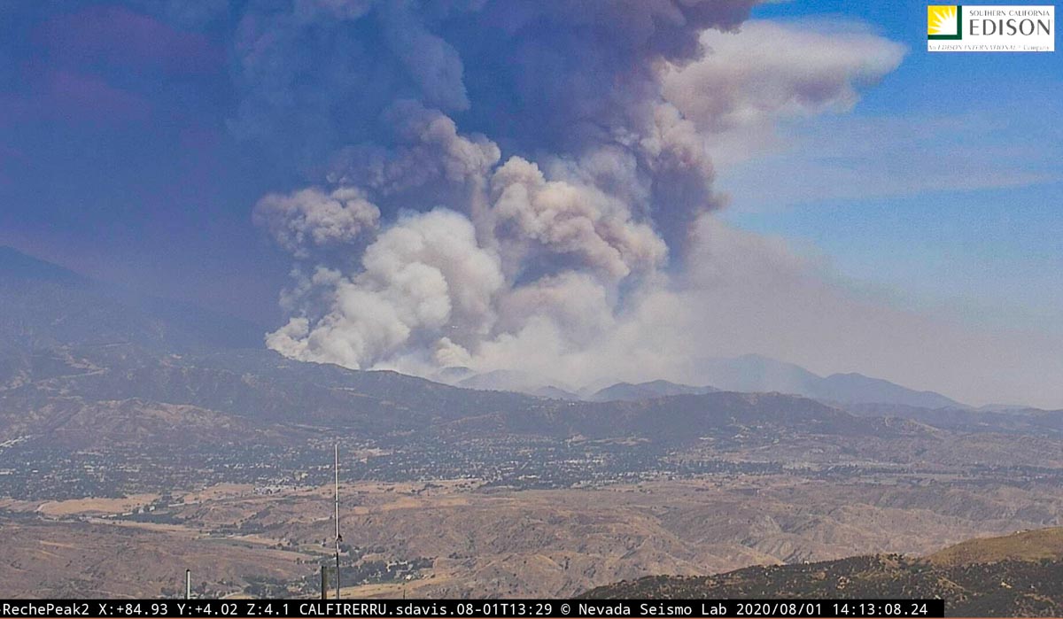
The weather conditions are not in favor of the firefighters. At 2:13 p.m. Saturday a weather station at Banning recorded winds out of the west at 10 mph gusting to 22, temperature of 99 degrees, and relative humidity of 9 percent.
(Originally published at 10:32 p.m. PDT August 1, 2020)

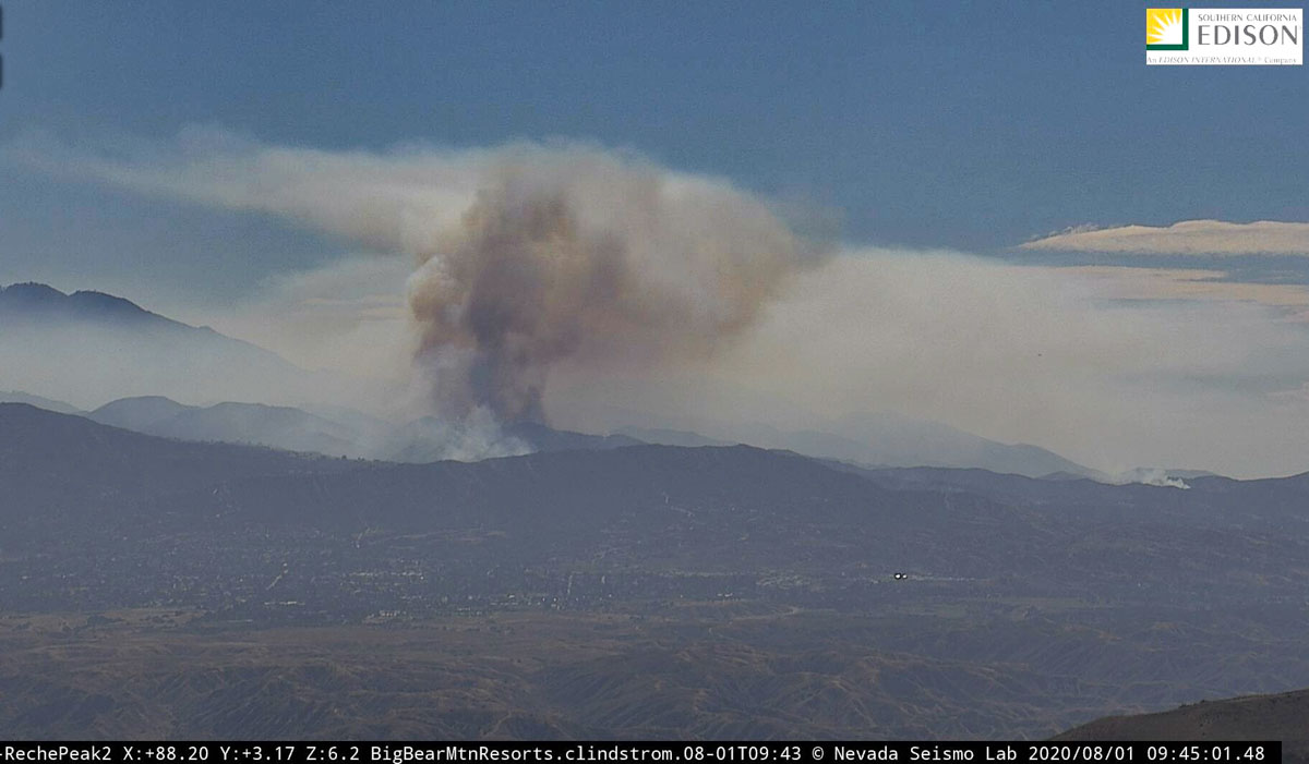
At about 5 p.m. Friday when firefighters arrived at what is now the Apple Fire north of Beaumont, California in Cherry Valley, they found at least two separate fires burning along Oak Glen Road. Saturday it has grown into a 1,900-acre blaze that has prompted evacuations and has destroyed at least one home and two outbuildings.
CAL FIRE/Riverside County Fire is in Unified Command with the U.S. Forest Service, Riverside County Sheriff’s Department, and California Highway Patrol.
The fire is burning between Oak Glen Road on the west and Bluff Street on the east. It is about three miles south of Oak Glen.
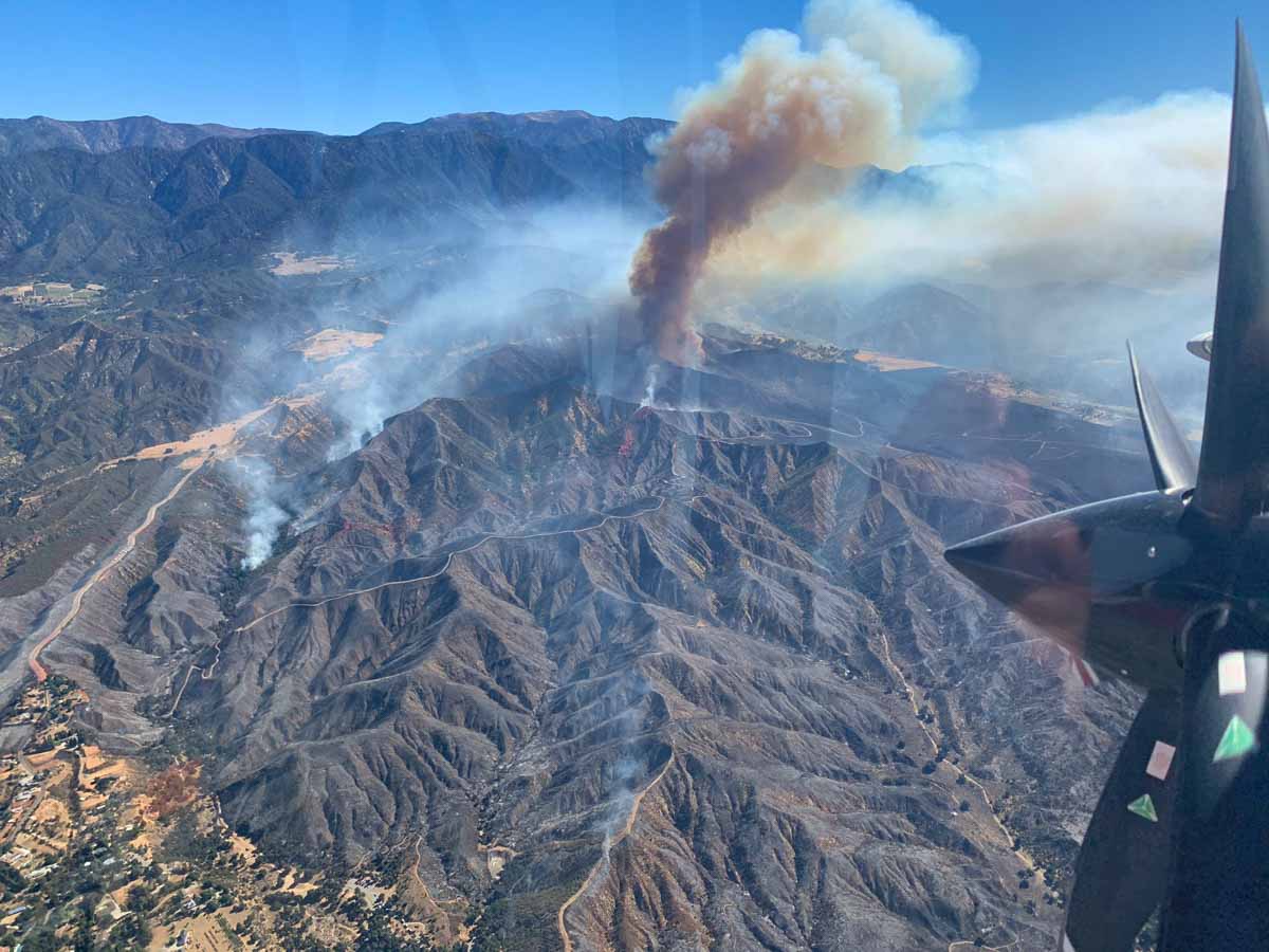
Resources working on the fire Saturday morning include 5 helicopters, 43 fire engines, 10 hand crews, 3 water tenders, and 3 dozers, for a total of 375 personnel. Large and very large air tankers are busy over the fire this morning.


What are we not discussing the CAUSE of these fires? Did pyros start the fires? It wasn’t lightning.
From KTLA today:
“The Apple Fire burning in the San Bernardino Mountains north of Beaumont was sparked by a vehicle malfunction, authorities announced Monday.
“Cal Fire investigators determined that a diesel-vehicle emitting burning carbon from the exhaust system malfunctioned, igniting the massive inferno Friday evening. That conclusion was drawn from multiple independent witnesses, as well as corroborating physical evidence, according to a statement from the Riverside County Fire Department.”
Because you can. Just like building a house on the gulf coast of hurricanes, or Florida swamp lands ready for more hurricanes, or tornado alley…… accepting the fear and living your dream is what life’s about. I wouldn’t want to live in a city where people are pressed on each other and spreading Covid like mad.
It’s a choice, and so is asking silly questions.
Great answer!
First of all – The houses are not in that remote of an area. They are not in the mountains, but lower, flatter foothills of a valley.
Second of all – Fires are not a disaster that happens in the same areas every year. (Unlike people who live along rivers and have their house flood every year). This area has not burned in what, over 50 years?
Third of all – I and others around me pay a fire fee tax directly to the state of California every year for the purpose of fighting fires. I also pay additional fees on our insurance because of living in a possible fire zone.
So Ted – your tax dollars, just like mine, go to help the emergency response units to protect us all should we have a problem. You are not paying to rebuild my home – I pay my insurance to that.
Are the Riley’s Farm apple orchards OK?
I’m on here looking for the same information. As of yesterday the fire was bearing down on the Oak Glen Conservation Camp which is just east of Oak Glen proper.
I got an email from them yesterday saying that all their weekend activities have been cancelled due to the fire being on an adjacent hill.
Can someone please explain to me why people think it’s safe to build a house in a place like this?
Cause it’s beautiful and amazing there. You live there knowing the threat and enjoy what you can. If it burns you get out and rebuild if needed.
I can see both sides of the issue, but I lean towards the earlier comment because when the state or Feds dole out funds for folks to rebuild that’s my money confiscated from me in the form of taxes meanwhile I cant afford to go on vacation, buy a new vehicle or fix my old ones. So someone who more than likely has more money than me gets to use my money to rebuild to possibly have it happen again and use my money again.
Where are people supposed to live? The same question comes up after every disaster from people who aren’t familiar with the affected area – earthquakes, hurricanes, tornadoes, ice storms. No place is “safe” from everything. It just becomes a way of life.
First of all – The houses are not in that remote of an area. They are not in the mountains, but lower, flatter foothills of a valley.
Second of all – Fires are not a disaster that happens in the same areas every year. (Unlike people who live along rivers and have their house flood every year). This area has not burned in what, over 50 years?
Third of all – I and others around me pay a fire fee tax directly to the state of California every year for the purpose of fighting fires. I also pay additional fees on our insurance because of living in a possible fire zone.
So Ted – your tax dollars, just like mine, go to help the emergency response units to protect us all should we have a problem. You are not paying to rebuild my home – I pay my insurance to that.
We moved out here because LA and Orange county are full, and as a young family it was our only viable option to have a single-family home.
Don’t worry, I have fire insurance so I won’t be mooching your tax dollars if we burn up.
Read your message- totally understand why you would live there. I would too if I could. So beautiful up there. I hope your family is safe, first and foremost, and that the fire bypasses all of the homes. God bless!!!
Ted- Money from FEMA is in the form of a low interest LOAN, which needs to repaid, not a gift so stop being jealous of people who lost everything. They didn’t take away your vacation.
You have no clue about the area this fire is burning in. 20,500 acres and only one house has been lost. Just because you’re jealous that you live in a concrete jungle, doesn’t mean everybody wants to do the same. Some people would rather see nature than concrete. And no, it doesn’t cost you a dime.
I’m not sure what you think the area as a whole is. The fire started lower in the foothills which are more level flat areas not in forest areas. I live in Cherry Valley in a senior mobile home park where the fire started. I certainly don’t live in the dense mountains.
Watching Boeing 747-400 TNKR944 load/reload at McClellan Airfield several days now as well as the DC10 and MD85. Smoke from fires casting a dark shroud over Sacramento to the west and centrally, but still blue to the east. Hope for better days and thanks to firefighters everywhere!