Hot, dry and in some cases windy weather will bring elevated wildfire danger to many of the western states through the Labor Day weekend.
Southern California
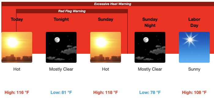
Extreme heat in southern California could set all-time high temperature records with the possibility of rolling power blackouts and more wildfires. Some of the inland cities could have temperatures 10 to 20 degrees above normal through Monday. The hottest days will be Saturday and Sunday, with slightly lower temperatures Monday. Riverside could see highs of 116 on Saturday and 118 on Sunday.

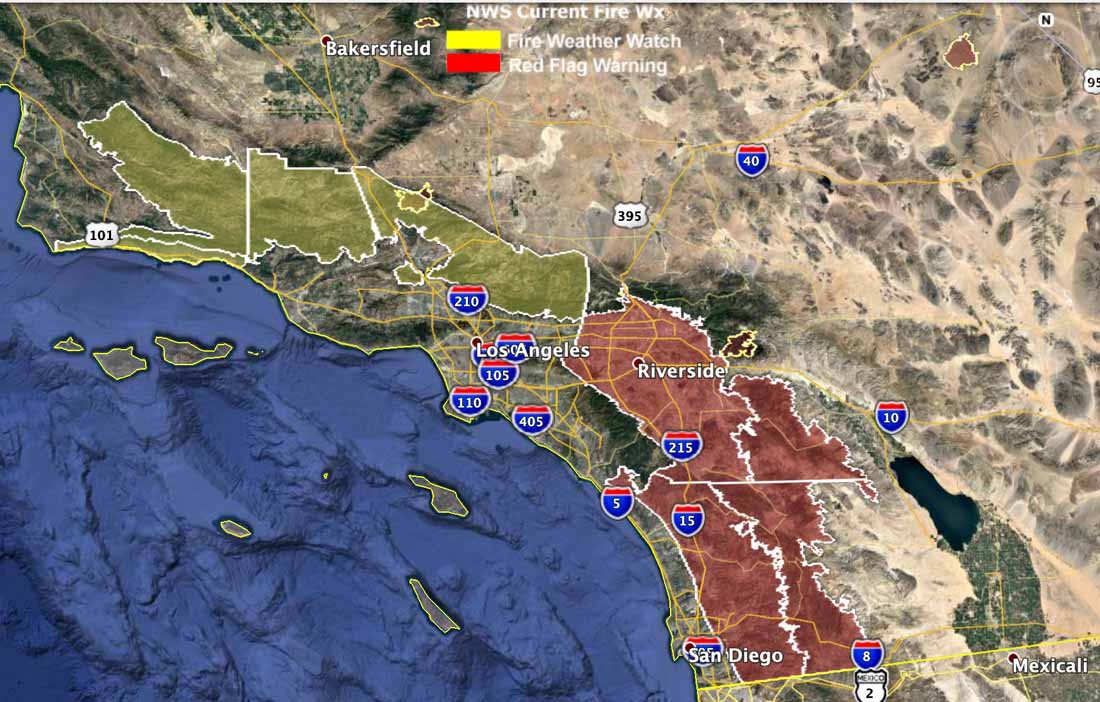
Red Flag Warnings are in effect Saturday for portions of Riverside and San Diego Counties through Sunday at 6 p.m. Forecasters expect east winds of 15 to 20 mph with gusts of 25 to 35 mph, with single-digit humidities in the afternoons.

A Fire Weather Watch for the Los Angeles, Ventura County, and Santa Barbara mountains for Monday evening through Tuesday evening will probably be turned into a Red Flag Warning for gusty sundowner winds from the north or northeast at 15 to 25 mph with local gusts up to 40 mph Saturday, increasing to 15 to 30 mph with local gusts up to 45 mph Sunday evening and Monday evening. The strongest winds will be in the western portions of the Santa Ynez mountains and Santa Barbara south coast.
The National Weather Service did not mince any words in describing the forecast:
The very hot and unstable conditions will bring a significant threat of large plume dominated fires across the region through Labor Day.
Northwestern United States
A strong high pressure ridge centered across the western Great Basin Saturday will bring continued hot and dry conditions through the afternoon and early evening, with temperatures in the 90s and humidities below 15 percent, contributing to potentially extreme fire behavior given the very dry fuel conditions. In central Idaho and western Montana winds are expected to exceed 20-25 mph for several hours Saturday afternoon.
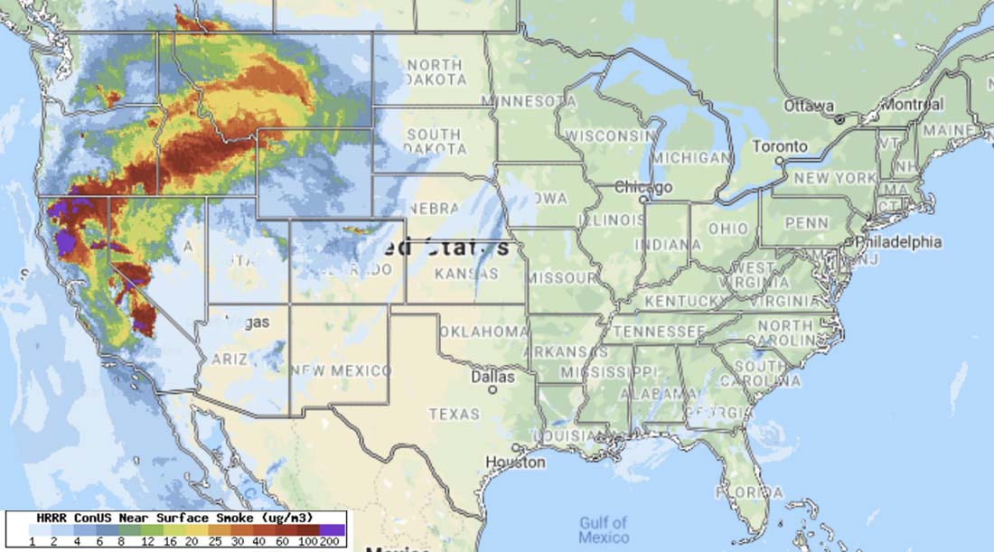
Smoke


Our Durango Interagency Fire Dispatch zone update today said this unusual mix “A major storm is expected to drop southward out of Canada and begin to affect our region this weekend and last into mid-week. Hazards will be record heat, fire weather, snow and record cold.” We’re expecting a couple of inches of snow at the lookout by Wednesday. Crazy.