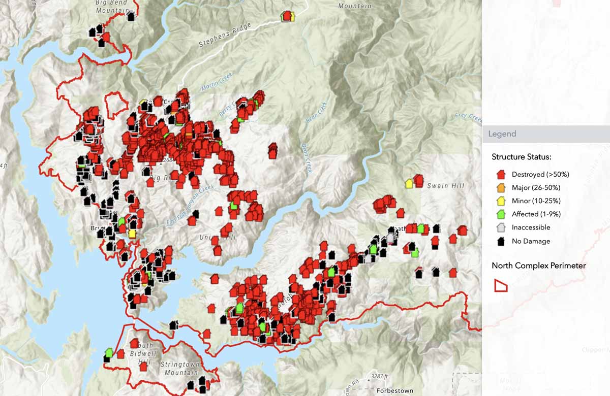
CAL FIRE has a zoomable map showing the status of structures that have been evaluated for damage during the North Fire.
“The damage inspection is still ongoing and subject to change,” CAL FIRE writes on the map’s page. “The points shown in this map are being updated regularly. Data is subject to change as information is gathered and verified. The icons on the map indicate the current known status of the structure. If your structure is not identified by an icon, it has not yet been identified. Addresses may be entered into search bar to find a specific location.”
CAL FIRE reports that 1,393 structures have been destroyed in the blaze.

On the map it shows a few houses in green color (1-9 percent affected) I wonder why? Because of location, pure luck? Or building material is different, such as tile roof, stucco wall?
I felt for the victims. Can’t imagine the devastation for losing one’s home with everything in it. I heard the term “global warming” first time in 2007. It is a long process to get the earth “dried up” gradually. I hope we all recognize the changes in climate and be prepared.
Bless our firefighters… Am retired firefighter wild land…to all of our firefighters and rescue/law enforcement….THANK YOU