Updated 4:14 p.m. MDT April 22, 2022

Additional evacuations have been ordered for the Calf Canyon and the nearby Hermits Peak Fires in Northern New Mexico. They were posted at 1 p.m. April 22 by San Miguel and mora Counties in New Mexico. A map is available on Facebook but it is almost undecipherable. Below is a list of the areas affected.

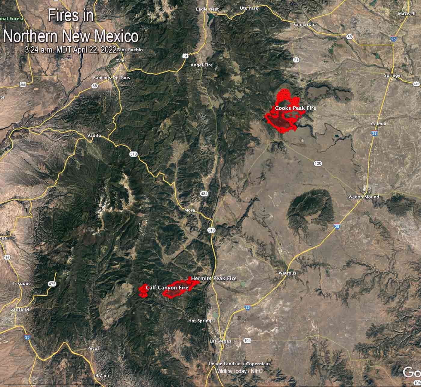
The satellite photo above shows a large plume of smoke from the Calf Canyon Fire which was blowing northeast over the Cooks Fire when the photo was taken at 3:36 p.m. MDT Friday. It appears that pyrocumulus was forming over the Cooks Peak Fire, indicating extreme fire behavior.
Click to see all articles on Wildfire Today, including the most recent, about the Calf Canyon, Hermits Peak, and Cooks Peak fires.
At 3:04 p.m. MT Friday the Bartley weather station north of the Calf Fire recorded 17 mph winds gusting from the south at 35 mph. The relative humidity was 11 percent.
Smoke maps are posted in another article on Wildfire Today.
9 a.m. MDT April 22, 2022
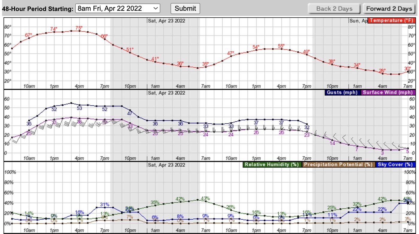
The critical and extreme fire weather predicted for areas in New Mexico and Colorado on Friday will affect the three existing wildfires in Northern New Mexico on Friday and Saturday.
The Calf Canyon and Hermits Peak Fires are 24 and 27 miles, respectively, east of Santa Fe, and are northwest of Las Vegas, NM.
The Calf Canyon Fire was very active Thursday, creating a large smoke plume as it spread primarily north and northeast. It was listed at 2,877 acres Thursday night.
The Hermits Peak Fire has been fairly quiet in recent days and is nearing containment. The strong winds will test the fire lines on the 7,573-acre blaze.
The 21,000-acre Cooks Peak Fire 13 miles south of Cimarron was also very active Thursday as it grew to the north and northeast.
The Storm Prediction Center’s forecast for Northeast New Mexico and Eastern Colorado on Friday is for “5-15 percent minimum RH. At the same time, 30-40 mph sustained south-southwesterly surface winds (with widespread gusts of 50-60 mph) will overspread critically dry fuels.” There is a chance for scattered thunderstorms with lightning and little or no rain.
The specific forecast for the Calf Canyon Fire calls for southwest winds of 46 mph gusting up to 64 mph with relative humidity in the teens and 20s. It will also be very windy on Saturday. Conditions on the Cooks Peak Fire will be similar, but with the humidity dropping into the single digits.
The southwest winds on Friday will shift to come out of the west-southwest Friday night, then from the west on Saturday. The speeds will decrease Friday night and Saturday, but will still be sustained in the mid-20s with gusts in the 30s.
These dangerous conditions will be conducive to significant spreading of the Cooks Peak and Calf Canyon Fires to the northeast and east.