
Updated 1:39 p.m. MDT July 5, 2022
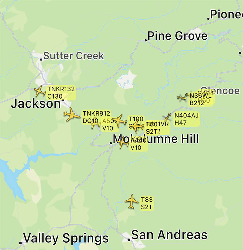
The activity on the Electra fire southeast of Jackson, California has been increasing since noon Tuesday. Several air tankers are dropping retardant, including a DC-10, MD-87, C-130, and S-2T.
The Amador County Sheriff’s office has created an online map showing the areas under evacuation orders.
To see all articles on Wildfire Today about the Electra Fire, including the most recent, click HERE.
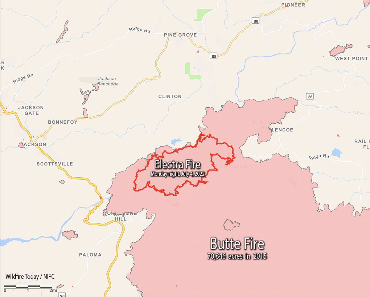
As of the Monday night mapping data, the Electra Fire has been burning entirely within the footprint of the huge Butte Fire that blackened more than 70,000 acres in 2015 while leading to two deaths and 135 destroyed homes.

Resources working the fire include 128 engines, 22 water tenders, 33 dozers, 39 hand crews, and multiple aircraft.
On Monday approximately 100 recreational visitors and PG&E employees had to shelter in the Electra Powerhouse, but were safely evacuated from the area by 9:30 p.m.
The control objectives are to keep the fire east of Hwy. 49, south of Hwy. 88, north of Jesus Maria Road, and west of Hwy. 26 and Railroad Flat Road.
About 450 structures are threatened.
The weather at the Golden Chain Highway weather station south of Jackson at 1:20 p.m. Tuesday was 80 degrees, 49 percent relative humidity, and 6 mph winds out of south gusting to 12 mph. The forecast is for the RH to drop to about 40 percent by late afternoon. Monday afternoon while the large convection column was raging, the nearby weather stations recorded a minimum RH of around 60 percent — remarkably high for such vigorous fire behavior.
Updated 5:25 a.m. PDT July 5, 2022
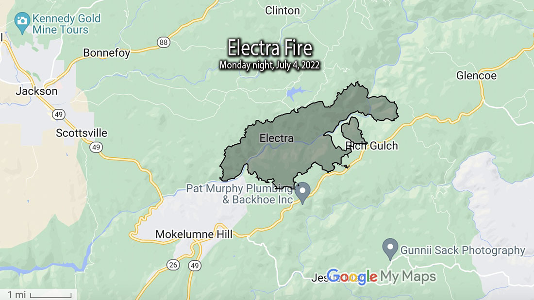
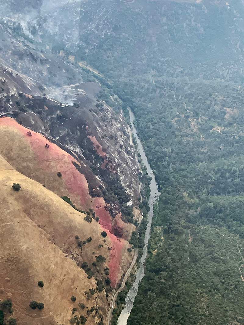
The Electra Fire 5 miles south of Jackson, California grew substantially Monday evening and into the night, but the activity slowed in the very early hours of Tuesday. Most of the growth was on the north and east sides after it crossed the Mokelumne River and reached highway 26 near Rich Gulch.
The FIRIS mapping crew estimated the size at 3,034 acres at about 1 a.m. Tuesday.
6:00 p.m. MDT July 4, 2022
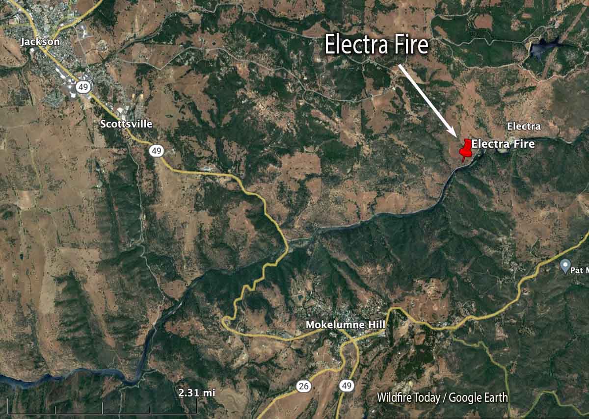
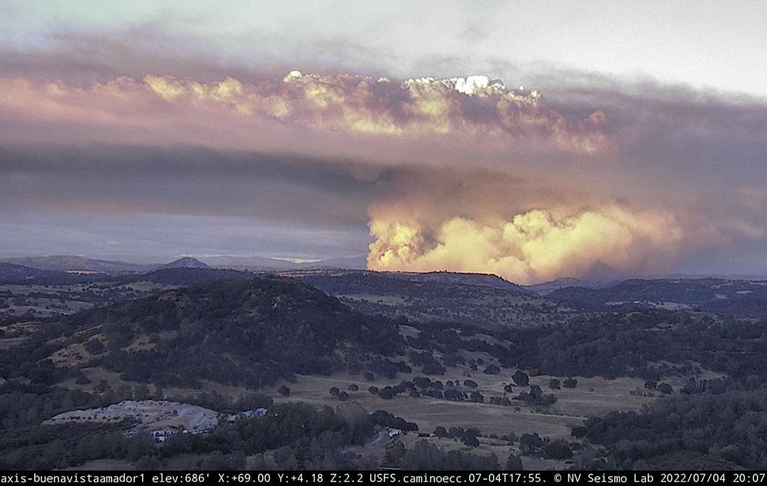
The Electra Fire that started Monday afternoon near Electra Road approximately 5 miles southeast of Jackson, California has prompted evacuations. At 5:06 p.m. a mapping aircraft estimated the size at nearly 390 acres. It is on both sides of the Mokelumne River.

At 5:36 the Amador County Sheriff Office said a mandatory evacuation order has been issued for all residents in the Butte Mountain Road area. Butte Mountain Road will be closed except for egress purposes.
An evacuation warning is in effect for all residents in a two mile radius around Lake Tabeau.
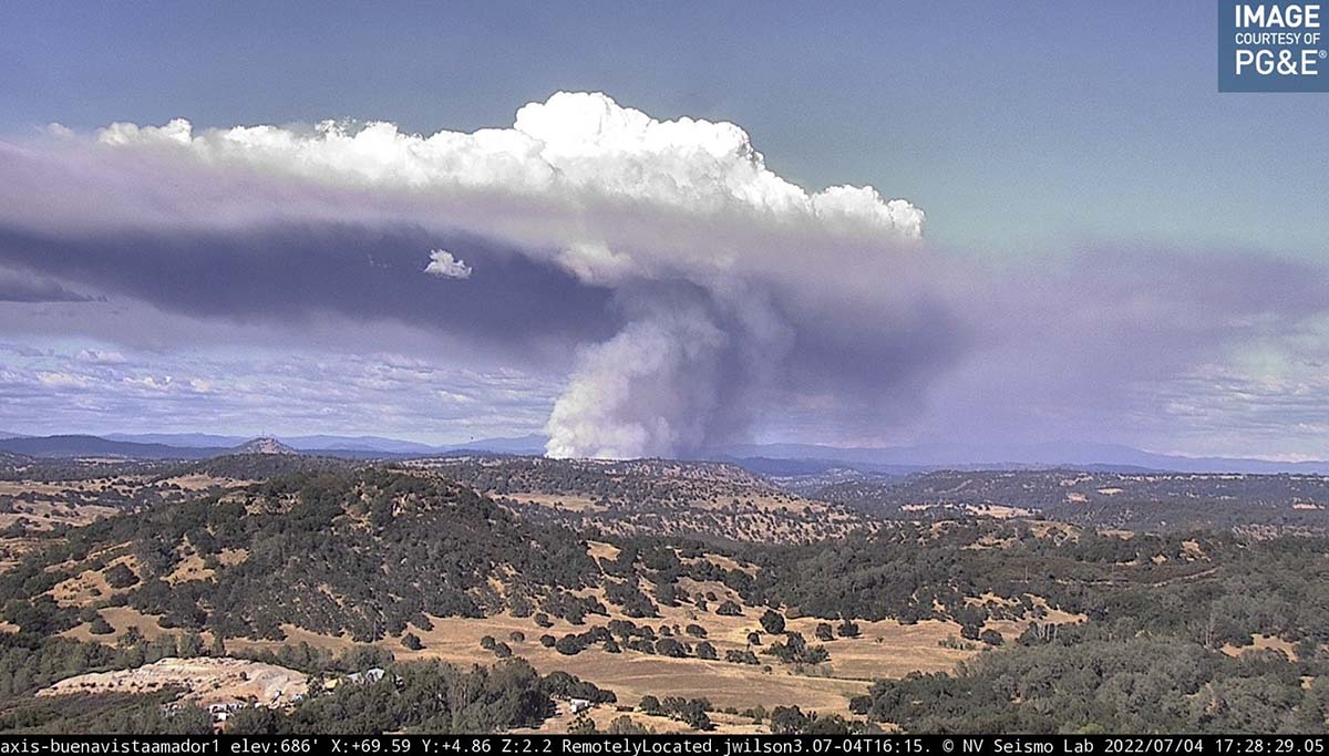
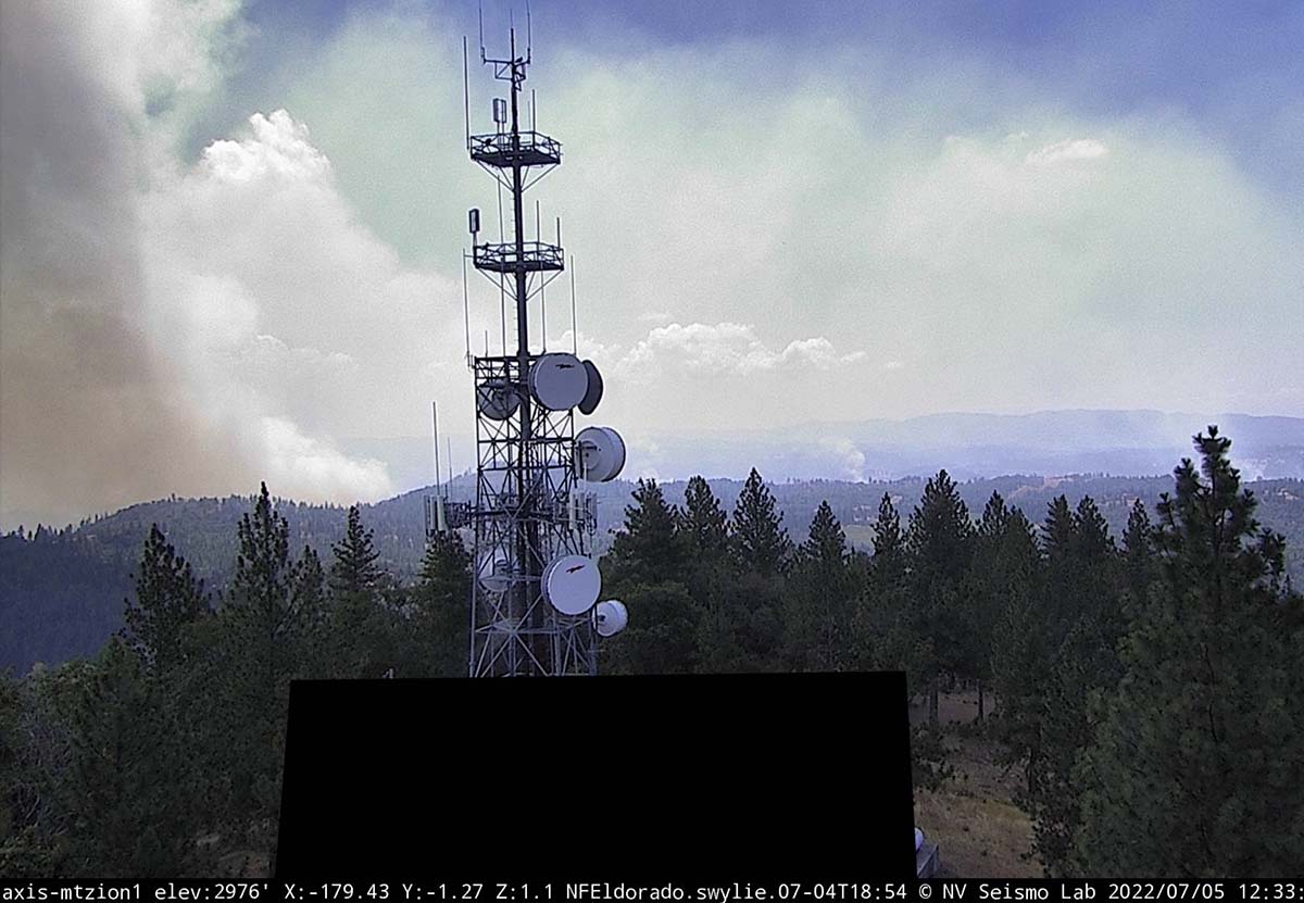
Soon after it started the fire was putting up a very large plume of smoke topped by condensation and a pyrocumulus cloud, indicating extreme fire behavior.
OCFA’s Intel 12 on the #ElectraFire Amador County. Fire is mapped at 390 acres at 17:06 hours. pic.twitter.com/fVzbCJ0cMA
— FIRIS (@FIRIS) July 5, 2022

Going to be another fire break for a few years just like all the others that is how thinning is done now. Let it burn
Hi Bill,
Did you happen to work on the El Cariso Hotshot Crew on the Cleveland NF?
Please contact me if you did.
For the most part, the Butte Fire left a mess. A lot of dense live oak-dominated woodlands, with a significant manzanita and toyon component, burned in the fire. The toyon and oak resprouted and the manzanita germinated. Now there’s a lot of waxy-leafed live fuel with a lot of dead material from the ground to about 8 feet high. The best thing for that ecosystem would a good re-burn under the right conditions, but there’s just way too many structures and private land in the area to let that happen.
I am interested to see if the fire managers will be able to stop the eastward spread of the fire, before it hits the confluences. The Mokelumne River drainage is super steep with lots of chaparral type species. It’s a lot like the Cosumnes River to the north, where last year’s Caldor Fire started. If it gets to the confluence of the North and Middle Forks, then the South Fork, it would start running up a few different steep canyons with several communities at risk sitting above and between the forks. If it gets past West Point, it’s on to a lot of SPI industrial timber ground…and things haven’t been going so well for SPI plantations since the Rim Fire.
Typical CALFIRE IA, lots of ac and other resources, I’m sure. Looks to be fairly inaccessible, so ac won’t be as effective until folks get in. Looking at the video, seem to be anchor and flanking, and waiting for the fire to come out of the drainage. Pretty straight forward.
Lots of AC like you and everyone else?
From the looks of that column…I’d say the air tankers were ineffective at catching it. Time to put them on a hold and hopefully pound the next new start before it gets a chance to look like Hiroshima.