
Updated 8:50 a.m. PDT Sept. 11, 2022
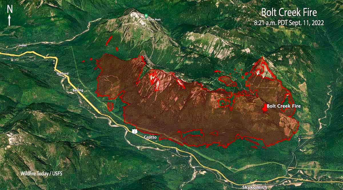
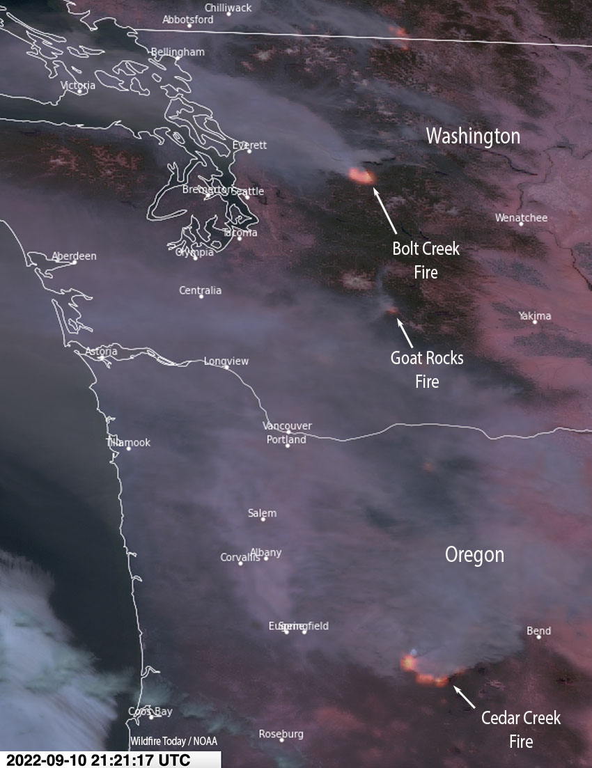
The Bolt Creek Fire 42 miles north-northeast of Seattle is producing smoke that is moving into Everett and Bellingham. The fire spread eight miles to the northwest after it started Saturday near Skykomish off US Highway 2. So far it has remained north of the highway as it burned past Grotto and Baring. A US Forest Service mapping flight Saturday night determined it had blackened about 7,660 acres and was 3 miles southeast of Index. This data from a fixed wing aircraft is much more accurate than some of the maps being posted on social media.
To see all articles on Wildfire Today about the Bolt Creek Fire, including the most recent, click HERE.
An 18-mile corridor of Highway 2 remains closed and evacuations are in effect. Snohomish County has the details.
Only about 50% of the people asked to evacuate for #boltcreekfire in @SnoCounty have taken that advice. We ask that they reconsider. The fire remains active. We need everybody’s help protecting lives today. Evacuation and shelter info: https://t.co/yBJADscWJG pic.twitter.com/ov36beDL2S
— snocosheriff (@SnoCoSheriff) September 11, 2022
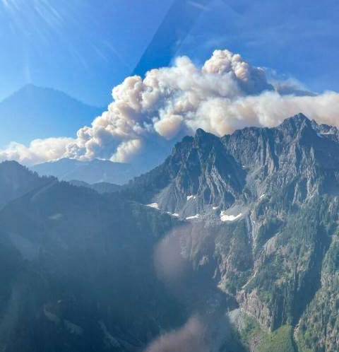
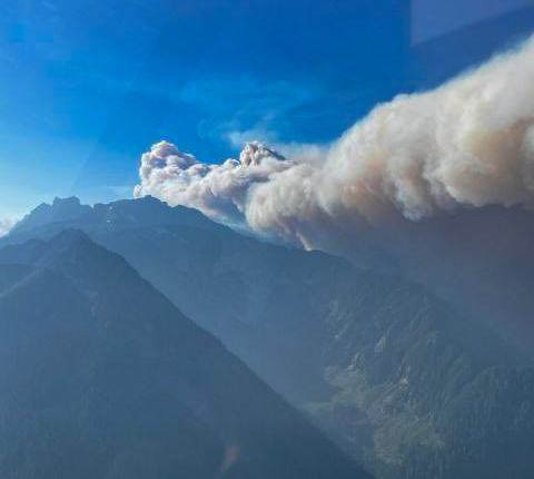
This kind of wildfire activity is exceptionally rare for the western slopes of the central Cascades in Washington.
Two hikers that were on the mountain had a harrowing escape from the fire. They called 911 and were told it was too dangerous to rescue them by helicopter, but eventually after scrambling down steep terrain they made it out of danger. (Update, Sept. 13, 2022: the hikers documented their escape from the fire.)
3:47 p.m. PDT Sept. 10, 2022
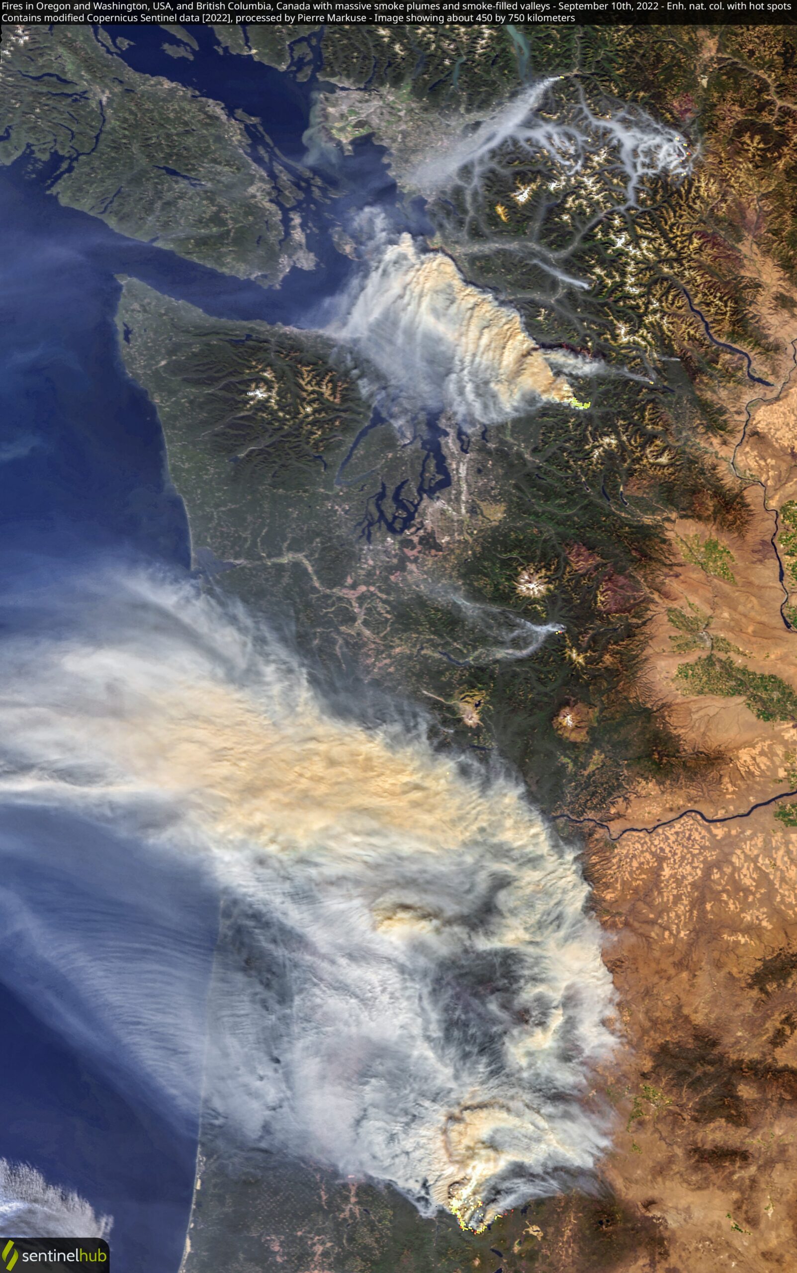
Several wildfires are pushing smoke into western Oregon and Washington. The Bolt Creek Fire, which started Saturday in northwest Washington near Skykomish off US Highway 2 is growing very quickly. It is producing a great deal of smoke blowing to the northwest toward Everett and Bellingham.
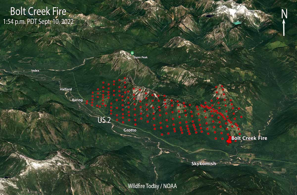
Our very, very rough estimate of the size, based on the imprecise satellite heat data, is that the Bolt Creek Fire had burned more than 2,500 acres by 1:54 p.m. PDT Saturday.
A section of Highway 2 is closed.
The US 2 closure now extends from milepost 31.7 (east of Zeke’s Drive In and Gold Bar) to milepost 49 (east end of Skykomish). The road is only open to people evacuating. Please continue to monitor @wspd7pio, @kingcosoPIO and @waDNR_fire for evacuation/fire info. #BoltCreekFire
— WSDOT Traffic (@wsdot_traffic) September 10, 2022
Snohomish County has evacuation information about the Bolt Creek Fire.
A fire south of Mount Rainier National Park, the Goat Rocks Fire, is also producing smoke, but it is heading generally west to the Centralia area. As of Friday it had burned about 1,500 acres.
The smoke from a very large fire that has been burning since August 1 in west-central Oregon, the Cedar Creek Fire, is sending smoke into Washington. The Washington State DNR said today that smoke from that 35,000-acre fire is being lofted to higher altitudes and is not expected to contribute significantly to further reductions in air quality at ground level. It will actually help keep temperatures down a few degrees Saturday afternoon, they said, and limit the minimum relative humidity values experienced in the Puget Lowlands.

It’s so bad at my school, that the fire alarm went off because of all the smoke that made it into the school through the filters.
Infrared flight at 2021 hrs on 9/10/22 shows Bolt 7660 acres and Goat rocks 2842 acres.
Keep all firefighters, law enforcement and those who are evacuating in your prayers. This type of area where the fire is located is like a train going down hill, it (the fire) has no brakes or steering wheel!! It goes where it wants to burn!! ??? ??? ???
Prayers won’t help. More assistance and people listening to good advice will help.
Agreed
I’ve spent a lot of time in that area, it’s amazingly beautiful. Hopefully some excellent progress can be made soon! I do have to wonder though, why are they flying to Snohomish (about 50 or so air-miles to the west) for fuel? I would have thought that surely someone could bring a fuel truck out to the small airfield in Skykomish, literally a minute (flying time) away from the fire. And for whatever it’s worth, Bolt Creek is a very small, short creek right where the red thumbtack is on the map above, and I would guess that is where the fire was first discovered. Obviously the fire is spreading, but I am optimistic that the wind from the east carried more heat than fire (so far) to the west, attributing to the heat signature along the whole ridgeline (Klinger Ridge).
Uh driving a fuel truck thru fire? And posing it up within the heart bubble and immediate fire near zone? That’s a scene from an action movie just waiting to blow off
Correction
Heat bubble
Fires on the “wet side” of the Cascades can be noted as a significant event given the general lack of fire here historically. We could start to see a ripple effect down this mountain range as dry conditions persist.