


 New King Air 260 delivered to the US Forest Service, August, 2022. Textron photo.
Two new aircraft have been delivered to the US Forest Service for mapping wildland fires. The Beechcraft King Air 260 can cruise at 356 mph at 35,000 feet, can take off in 2,111 feet, and has a maximum range of 1,980 miles.
The aircraft have the latest infrared (IR) sensing technology, the Overwatch Imaging TK-9 Earthwatch Airborne Sensor, along with legacy U.S. Forest Service sensors, that can accurately map wildfires, even at night and through smoke. The system can perform high-resolution scans of fires in a range of spectrums including thermal and infrared from 2,000 to 20,000 feet in altitude.
The TK-9’s speed of data delivery and automation of mapping processes will make it possible for the Forest Service to quickly release imagery to the public, if they desire. We are checking, but it may be possible for the system to live-stream video.
 Images of the same fire produced by Overwatch Imaging’s TK-9 payload, featuring SWIRNI, Visual, MWIR, and LWIR sensor technology. Overwatch Imaging photo.
The two Citation V aircraft that Coulson Aviation configured and sold to New South Wales in 2021 to serve as lead/intelligence planes were outfitted with the TK-9 Earthwatch multispectral imaging systems.
 Overwatch Imaging TK-9 Multispectral Imaging payload.
“It took roughly 90 minutes to produce aerial fire images under the old process, once we had planned the flight path, sourced approval, undertaken the flight, scanned the fire, downloaded the imagery, and entered it into our mapping systems,” said New South Wales Rural Fire Service Chief Superintendent Christopher Ryder. “Now with the Citations and the TK-9 scanning technology, that process will take more like 30 minutes. The new system will take much of the human intervention out of the scanning and mapping process and provide a better and more timely understanding of where the fire is for the public.”
Previous Forest Service IR mapping aircraft
For decades the US Forest Service has usually operated two infrared mapping planes — a variety of twin-engine King Airs and for a while a Cessna Citation Bravo jet. The Citation suffered a serious avionics issue in June, 2019 and was not used the rest of that year or in 2020. We are unsure if it was ever used again to map fires. The FS filled the gap with privately owned aircraft on exclusive use and call when needed contracts.
Currently the FS is using the agency-owned King Air 200, N149Z, manufactured in 1985 and a King Air B300 owned by Tenax Air Logistics, N350SM.
 US Forest Service infrared plane, N149Z, at Boise, July 19, 2014
We contacted the Forest Service to get an update on the infrared fleet, but they were not able to immediately answer our questions.
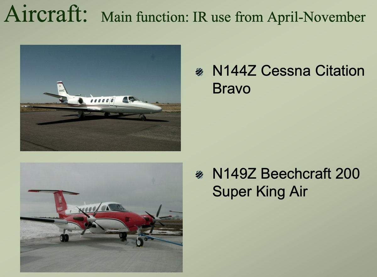 The two USFS aircraft equipped with infrared sensors used to map vegetation fires. USFS graphic from ~2020.
Thanks and a tip of the hat go out to Tom.





3 Comments
…But show a lunch and be sure to get a Presidential signature for a loop of chain…
Actually, the Citation was auctioned off through GSA in 2021. These 2 new King Air 260GT’s will allegedly be Multi Mission platforms, capable of swapping between IR, Leadplane and ATGS roles. Accommodations for a retractable FLIR ball have also been included, I think the idea is to have some daytime IR capability while on ATGS missions.
N350FV owned by Tenax Air Logistics is also being used for IR.
Comments are closed for this article!