


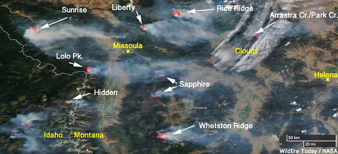
Above: Satellite photo taken August 1, 2017 showing smoke produced by wildfires in western Montana and Northeastern Idaho. The red dots represent heat detected by a sensor on the satellite.
(Originally published at 10:48 a.m. MDT August 2, 2017)
The residents of Western Montana have been dealing with wildfire smoke for several weeks and there is no relief in sight.
Our map above identifies eight of the largest blazes in the area. Here are a few facts about some of them, with them ranked in priority order according to fire management officials.
- Rice Ridge: Six miles north of Seeley Lake, MT; 3,994 acres, 150 personnel assigned.
- Sunrise: Six miles south of Riverbend, 9,900 acres, 548 personnel assigned.
- Sapphire Complex: Three fires, 15 miles southeast of Clinton, MT, 12,756 acres, 864 personnel assigned.
- Lolo Peak: 8 miles southwest of Lolo, MT, 5,724 acres, 822 personnel assigned.
- Arrastra Creek: 6 miles northwest of Lincoln, MT, 3,675 acres, 127 personnel assigned.
- Whetston Ridge: 25 miles southwest of Philipsburg, MT, 3,621 acres, 30 personnel assigned.







