


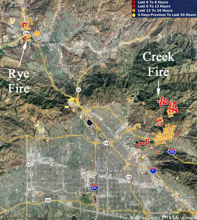
The Creek Fire on both sides of the 210 freeway in Los Angeles has burned 11,377 acres and destroyed 30 homes. Three firefighters have been injured and 30 horses were killed.
Both sides of the 210 freeway near Sylmar that had been closed, reopened Wednesday morning. The fire started early Tuesday morning in the Kagel Canyon area.
Another fire in the same general area has burned 7,000 acres. The Rye Fire was reported Tuesday morning in Santa Clarita near Castaic Junction, the intersection of Interstate 5 and Highway 126. Officials are considering lifting some of the mandatory evacuation orders. About 775 firefighters are on scene.







