(UPDATED at 7:53 a.m. MDT June 25, 2020)
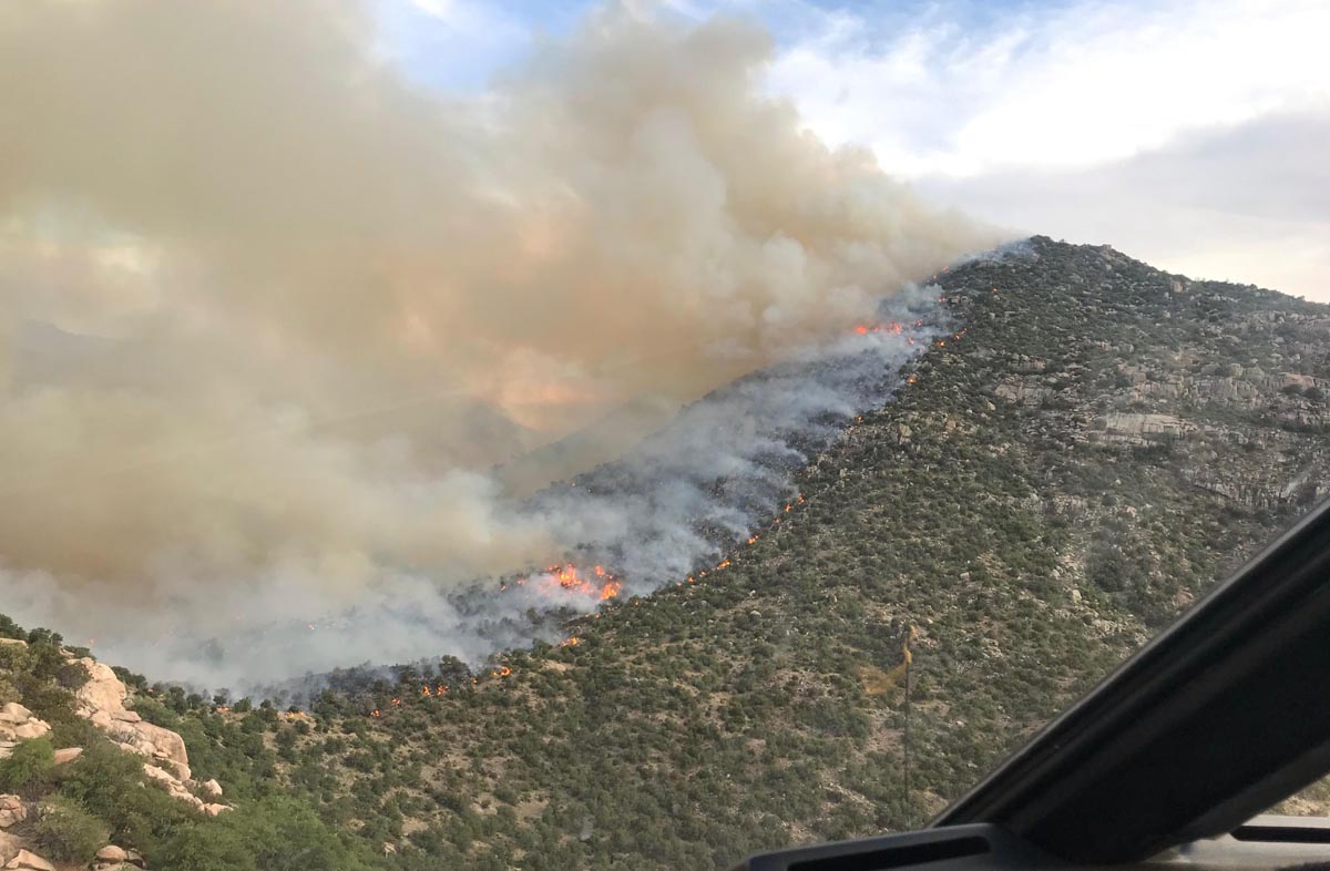
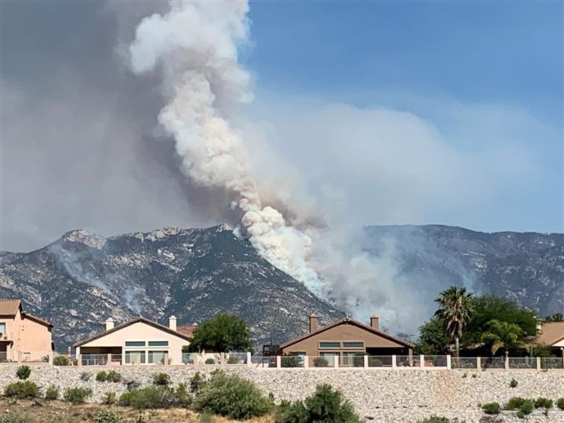
The Bighorn Fire north of Tucson was active Wednesday and Wednesday night. As firefighters worked on structure protection and fireline reinforcement in the Summerhaven and Willow Canyon areas, helicopters and air tankers successfully slowed fire spread and reduced fire intensity in the west fork of Sabino, Bird, and Rattlesnake canyons. Aerial firing operations in the Charouleau Gap area four miles east of Saddlebrook started around 5 pm.
(To see all articles about the Bighorn fire, including the most recent, click here.)
Firing operations also were carried out along the Catalina Highway near Spencer Peak and Spencer Canyons one mile east of Summerhaven and reinforced firelines near Dodge Wash two miles south of Oracle.
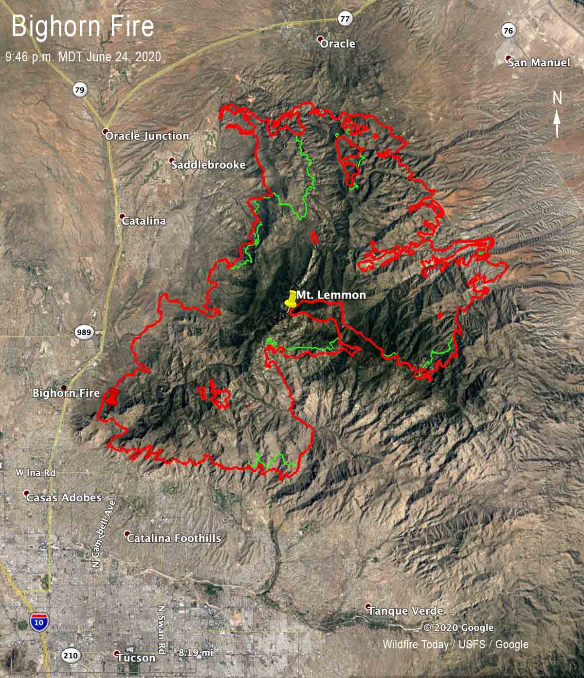
A mapping flight Wednesday night determined that the Bighorn Fire had burned 81,702 acres, a 24-hour increase of over 7,000 acres.
Evacuations are in effect. For more information visit pima.gov/bighorn or pinalcountyaz.gov/emergencymanagement
(Originally published at 9:47 a.m. MDT June 24, 2020)
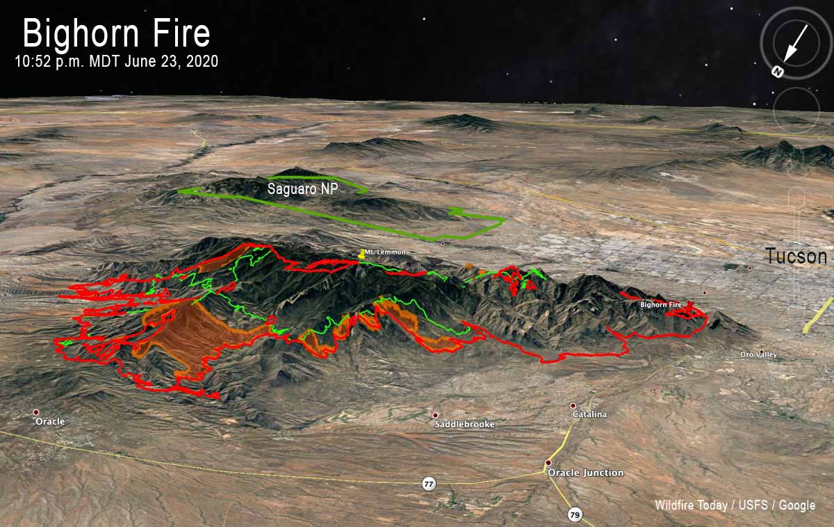
The Bighorn Fire has grown significantly in recent days to the north, west, and east. Since June 19 it has spread two miles to the west, five miles north, and three miles east.
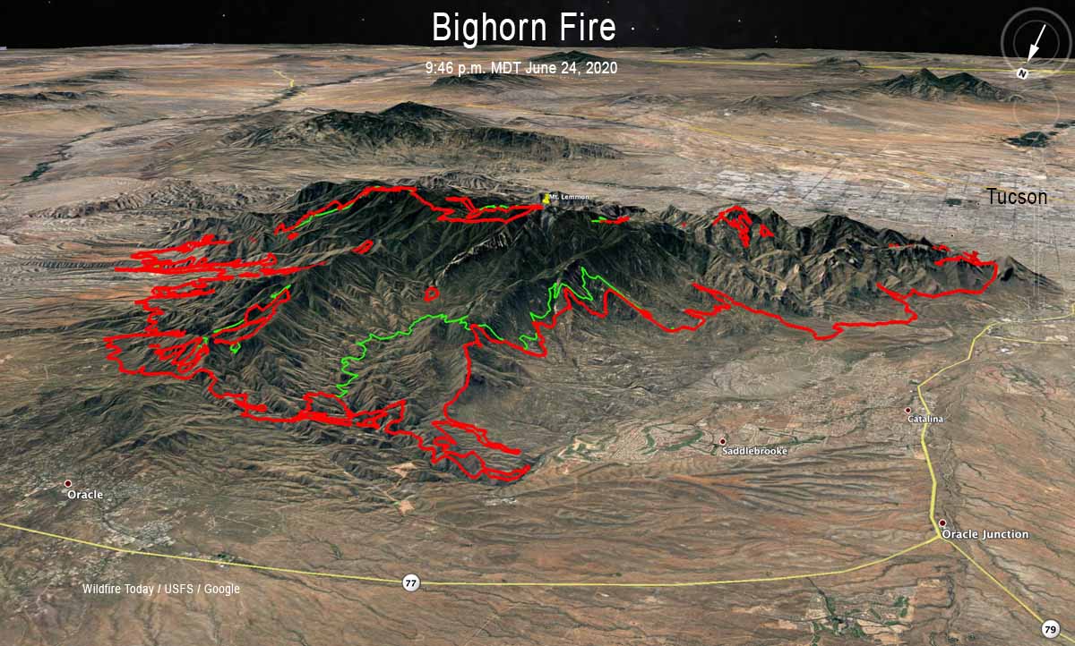
During a mapping flight at 10:52 p.m. June 23 the fire was two miles south of Oracle, three miles south of Highway 77, and 2.5 miles southeast of Saddlebrooke. The fire has now burned 74,547 acres after starting from a lighting strike on June 5. About $21 million has been spent on managing the blaze.

On Tuesday structure protection and containment work supported by helicopter bucket drops focused around Mt. Lemmon, Summerhaven, and Willow Canyon. Low-intensity firing operations removed pockets of unburned fuels in these areas. Aerial firing operations were conducted south of Oracle. The efforts near Oracle Ridge and Rice Peak are intended to reduce the risk of uncontrolled fire growth to the north in the coming days.
Evacuations are in effect. For more information visit pima.gov/bighorn or pinalcountyaz.gov/emergencymanagement
Resources assigned to the fire Tuesday included 20 hand crews, 81 fire engines, 6 dozers, 19 water tenders, and 10 helicopters for a total of 876 personnel. The number of personnel assigned has decreased by 112 since Monday. There have been 4 minor injuries.