


7:40 a.m. PDT July 16, 2021
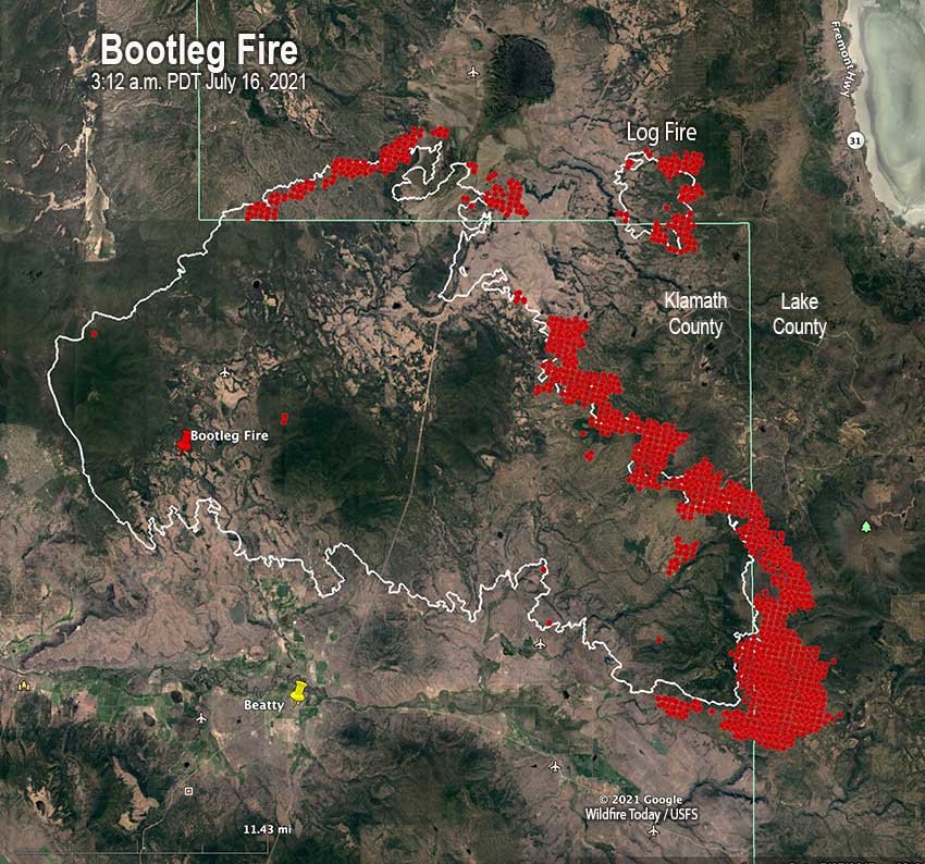
In Southern Oregon on Thursday firefighters were pulled off some areas of the Bootleg Fire for their own safety. With extreme wildfire behavior causing large fire growth on the north side, it became too hazardous for crews, engines and heavy equipment so they relocated and regrouped.
The southeast side of the fire moved two to four miles east Thursday and crossed into Lake County.
(To see all articles on Wildfire Today about the Bootleg Fire, including the most recent, click HERE.)

In the video below, retired smokejumper and Bootleg Fire Public Information Officer Jacob Welsh narrates from the front lines Thursday afternoon as equipment was relocating.
An overnight mapping flight determined that the Bootleg Fire had burned over 236,300 acres.
The Incident Management Team is also managing the Log Fire. It was active on its east side Thursday when the gap between the two narrowed to four miles.
Evacuation information for the fire is available HERE.





