


8:40 a.m. PDT Sept. 27, 2021
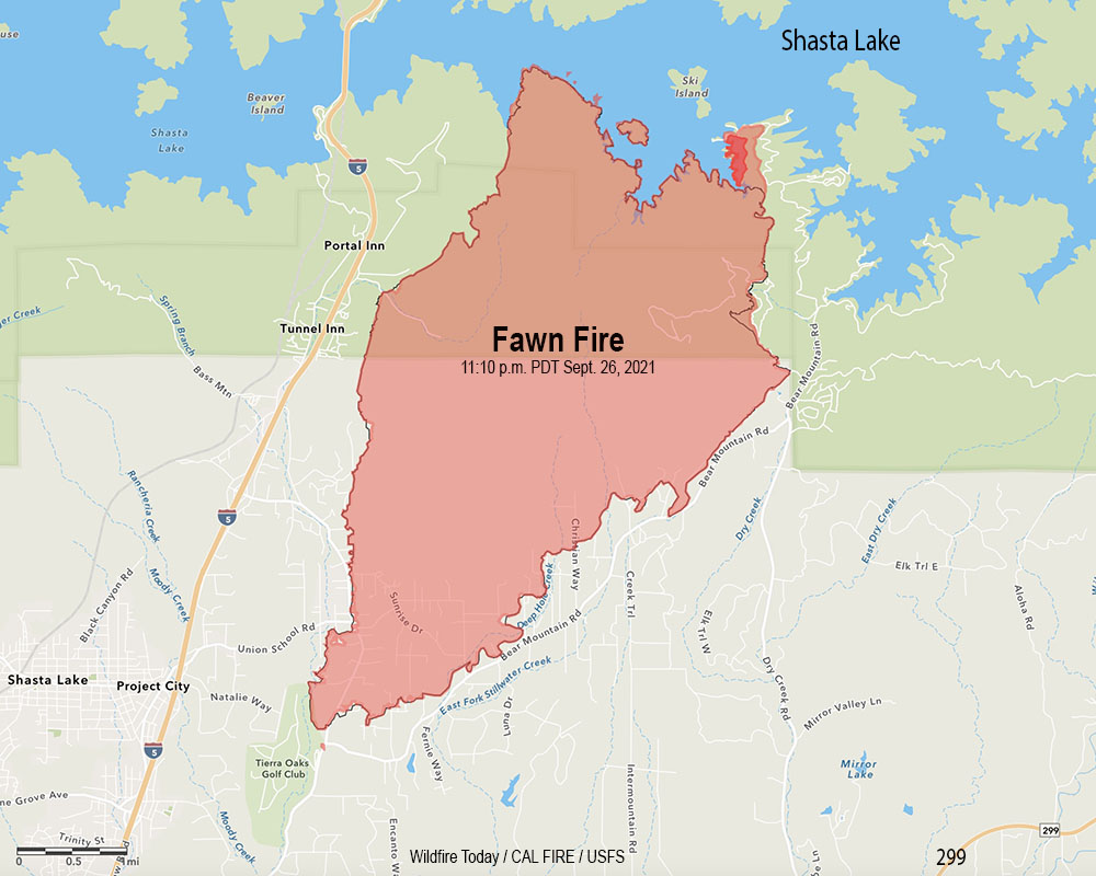 Fawn Fire map. The outer red line was the perimeter mapped by a fixed wing flight at 11:10 p.m. Sept. 26, 2021. The blackish/red line was the perimeter about 26 hours before. The dark red area represents intense heat when the fire was mapped.
The incident management team on the Fawn Fire north of Redding, California reports that Damage Inspection Teams have documented 76 residences and 79 other structures that have been destroyed.
Shasta County has established a map showing the structures that have been evaluated for damage. Redding maintains a map showing evacuation status.
A mapping flight Monday night determined the blaze had burned 8,559 acres.
Backfiring operations near the lake on the northwest and northeast sides were both successful Sunday, stopping the spread. Firefighters now have a fireline around the entire fire, however the weather could test those lines.
Weather forecasters predict breezy conditions beginning late Monday afternoon ahead of a front which could drop 0.1″ of rain, but no wetting rains are expected. Winds will be out of the southwest gusting from 25 to 35 mph then turning to come from the northwest with gusts to 25.





