


6:19 p.m. PT Feb. 16, 2022
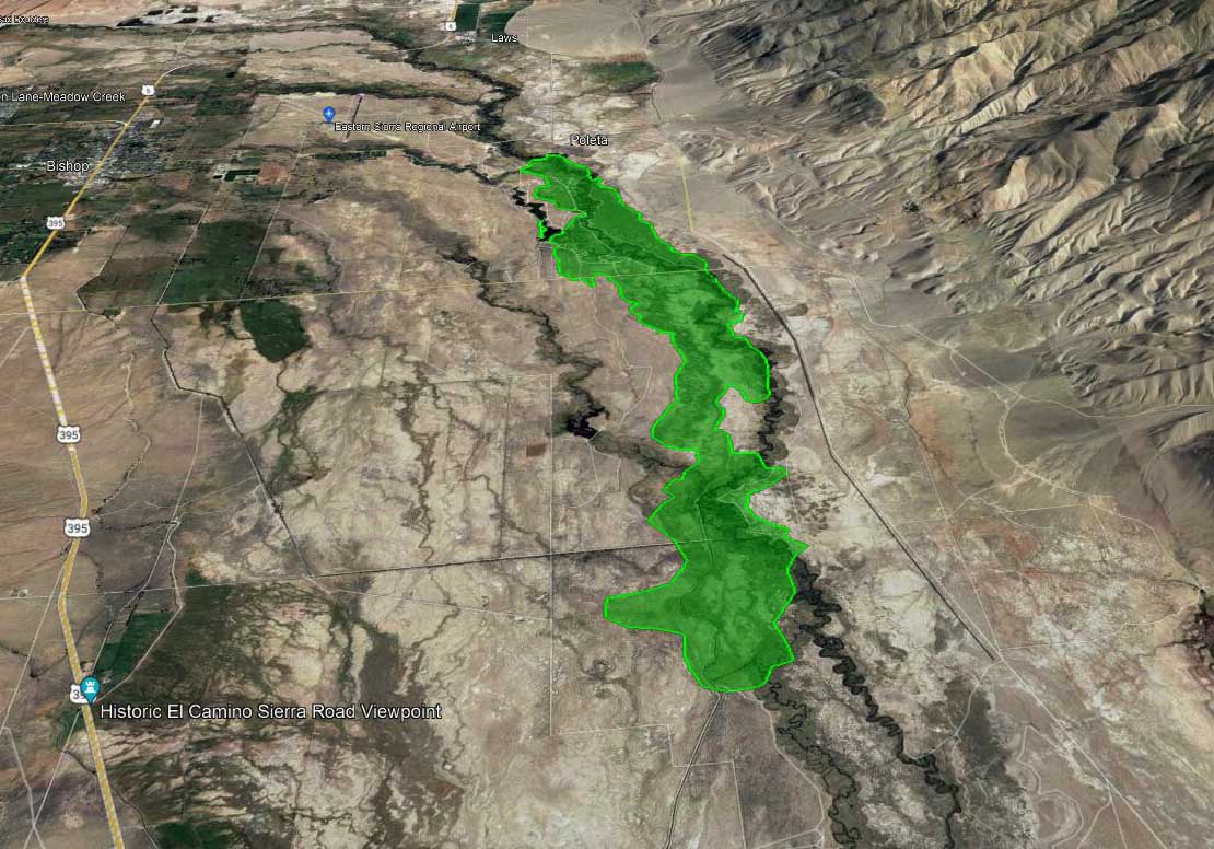 Map, Airport Fire at approximately 5 p.m. Feb. 16, 2022, looking north. By FIRIS aircraft, via Muni-Captain.
A fire in the northern end of California’s Owens Valley has burned about 2,156 acres, according to the FIRIS mapping aircraft at 4:45 p.m. PT Wednesday.
(To see all articles on Wildfire Today including the most recent, click https://wildfiretoday.com/tag/airport-fire/)
The incident is three miles east of Bishop and one mile southeast of the Eastern Sierra Regional Airport. Aircraft are having difficulty flying safely and dropping retardant accurately in the very strong winds gusting out of the north at 28 mph gusting at 32 to 50 mph while the relative humidity is 30 percent.
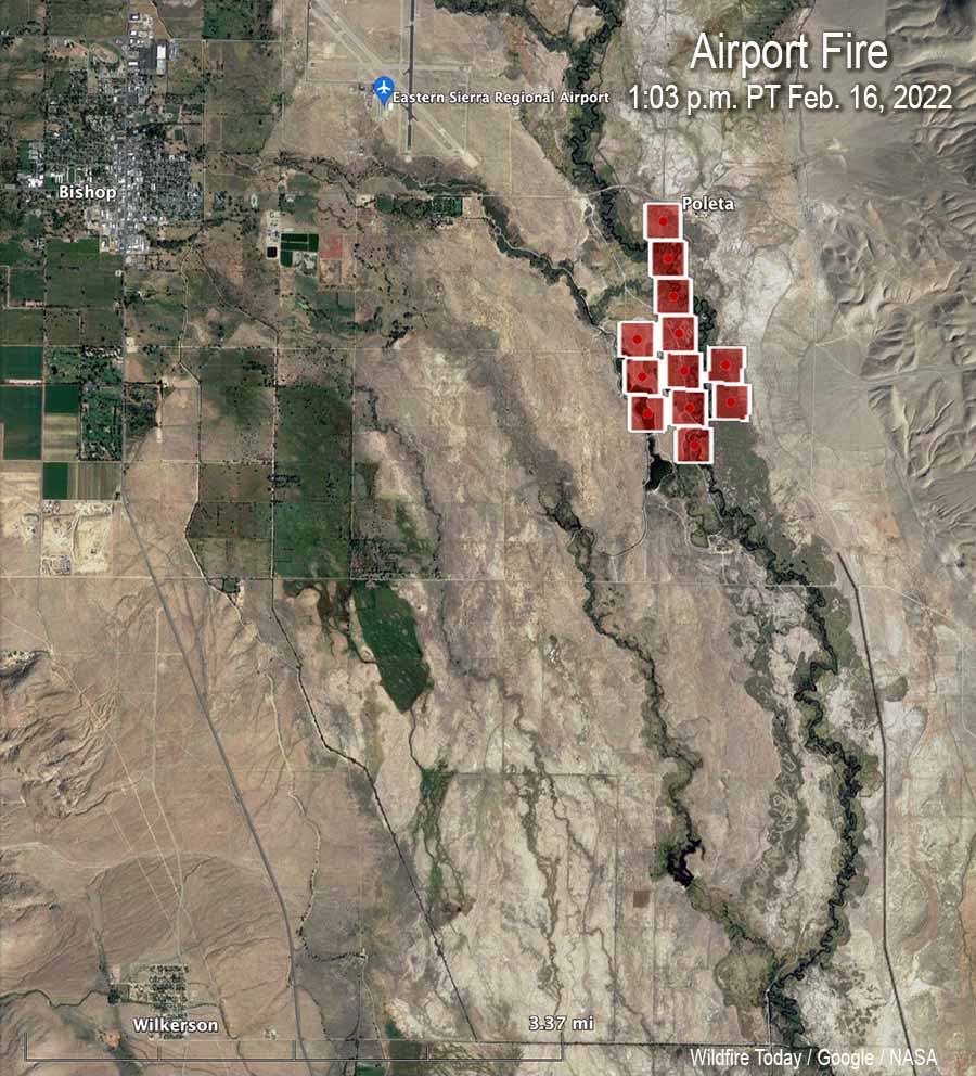 Map, Airport Fire, heat detected by satellite at 1:03 p.m. Feb. 16, 2022.
The wind is pushing it to the south. The CHP reports it has crossed Collins Road, which is five miles south of Bishop.
CAL FIRE reported at 5:38 p.m. that the town of Big Pine is being evacuated. The agency said the evacuation center is at the Bishop Senior Center, 506 Park Ave., in Bishop.
 Airport Fire, posted by CAL FIRE BDU at 4:54 p.m. Feb. 16, 2022.
Below is video, visual and infrared, of the Airport Fire southeast of Bishop, California at 4 p.m. PT Feb. 16, 2022. Shot by the Orange County FIRIS aircraft, Intel 12. When in infrared mode, the bright white areas represent heat from the fire.
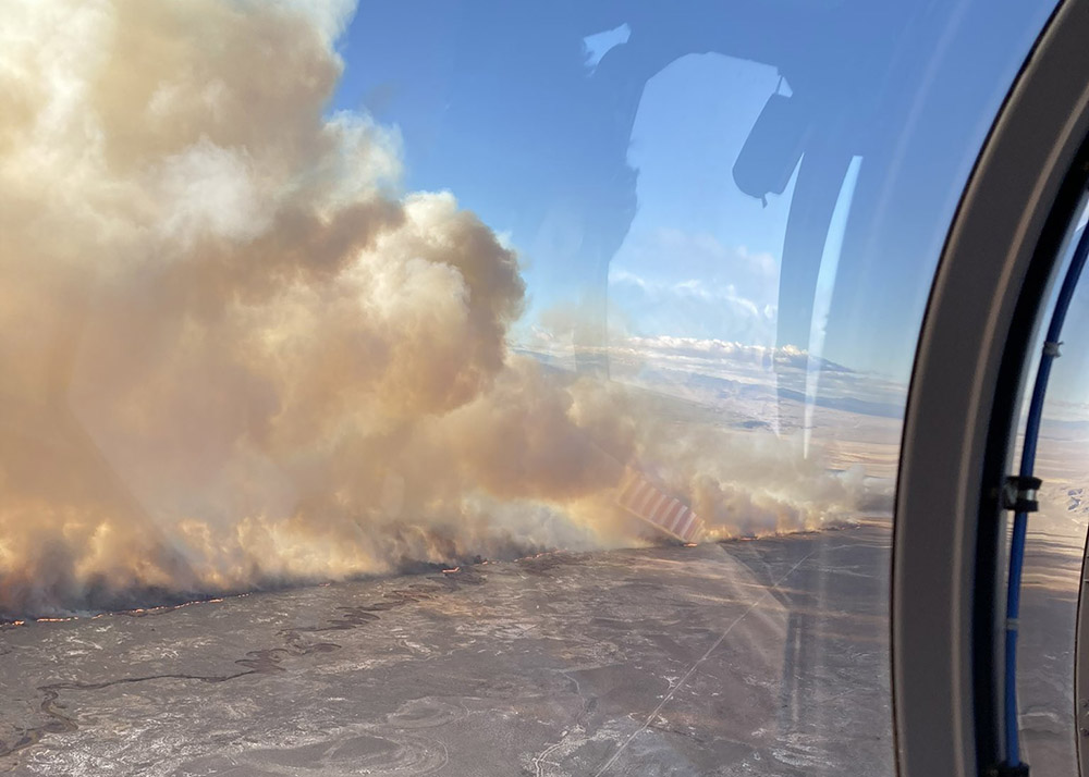 Airport Fire, posted by CAL FIRE BDU at 4:54 p.m. Feb. 16, 2022.
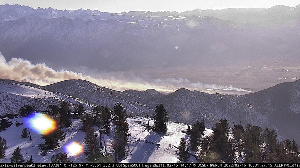 Airport Fire, as seen from the Silverpeak 2 camera at 4:31 p.m. Feb. 16, 2022.





