


UPDATE @ 9:15 p.m. MT, Aug. 27
The U. S. Forest Service has lifted the evacuation orders for some areas. More information is at InciWeb. They are now saying the fire has burned 2,050 2,800 acres as of approximately 6 p.m. today and it is 20% 5% contained. Jess Secrest’s Type 2 Incident Management Team will assume command of the fire at 9 p.m. tonight.
The weather forecast for the fire area brings some good news, including a 50-60% chance of rain Saturday night and Sunday morning. On Saturday the temperature will be 55 to 70, depending on the elevation, and winds should be light and variable, becoming 5-10 out of the northeast on the ridge tops in the afternoon.
Ellen Bacca, the meteorologist for the Helena NBC station, posted some photos related to the fire. I believe they were taken from Helena.
======================================================
UPDATE @ 11:00 a.m. MT, Aug. 27
The weather forecast is more favorable for firefighters on the Davis fire today than the weather conditions were on Wednesday and Thursday. The temperatures will be much cooler, maxing out at 53-58 at the fire, however it will still be breezy with west winds of 15-25 gusting up to 35 in the morning . The RAWS weather station at Lincoln, 11 miles northwest of the fire, received 0.04″ of rain at 2 a.m. today, Friday.
======================================================
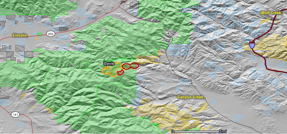
The updated map of the Davis fire, an escaped prescribed fire between Lincoln and Helena, Montana, shows that the fire has spread to the east near the eastern boundary of the Helena National Forest.
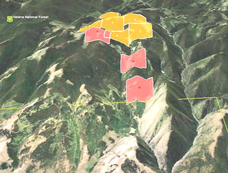
The latest official update from the U.S. Forest Service late Thursday night said the fire had burned 2,000 acres and that “Lewis & Clark County Sheriff Leo Dutton has ordered evacuations of homes located at the top of Stemple Pass over to Highway 279 (Lincoln Road)”. There are some media reports that the fire has burned 2,800 acres.
Helenair.com has an article describing a public meeting on Thursday at which the USFS District Ranger for the area, Amber Kamps, talked about what they were thinking when they decided to conduct the prescribed fire on Wednesday. On Thursday the high temperature of 97 set a new record in Helena. Here is an excerpt from the article:
She said they got a “spot weather” report from the National Weather Service Tuesday, and again on Wednesday. The reports predicted temperatures around 70 degrees at the high elevation burn site on Granite Butte, relative humidity around 20 percent and winds less than 10 miles per hour — exactly what the Forest Service wanted — even though Helena’s high reached 90 degrees Wednesday.
“We had the green light with the weather conditions to move forward,” Kamps said, adding that the recent heavy rains, along with wet weather earlier this summer, caused her to believe that they could do the type of burns usually postponed until September or October.
They lit a test fire, but that didn’t catch well. Kamps said they almost decided the humidity was too high to go forward with the burn, but instead waited an hour and tried again, this time successfully.
Kamps said it wasn’t until later Wednesday afternoon that the red flag warning was issued.
“Before we got the red flag warning we had already shut down ignition,” Kamps said.
The fire was supposed to be in a 100-acre area. But Wednesday afternoon, it had jumped outside the boundary onto another 20 acres. For reasons not fully explained at Thursday night’s meeting, the fire wasn’t fully extinguished.
Greg Archie, who works for the state Department of Natural Resources and Conservation, is the incident commander for what’s now being called the Davis fire. He was helping the Forest Service with the prescribed burn Wednesday, and said that when they returned on Thursday morning, he brought “65 people to deal with that 20 acres.” They also had nine engines, three water tenders and a helicopter as they started the day.
“We were making pretty good headway collecting all the spots, controlling the 20-acre slop-over, when a spot came up that we hadn’t had any people on and were not aware of,” Archie said. “Once it got going and started to branch out in the subalpine fir, it’s pretty alarming in the way it can spread.”
The prescribed burn turned into a wildfire by 1 p.m. in the upper portion of Gould Creek, growing from 20 to 100 acres in an hour. Archie said they couldn’t safely put people on it, so they called for an air tanker and retardant, as well as other resources. By 8 p.m. the Davis fire was estimated to cover 2,800 acres.
Ryan Grady, who said he lost about 1,000 acres to the blaze, praised the firefighters for their effort.
“This was the greatest response I’ve ever seen,” he said.
But another woman tearfully noted how her two children were home alone at the time the fire exploded, and said had she known the Forest Service was going to set the prescribed burn she would have taken them with her.
“I could have lost my children,” she said.
We are working on more information and will post it here throughout the day.
=====================
Our original report on the fire.
=====================
UPDATE November 30, 2010:
The official report on the fire was released on November 24, 2010.







