


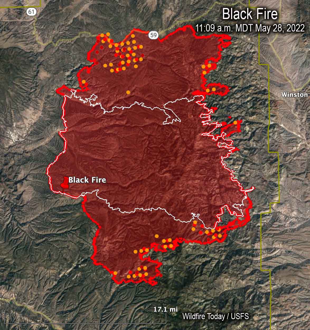
 Map of the Black Fire. The red and yellow dots represent heat detected by a satellite as late as 11:09 a.m. MDT May 28, 2022. The red line was the perimeter at the end of the day on May 28. The white line was the perimeter on May 22.
The Black Fire in southwest New Mexico 25 miles west of Truth or Consequences has grown to 228,312 acres. The movement over the last week has mostly been to the north and south.
The fire was active Friday with extended downslope pushes through drainages on the east side of the Divide, additional spread to the south through heavy dead and down fuels, and uphill runs and spotting across containment lines on the northwest flank.
A Red Flag Warning is in effect Sunday for low humidity and winds gusting up to 40 mph.
The firefighters are being led by a Type 2 incident management team, Southwest Team 3. The estimated costs to date are $16,100,000.
Evacuations are still in effect (more information) and one residence has been destroyed.
Resources assigned to the fire Saturday evening included 21 hand crews, 26 engines, and 6 helicopters for a total of 756 personnel.
 Map of the Black Fire, May 28, 2022. The black line is contained fire edge. The red line is not contained.





