


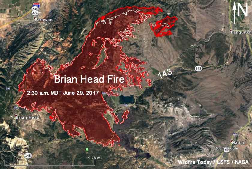
Above: Map of the Brian Head Fire in southwest Utah. The red line was the perimeter at 2:30 a.m. MDT June 29, 2017. The white line was the perimeter 24 hours earlier.
(Originally published at 12:52 p.m. MDT June 27, 2017)
The spread of the Brian Head Fire in southwest Utah slowed on Wednesday, thanks to weather less conducive to extreme wildfire behavior, but it still continued to grow on the northeast side. In that area there are large expanses with much lighter vegetation (or fuels), possibly due to past fires, but a couple of spot fires east of those locations are in heavier fuels and have expanded during the last two to three days progressing to within six miles of Panguitch.
On Wednesday the fire consumed another 4,117 acres, bringing the total to 58,318 acres.
On Thursday firefighters will be assessing structure protection needs in Walker and Potato Patch as well as continuing efforts in Breezy Pines. Tactical options are being developed on the north side of the fire.
An illegally operated drone flew into the fire area Wednesday, forcing all firefighting aircraft to be grounded for safety reasons. Law enforcement responded and is investigating the incident. Hobbyist drone operators are reminded that “if you fly, we can’t fly.” There is a Temporary Flight Restriction (TFR) over the fire area and it is against federal law to fly a drone within the restricted area. This also happened on the Goodwin Fire in Arizona Wednesday, as well as the Lightner Fire in Colorado.
Resources assigned to the fire include 48 hand crews, 82 engines, 14 helicopters, a variable number of air tankers, and 1,729 personnel. The suppression costs to date have totaled $14.9 million.
Evacuations are still in place for several communities.


