


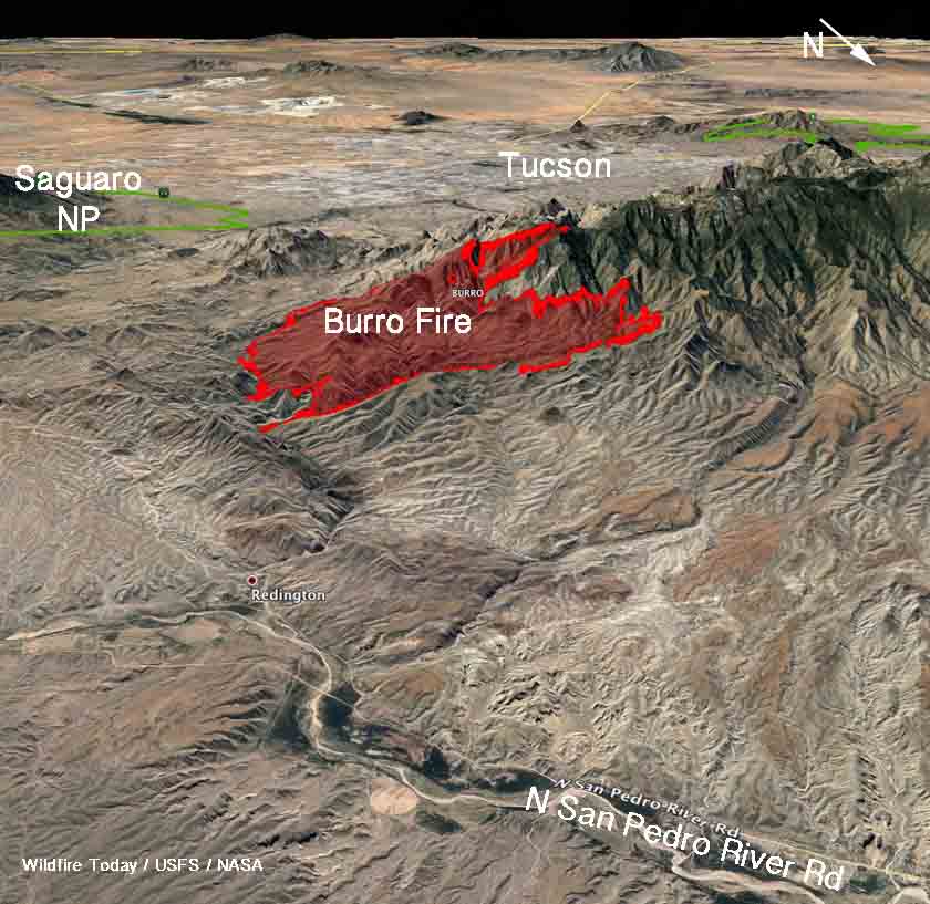
Above: 3-D map of the Burro Fire showing the perimeter at 8:30 p.m. MDT July 2, 2017. Looking southwest.
(Originally published at 8:20 a.m. MDT July 3, 2017.)
The Burro Fire is causing evacuations near Tucson, Arizona in the Mt. Lemmon area. The fire was reported June 30 on the southeast side of Mt. Lemmon in the foothills of Redington Pass and as of 8:30 p.m. MDT on Sunday had spread for six miles to within a mile of the Mt. Lemmon Highway. At that time it had burned about 11,300 acres according to an overnight mapping flight, which is an increase of over 6,000 acres from the last estimate. Monday morning the Incident Management Team estimated it had grown to about 14,000 acres.
The Burro Fire is 6 miles northeast of the outskirts of Tucson and 20 miles east of Interstate 10.

The Pima County Office of Emergency Management’s notices on their Facebook page are a little vague about what areas are being evacuated and when, but a news release from the Incident Management team said Summerhaven is being evacuated as well as the Mt. Lemmon Highway from Mile Marker 0 up to Palisades Road. Other locations are on a pre-evacuation notice. Residents can call 928-351-7537 for more information.


