


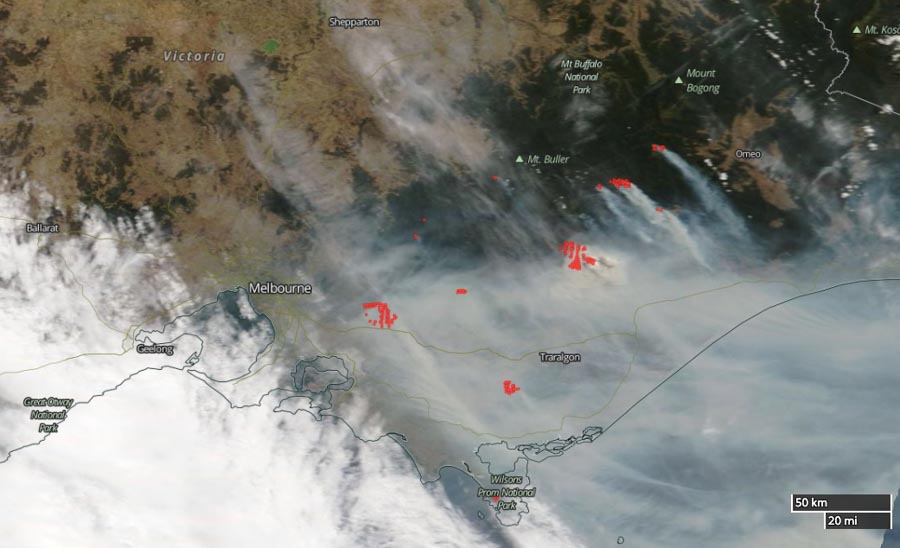
The large bushfire about 65km east of Melbourne, Victoria, Australia has doubled in size during the last 24 hours. It is a result of four fires in Bunyip State Park merging and has now blackened about 12,400 HA (30,600 acres).
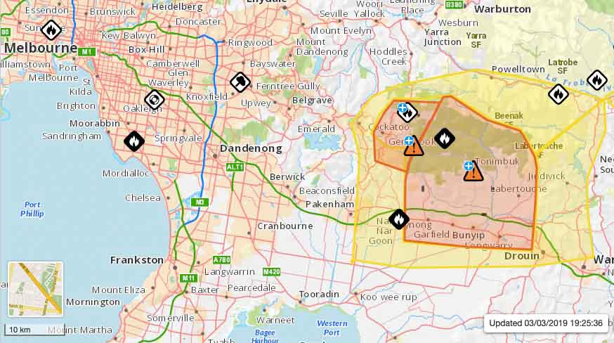
Emergency Management Victoria has downgraded the incident from an emergency alert to a Watch and Act that affects the following areas: Basan Corner, Beenak, Bunyip, Bunyip North, Cornucopia, Garfield, Garfield North, Gentle Annie, Labertouche, Longwarry North, Maryknoll, Nar Nar Goon, Tonimbuk, Tynong, Tynong North.
On Saturday and Sunday the wind direction changed several times pushing the fire in a variety of directions. This can be very dangerous for firefighters.
The video below at 1:30 captured Air Tanker 137, a Boeing 737, making a retardant drop.
BUSHFIRE EMERGENCY: Several out-of-control fires are burning in Victoria’s east, forcing hundreds of people out of their homes. @SamCucchiara9 is LIVE. #9News pic.twitter.com/HeeiGPIltA
— Nine News Melbourne (@9NewsMelb) March 4, 2019


