


Photo above: Backburning near Arthur River in northwest Tasmania, January 29, 2016. Photo by W. Frey.
Bushfires that have been raging across northwest Tasmania for several weeks are still causing great concern in the island state south of Australia.
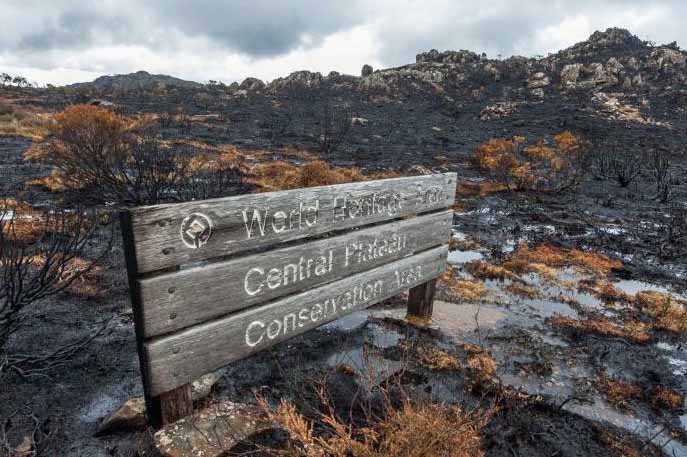
One of the fires in the Central Plateau has burned about 11,000 hectares (27,000 acres) in the World Heritage Area, about 1.2 percent of the WHA. Unique alpine flora such as pencil pines, king billy pines and cushion plants — some more than 1,000 years old — have been destroyed.
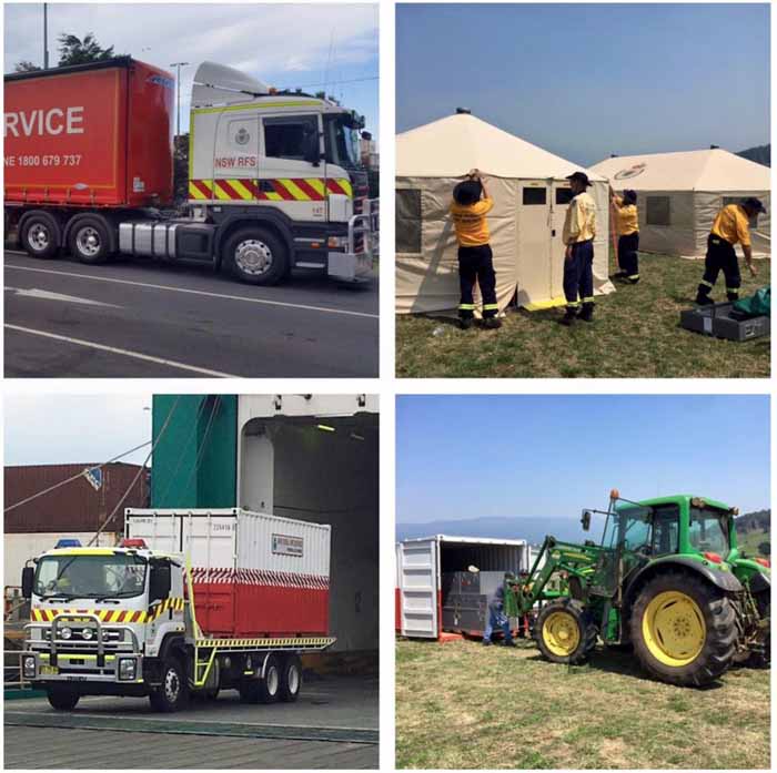
The New South Wales Rural Fire Service has sent many of their wildland firefighters across the Bass Strait to assist their neighbors in Tasmania.
Three air tankers from North America that have been working in Australia during their summer bushfire season have also been deployed, including a DC-10, Avro RJ85, and a C-130. This may be the first time these large aerial firefighting resources have been used in Tasmania. The Fire Service felt it was necessary to warn the residents to “not be alarmed” when they saw the air tankers “flying a bit low over the coast”. More information about the air tankers in Tasmania is at Fire Aviation.

Most of the most active bushfires are in the northwest part of Tasmania. Three of the largest are in these areas:
- Arthur River and Nelson Bay. 21,000 hectares (52,000 acres).
- Pipeland Road. 62,000 hectares (153,000 acres).
- Lake Mackenzie Road. 25,000 hectares (68,000 acres).
Another fire in the southwest part of the state has burned 4,000 hectares (10,000 acres) between Lake Gordon and Lake Pedder.
At least 26 bushfires are still active while 48 others have been contained.
Below are maps showing the locations of the fires, and more photos.


In the video below Tasmania Fire Service Chief Officer Gavin Freeman provides information about the ongoing bushfires.


