


(UPDATE July 15, 2013)
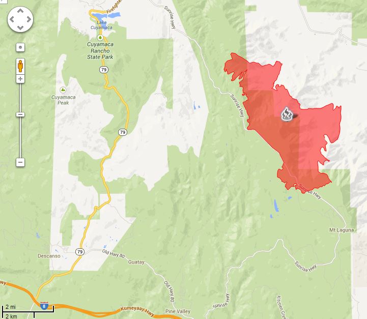
The Chariot fire is listed at 100 percent contained, so the map below could be the final one. A zoomable map is available HERE.
****
(UPDATE at 9:15 a.m. PDT July 10, 2013)
The Chariot Fire not only burned a landmark-type lodge on Mt. Laguna east of San Diego, it also destroyed 120 structures, according to CAL FIRE, the agency attempting to suppress the fire. Initial reports by the San Diego Union that the lodge at the Sierra Club’s facility across the highway was destroyed were incorrect, but at least one structure there did burn.
Most of the structures, including the lodge built in 1925, were in the Al Bahr Shrine Camp a mile north of the US Forest Service’s Laguna Engine Station and about two miles north of the post office in the small community.
The fire started Saturday afternoon near the Butterfield Ranch in the Anza-Borrego Desert, 3.000 vertical feet below the community. Most of the damage was done Monday afternoon. CAL FIRE reports the fire has burned 7,055 acres and is 40 percent contained. The only map provided by CAL FIRE is dated July 8 and does not show the fire’s presence on Mt. Laguna.
Shriners International contributes funding to children’s hospitals, but most people know them as the organization that drives tiny cars performing maneuvers in parades.
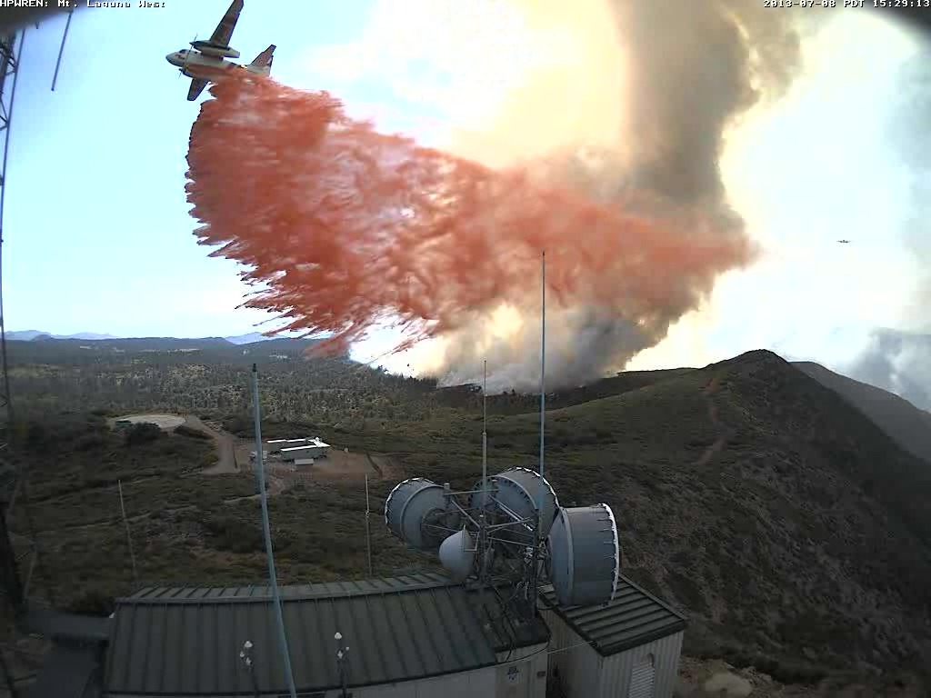
The web cameras operated by the University of California’s High Performance Wireless Research and Education Network (HPWREN) captured the aerial fire fight as air tankers dropped retardant to protect the electronic sites, including their own, on Mt. Laguna at the former Air Force base.
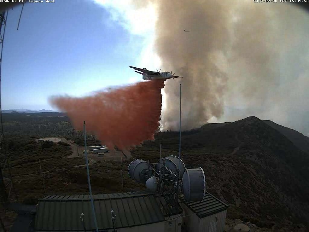
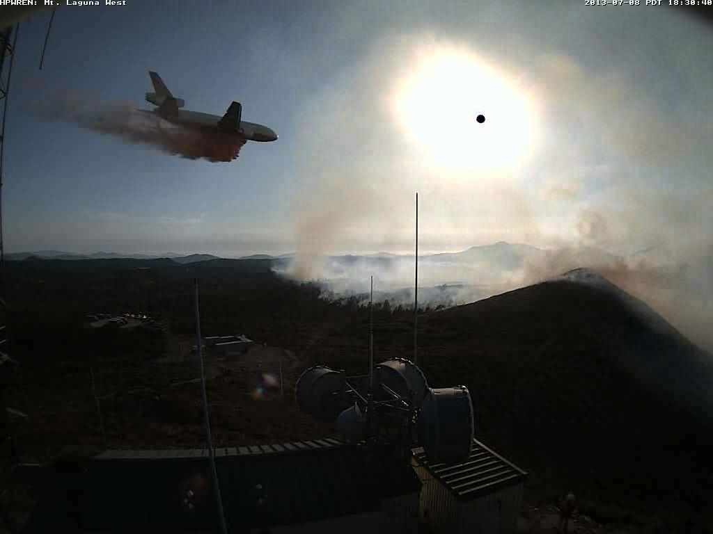
Thanks go out to the Lone Ranger for pointing out the HPWREN site that has 14 other photos of the air tankers working on Mt. Laguna.
****
(UPDATE at 11:18 p.m. PDT, July 8, 2013)
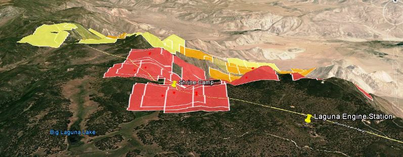
The San Diego Union is reporting that the Chariot Fire not only made it to the top of the slope, from the desert 3,000 vertical feet up to the Mt. Laguna area, but it crossed the Sunrise Highway and burned into the Cleveland National Forest. And, most importantly, it burned two landmark-type buildings on special use permits in the Forest — the large and very old lodges at the Sierra Club and the Al Bahr Shrine Camp on opposite sides of the highway, plus about six other buildings.
The fire crossed the Sunrise Highway and burned into at least one of the group campgrounds in the Laguna Campground complex adjacent to the Shrine Camp. A fire spokesperson said 120 residences were evacuated. The fire is burning about a mile north of the Laguna (or Camp Ole) engine station… one of my old stations on the Cleveland National Forest.
CAL FIRE reports the fire has burned 4,700 acres and is being fought by 1,383 personnel. It is about 50 miles east of San Diego.
The San Diego Union also reported, (incorrectly) “Loud booms could be heard as trees caught fire and their tops exploded.” The old “exploding trees” myth lives on.
****
(UPDATE at 3:42 p.m. PDT, July 8, 2013)
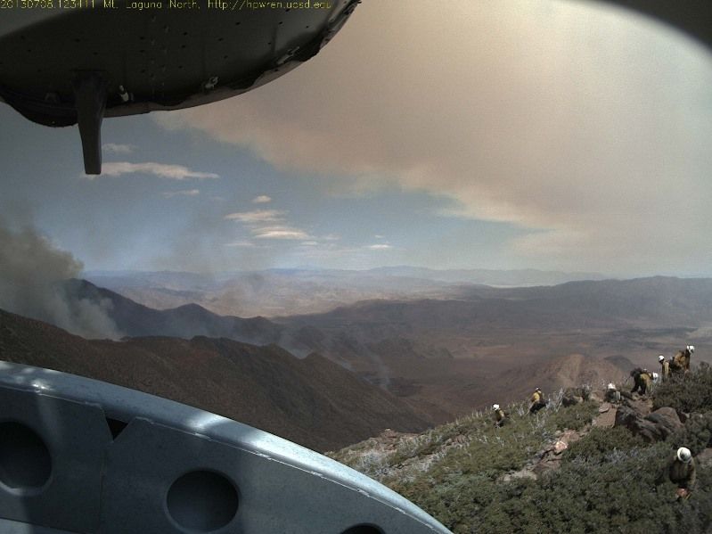
Kelly found this photo on the Mt. Laguna web cam that shows a crew in the foreground.
****
(Originally published at 7:12 a.m. PDT, July 8, 2013)
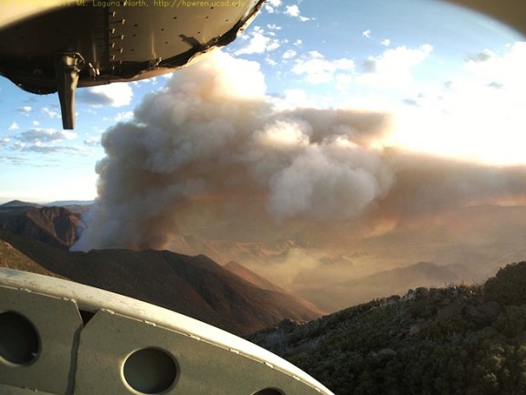
The Chariot Fire north of Mt. Laguna, California that is causing evacuations on the mountain can be watched in near-real time thanks to a web camera at the old Air Force Base at Mt. Laguna. The photo above was taken at 6:10 a.m. on Monday — the one below at 11:58 a.m. Sunday. Several campgrounds as well as the Al Bahr Shrine Camp have been evacuated.
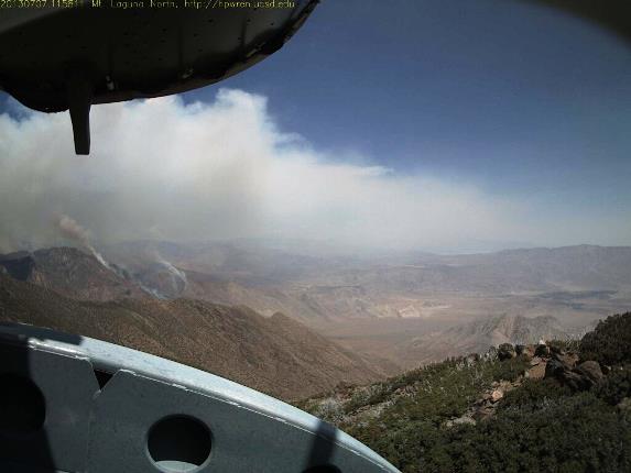
CAL FIRE said at 7:15 Sunday night the fire had burned 2,500 acres. The fire is burning on the desert slopes below Mt. Laguna, my old stomping grounds. There is a difference in elevation of about 3,000 feet from the desert floor to the forested area at the top. In the last 10 years or so there have been several fires in this general area so it is possible that it will burn into one or more of those and slow down considerably.
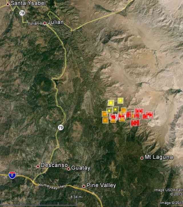
The map of the Chariot Fire above shows heat detected by a satellite at 2:20 a.m. Monday.
The San Diego Union has some photos of firefighters from the U.S. Forest Service’s Descanso Engine Crew watching the fire from the top of the hill. The slopes below are far too steep on which to attack a rapidly moving fire.







