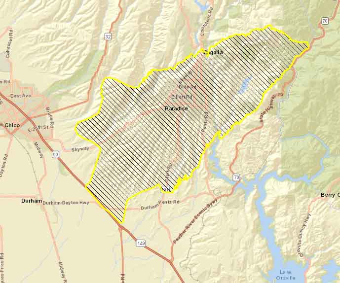
(UPDATED at 11:20 a.m. PST November 9, 2018)
The CBS station in Sacramento had this information Friday morning:
The Butte County Sheriff’s Office says at least five people have been found dead after the Camp Fire tore through the town of Paradise on Thursday. Investigators found the five people in the area of Edgewood Lane in Paradise inside of cars. It’s believed the victims were overcome by the Camp Fire when they were in their cars. No identification of the victims was able to be made due to the burn injuries, deputies say.
Investigators have been working to confirm reports of fatalities due to the destructive fire. Anyone with missing loved ones are encouraged to check http://safeandwell.org.
(Originally published at 7:45 a.m. PST Nov. 9, 2018)
In the first 12 hours the Camp Fire burned 54,000 acres as it roared through Paradise, California destroying large sections of the city.
(To see all articles about the Camp Fire on Wildfire Today, including the most recent, click here.)
The wildfire started at 6:33 a.m. November 8. A mapping flight at 6 p.m. determined it had spread 15 miles to the southwest pushed by winds that at times in the higher elevations gusted to 65 mph out of the northeast. At 6 p.m. it had come to within two miles of Highway 99, but at 1:48 a.m. Friday a heat-sensing satellite found that it had neared the highway in at least two places and was approaching the outskirts of Chico.
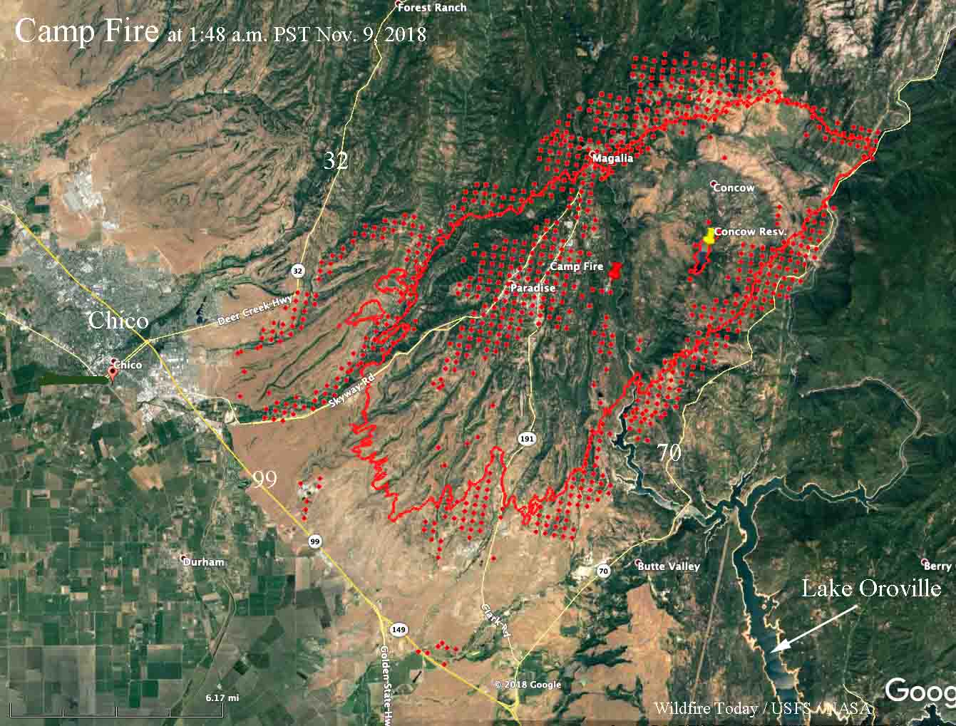
Fire officials are saying that hundreds of homes have burned but it could be days before accurate numbers are available.
Overnight the fire spread closer to Highway 70 on the east side, and on the west side it approached Highway 32 and moved through Magalia where heavy structure losses can be expected.
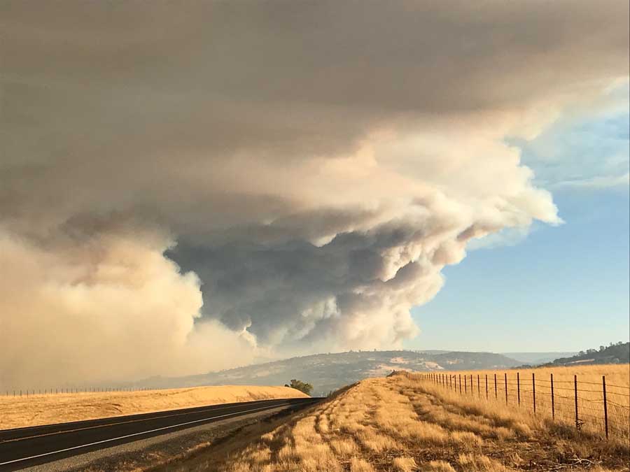
After sunrise Friday the fire was very active, as seen in the photo below.
The Feather River Hospital was evacuated, but there are conflicting reports on the status of the facility. Some say it burned, others say one or more structures at the site burned but the main building is intact.
The mapping flight at 6 p.m. Thursday determined that the fire had burned over 54,000 acres, but the satellite data from 8 hours later showed that it had increased substantially since then, possibly as much as an additional 15,000 acres. CBS in Sacramento reported at 7:02 a.m. that a spokesperson for CAL FIRE said the fire had grown to about 70,000 acres.
Heavy concentrations of smoke are affecting areas southeast of the fire. To see a map for the prediction of the distribution of smoke and a satellite photo showing the smoke, click here.
On the southeast side of the fire the Jarbo Gap weather station recorded overnight wind speeds of 28 mph gusting to 44 with 18 percent relative humidity. Those conditions should continue through the morning in the higher elevations on the fire but the winds will decrease substantially in the afternoon.
Update at 10:49 a.m. PST November 9, 2018. We found the following map on InciWeb, but there does not appear to be any further information on the site about the Camp Fire.