Above: Chetco Bar Fire August 17, 2017. Inciweb.
(Originally published at 9:35 a.m. PDT August 22, 2017)
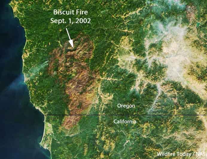
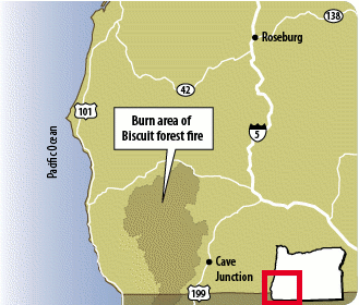
On July 13, 2002 the Biscuit Fire started in southwest Oregon. Under a limited suppression strategy 7,000 workers fought the fire as it spread into California. By November it had burned up nearly 500,000 acres and $150 million, becoming one of the largest wildfires in the recent history of the 48 contiguous states.
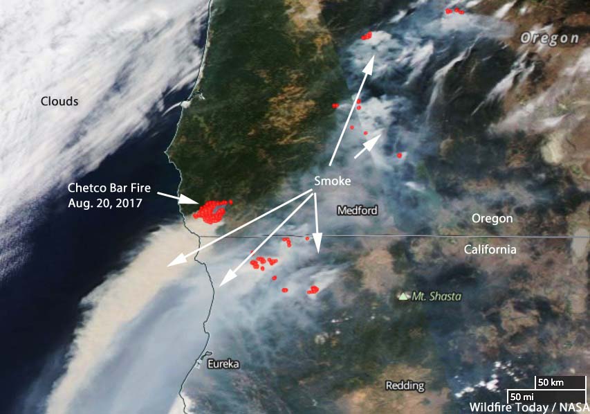
This summer another very large wildfire, the Chetco Bar Fire, is burning partially in the footprints of the Biscuit and another nearby blaze, the 1987 Silver Fire. Also under a limited suppression strategy, the 788 personnel assigned today are faced with the steep slopes in the Kalmiopsis Wilderness as well as brush and dangerous snags left in the previously burned areas.
Evacuations are in effect and Curry County Sheriff’s Office says at least five homes have been destroyed by the fire.
The Phoenix National Incident Management Organization (NIMO) Team with Incident Commander Bob Houseman, on the fire since July 29, explains their task:
Because of the risk to firefighter safety, low probability of success of a direct attack strategy and minimal values at risk, fire personnel are currently focused on constructing contingency lines, conducting reconnaissance for access, scouting safe entry points, locating natural features for containment opportunities, protecting wilderness values and developing a long term plan for safely engaging the fire.
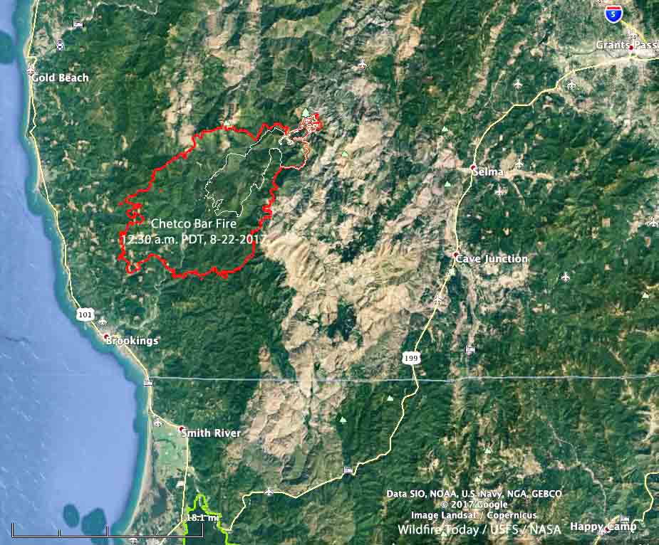
On August 18 at 4 p.m. the Chetco Bar Fire covered 22,042 acres. Early Tuesday morning August 22 it was mapped at 97,758 acres, approaching the 100,000-acre threshold of becoming a “megafire”.
For the last several days it has been spreading rapidly to the southwest growing to within five miles of Brookings, a community on the Pacific coast. It is 14 miles southeast of Gold Beach.
The Team is using a mixture of direct, indirect and point protection tactics when and where they expect there is a high probability of success. The fire is burning in areas of fire scar and islands that were previously unburned, as well as areas west of the previous fires. The combination of down and dead fuels in the old burns and newly cured grass adds complexity for firefighters.