


(Originally published at 7:30 a.m. PDT July 20, 2017)
(Updated at 7 p.m. PDT July 20, 2017)
CAL FIRE reported Thursday that the Detwiler Fire has destroyed 50 single family residences.
In the photo below Air Tanker 912, a DC-10, makes a retardant drop on the Detwiler Fire.
Fire crews continue to battle the #DetwilerFire near the town of Coulterville, Calif., on Thursday, July 20, 2017. pic.twitter.com/HOOI19hIXu
— Andrew Kuhn (@ARKuhn) July 21, 2017
(Updated at 5:02 p.m. PDT July 20, 2017)
Above: A 3-D map of the Detwiler Fire looking south from Coulterville, CA. The red shaded area was the perimeter at 1 a.m. July 20.
The Detwiler Fire was very active again Wednesday for the fourth day since it started and moved to within 2 miles of Coulterville, California. It grew by 4 miles on the north side, 3 miles on the south side, and 2 miles on the east. There was much less movement on the west side.
At 1 p.m. on Thursday the fire had spread north beyond the fire perimeter that was mapped at 1 a.m. and was less than 2 miles from Coulterville. It had crossed Crown Lead Road, which is south of Coulterville. The incident management team has a great many firefighting resources making preparations south of the town, including helicopters, hand crews, fire engines, and dozers. Firelines are being built and it is likely that when they are complete air tankers will reinforce those lines. The fire was also active at 1 p.m. Thursday on the northeast side as well as southeast of Catheys Valley on the south side.
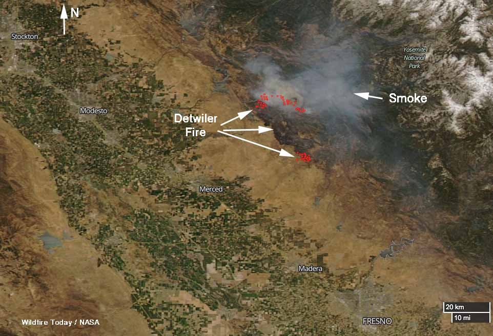
Southeast of Coulterville the fire is less than a mile from the boundary of the Stanislaus National Forest. A CAL FIRE incident management team has been running the fire but an Interagency Type 1 Incident Management Team has been ordered to report to the fairgrounds at Sonora 22 air miles north of the fire. The assumption probably is that the fire will be in the National Forest in a day or two.
By Thursday morning at 1 a.m. the fire had burned 73,096 acres, an increase of 27,372 acres since the previous mapping flight at 10 p.m. on July 18. (There is some confusion about the acres burned, with some sources reporting the total is 70,096.)
CAL FIRE reports that 45 structures have been destroyed. It is not clear if that number includes outbuildings.
The map of the Detwiler Fire was current at 1 a.m. PDT July 20, 2017
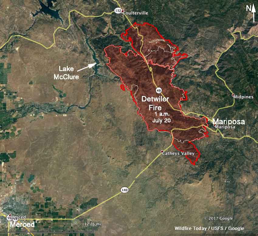
Highways 49 and 140 are both closed in the fire area. CAL FIRE and the Mariposa County Sheriff’s Office have more information about evacuations, although CAL FIRE’s information site about this rapidly spreading fire is updated infrequently.


The USFS Blue Sky Modeling Framework projects where smoke is expected from the #DetwilerFire , impacting the Sierra & foothills. #cawx pic.twitter.com/sZjwTFDF4Y
— NWS Sacramento (@NWSSacramento) July 20, 2017
(All articles on Wildfire Today about the Detwiler Fire are tagged “Detwiler Fire” and can be found here, with the most recent at the top.)


