


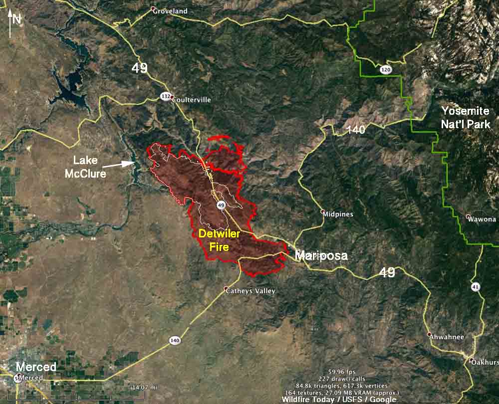
Above: Map of the Detwiler Fire. The red line was the perimeter at 10 p.m. PDT July 18, and the white line was the perimeter 21 hours earlier.
(Originally published at 7:34 a.m. PDT July 19, 2017)
(UPDATED at 9:54 a.m. PDT July 19, 2017)
The Detwiler Fire continued to burn vigorously Tuesday evening. When it was mapped at 10 p.m. it had more than doubled, adding another 26,123 acres during the previous 21 hours to bring the total burned area up to 45,724 acres according to CAL FIRE. Satellite data acquired four hours later at 2 a.m. Wednesday showed the fire had still been spreading and may have added at least another 5,000 acres.
About 4,000 people are affected by evacuations, including the entire city of Mariposa. CAL FIRE and the Mariposa County Sheriff’s Office have more information about evacuations. Approximately 1,500 homes are threatened and 8 structures have been destroyed.
The Detwiler Fire has burned very close to Mariposa and is 23 miles northeast of Merced.
The fire has crossed Highways 49 and 140, which are now closed in the area of the fire.
Firefighters are worried about the power lines that supply electricity to Yosemite National Park which is 16 air miles east of the fire.
About 2,200 personnel are assigned or en route.

The video below shows a drop from a DC-10 air tanker.
Retardant drop: trying to protect the town of Mariposa as the #detwilerfire flames come towards downtown @FOX40 pic.twitter.com/RGEF9IUSkw
— Eric Rucker (@EricRuckerfox40) July 19, 2017
(All articles on Wildfire Today about the Detwiler Fire are tagged “Detwiler Fire” and can be found here, with the most recent at the top.)


