


Above: Morning briefing at the Decker Fire, October 3, 2019. IMT photo.
(UPDATED at 9:01 a.m. MDT October 3, 2019)
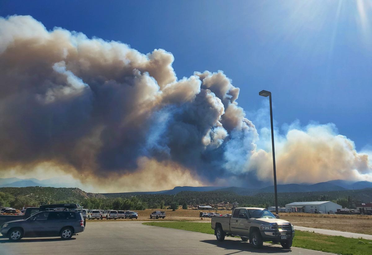
Strong winds gusting at over 25 mph out of the west on Wednesday pushed smoke from the Decker Fire to the east toward Colorado Springs. The wind combined with the relative humidity dipping down to the ridiculously low 2 percent at Salida resulted in the northern portion of the fire to spreading to the east. (see map below)
(To see all articles on Wildfire Today about the Decker Fire, including the most recent, click here.)
There was no fixed wing aircraft mapping flight Wednesday night due to mechanical problems with the plane. The map below shows heat detected by a satellite as late as 3:48 a.m. Thursday, but that data from hundreds of miles overhead is not as accurate as an aircraft 5,000 to 10,000 feet above the ground. So consider the dots that represent heat to be approximate locations. With that in mind, the fire may or may not have approached or crossed the boundary of the Rio Grande National Forest, the green line.


The Rocky Mountain Type 1 Incident Management Team assumed command of the fire at 7 am. Thursday.
Resources assigned to the fire Wednesday evening included 8 hand crews, 10 engines, and 5 helicopters for a total of 259 personnel. Approximately $1.9 million has been spent on managing this less-than-full-suppression fire to date.
We will update this post as more information becomes available.
(UPDATED at 3:50 p.m. MDT October 2, 2019)
VIDEO: Time-lapse of #DeckerFire. Officials say around 125 homes have been ordered to evacuate. @KKTV11News pic.twitter.com/ERggP6cv1h
— Kasia Kerridge (@KasiaKerridgeTV) October 2, 2019
#Wildfire season is not over yet. The #DeckerFire just south of Salida has burned more than 3,700 acres. Stage 1 #FireRestrictions are still in effect in Summit County. No open fires or fireworks allowed. https://t.co/UnTCrZdg1r
— Summit County, CO (@SummitCountyGov) October 2, 2019
(9:13 a.m. MDT October 2, 2019)
At about 3 a.m. Wednesday the Chaffee County Sheriff’s Office ordered evacuations for some areas between the Decker Fire and Salida, Colorado. Their Facebook page has the most current details.
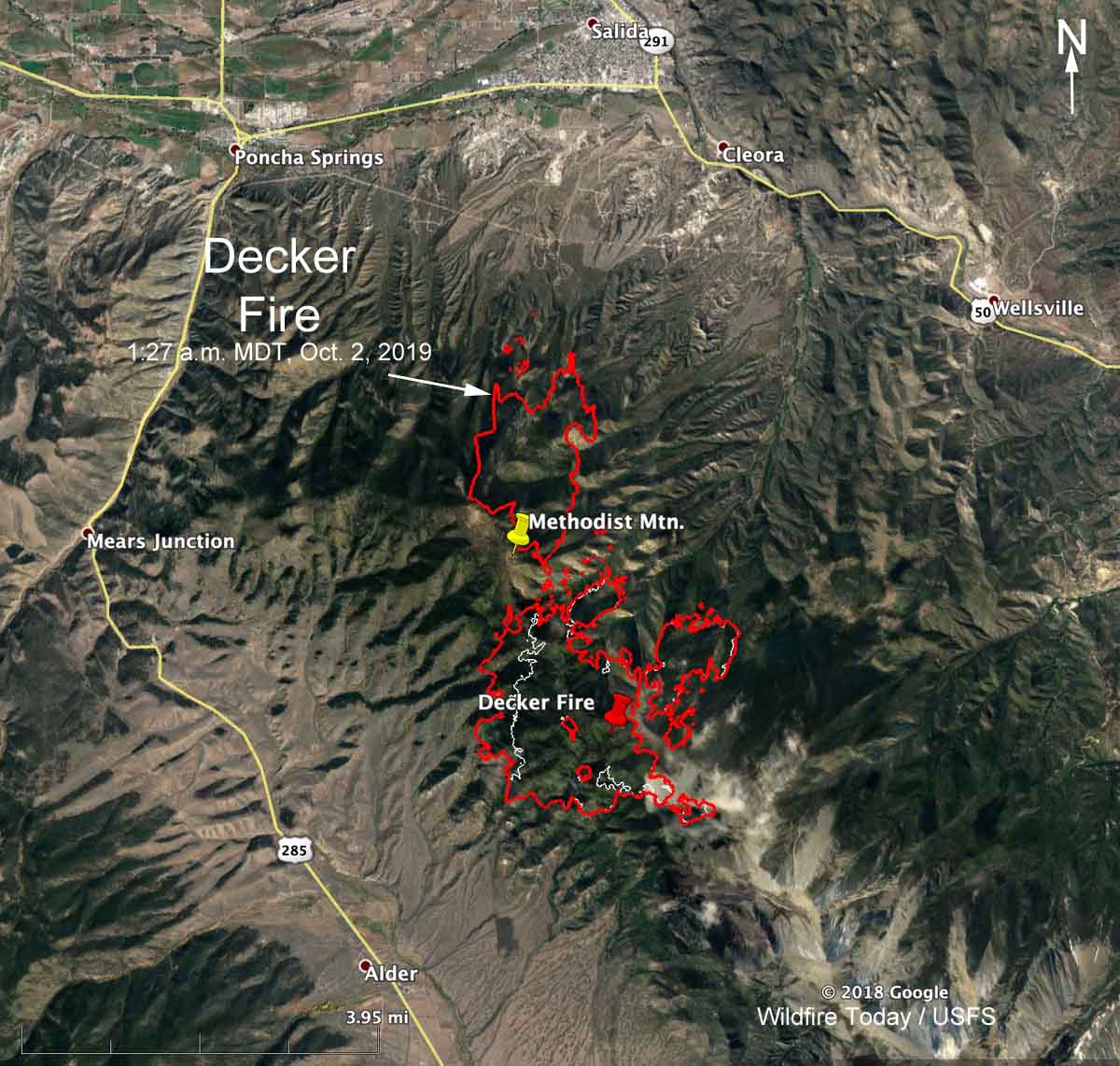
The Decker Fire was very active Tuesday evening and into the night spreading about two to three miles further north, depending on where the measurement is taken. It also grew on the west side up to half a mile. (see map) There are multiple spot fires up to one-half mile out ahead of the northern fire front.
During a Wednesday morning mapping flight at 1:27 a.m. the fire was still within the boundaries of the Rio Grande National Forest, by half a mile, but had spread from the 10,000-11,000 foot level down to the 8,500 foot elevation north of Methodist Mountain. The northern-most spot fire at that time was 2.7 miles south of Highway 50.
At 1:27 a.m. the fire was mapped at 3,746 acres.

Smoke from the Decker Fire is predicted to blow off to the east on Wednesday, and could affect residents in Colorado Springs.

The dry, windy conditions are expected to continue Wednesday, with a Red Flag Warning in effect from noon until 7 p.m. for strong winds and very low humidity. The forecast for the north side of the fire (at 7,400 feet) calls for winds out of the west at 20 mph, 71 degrees, clear skies, and 6 percent relative humidity — weather conditions that could be conducive to additional fire growth. The wind should decrease to less than 10 mph Wednesday night and Thursday.

The Rocky Mountain Type 1 Incident Management Team has been ordered and is expected to in-brief Wednesday at 6 p.m.
The strategy for the fire is not to completely suppress it, but to herd it around while protecting structures and private land.
The resources assigned to the fire Tuesday evening included 8 hand crews, 9 engines, and 3 helicopters, for a total of 231 personnel.


