


Above: A pyrocumulus cloud forms over the Trail Mountain Fire, as seen from Joes Valley Reservoir June 13, 2018. Inciweb photo.
At 9:31 a.m. on Thursday the relative humidity at the Mill Fork Canyon weather station near the Trail Mountain Fire in Utah had already dropped to 12 percent and will likely get even lower with the predicted Red Flag Warning conditions. During the night it never got above 30 percent. A mapping flight Wednesday evening showed that the fire had burned 9,554 acres.
The forecast for Thursday calls for sustained 23 mph winds out of the southwest and west with gusts up to 38 mph. The Haines Index will max out at 6, an indication of atmospheric instability which can be conducive to rapid fire growth. On Friday the wind should increase with 22 to 29 mph southwest winds gusting above 40 mph under cloudy skies but there will be a 33 percent chance of showers.
In an update Thursday morning the incident management team said, “It is likely the fire will continue to spread north along Highway 31, where timber is denser.”
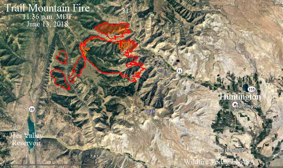
Highway 31 is closed as firefighters work to keep the fire from crossing the road. An evacuation order is in effect.
The origin of the Trail Mountain Fire was a prescribed fire that escaped control on the Manti-La Sal National Forest northwest of Huntington, Utah on June 6.


