


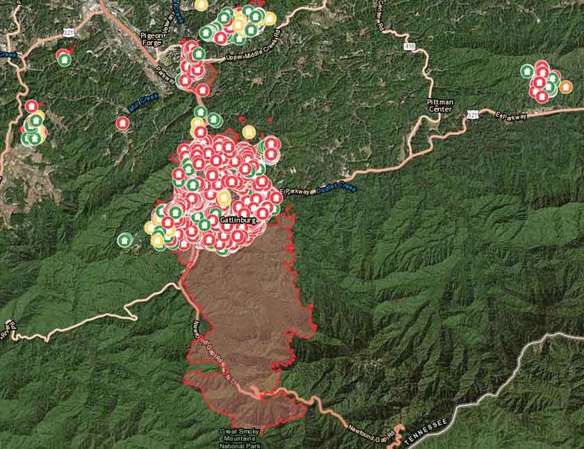
Above: Structures damaged or destroyed in the Chimney Tops 2 Fire and other fires in the Gatlinburg, Tennessee area.
Fire suppression activities on the Chimney Tops 2 Fire at Gatlinburg, Tennessee are winding down as firefighters continue to increase their control of the 17,006-acre fire that burned into the nearby communities. The fire resulted in the deaths of 14 people and damaged or destroyed 2,460 structures.
The park opened several roads to the public on Friday including US 441, Newfound Gap Road from the Gatlinburg Entrance to Cherokee, NC, Little River Road, the Spur between Pigeon Forge and Gatlinburg, and the Gatlinburg Bypass.
An interactive map is available showing which structures have been destroyed and damaged.
On Saturday the Type 1 Incident Management Team was released and the South Atlantic Incident Management Team assumed command.
The number of firefighting resources has decreased and now includes 8 hand crews, 17 engines, 1 helicopter, and 1 water tender, for a total of 306 personnel.
Public meeting, uploaded by the Incident Management Team December 9, 2016.For the most current information about the Chimney Tops 2 Fire at Gatlinburg, see our articles tagged “Chimney 2 Fire”.


